Acton Map, Satellite view of Acton, Minnesota
Acton is a township located in Meeker County, Minnesota, USA.
Location informations of Acton
Latitude of city of Acton is 45.11563 and longitude of city of Acton is -94.70552- What Country is Acton In? Acton is located in the United States of America.
- What State is Acton located in? Acton is located in Minnesota.
- What County is Acton In? The County of Acton is Meeker County
Acton, Minnesota (MN), USA Geographic Information
| Country | United States |
| Country Code | US |
| State Name | Minnesota |
| Latitude | 45.11563 |
| Longitude | -94.70552 |
| DMS Lat | 45°6'56.268" N |
| DMS Long | 94°42'19.872" W |
| DMS coordinates : | 45°6'56.268" N 94°42'19.872" W |
Current Date and Time in Acton, Minnesota, USA
| Acton Time Zone : America/Chicago |
What day is it in Acton right now?Sunday (April 27, 2025) |
What time is it?Current local time and date at Acton is 17:27:57 (04/27/2025) : (America/Chicago) |
Postcode / zip code of Acton
Acton is the actual or alternate city name associated with 3 ZIP Codes by the US Postal Service.
List of all postal codes in Acton, Minnesota, United States.
55355 Zip Code 56209 Zip Code 56243 Zip Code
Online Map of Acton - road map, satellite view and street view
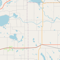


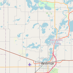


Check out our interactive map of Acton, Minnesota and you'll easily find your way around the Acton major roads and highways.
Satellite Map of Acton, MN, USA
This is online map of the address Acton, MN, United States. You may use button to move and zoom in / out. The map information is for reference only.
L & M Aerodrome (11.56 Km / 7.18 Miles)
Pagel's Field (12.17 Km / 7.56 Miles)
Stanton Hill Aerodrome (12.65 Km / 7.86 Miles)
Meeker County Memorial Hospital Heliport (13.83 Km / 8.59 Miles)
Lux Strip (15.12 Km / 9.40 Miles)
Litchfield Municipal Airport (15.69 Km / 9.75 Miles)
Empire Valley Airport (19.19 Km / 11.92 Miles)
Tyler Farms Airport (22.33 Km / 13.88 Miles)
A.C.G.C. SECONDARY (3.42 Km / 2.12 Miles)
ACGC ELEMENTARY GRADES 5 AND 6 (3.49 Km / 2.17 Miles)
List of places near to Acton
| Name | Distance |
|---|---|
| Grove City | 4.26 Km / 2.65 Miles |
| Atwater | 6.25 Km / 3.88 Miles |
| Swede Grove | 8.31 Km / 5.16 Miles |
| Litchfield (Township) | 9.21 Km / 5.72 Miles |
| Gennessee | 9.40 Km / 5.84 Miles |
| Danielson | 9.61 Km / 5.97 Miles |
| Harrison | 11.90 Km / 7.39 Miles |
| Litchfield | 13.98 Km / 8.69 Miles |
| Harvey | 14.10 Km / 8.76 Miles |
| Lake Elizabeth | 14.36 Km / 8.92 Miles |
| Greenleaf | 15.25 Km / 9.48 Miles |
| Kandiyohi | 17.80 Km / 11.06 Miles |
| Kandiyohi (Township) | 18.41 Km / 11.44 Miles |
| Union Grove | 18.65 Km / 11.59 Miles |
| Fahlun | 19.82 Km / 12.32 Miles |
| Cosmos | 19.98 Km / 12.41 Miles |
| Green Lake | 20.03 Km / 12.45 Miles |
| Darwin (Township) | 20.32 Km / 12.63 Miles |
| Irving | 20.50 Km / 12.74 Miles |
| Manannah | 20.76 Km / 12.90 Miles |
| East Lake Lillian | 22.21 Km / 13.80 Miles |
| Cosmos (Township) | 22.50 Km / 13.98 Miles |
| Spicer | 22.54 Km / 14.01 Miles |
| Cedar Mills (Township) | 23.19 Km / 14.41 Miles |
| Darwin | 23.23 Km / 14.43 Miles |
| Forest City | 23.30 Km / 14.48 Miles |
| Lake Lillian | 23.54 Km / 14.63 Miles |
| Cedar Mills | 23.98 Km / 14.90 Miles |
| Ellsworth | 24.22 Km / 15.05 Miles |