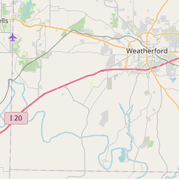
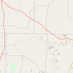
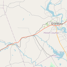
Aledo Map, Satellite view of Aledo, Texas
Aledo is a city located in Parker County, Texas, USA.
Location informations of Aledo
Latitude of city of Aledo is 32.69596 and longitude of city of Aledo is -97.60225- What Country is Aledo In? Aledo is located in the United States of America.
- What State is Aledo located in? Aledo is located in Texas.
- What County is Aledo In? The County of Aledo is Parker County
Aledo, Texas (TX), USA Geographic Information
| Country | United States |
| Country Code | US |
| State Name | Texas |
| Latitude | 32.69596 |
| Longitude | -97.60225 |
| DMS Lat | 32°41'45.456" N |
| DMS Long | 97°36'8.1" W |
| DMS coordinates : | 32°41'45.456" N 97°36'8.1" W |
Current Date and Time in Aledo, Texas, USA
| Aledo Time Zone : America/Chicago |
What day is it in Aledo right now?Sunday (April 13, 2025) |
What time is it?Current local time and date at Aledo is 09:45:05 (04/13/2025) : (America/Chicago) |
Postcode / zip code of Aledo
Aledo is the actual or alternate city name associated with 1 ZIP Codes by the US Postal Service.
List of all postal codes in Aledo, Texas, United States.
76008 Zip Code
Online Map of Aledo - road map, satellite view and street view


Check out our interactive map of Aledo, Texas and you'll easily find your way around the Aledo major roads and highways.
Satellite Map of Aledo, TX, USA
This is online map of the address Aledo, TX, United States. You may use button to move and zoom in / out. The map information is for reference only.
Bucker Field (2.26 Km / 1.41 Miles)
Triple S Airport (3.01 Km / 1.87 Miles)
Clear Fork Ranch Heliport (5.88 Km / 3.65 Miles)
Beggs Ranch (Aledo) Airport (6.25 Km / 3.89 Miles)
Trinity Meadows Race Track Heliport (7.47 Km / 4.64 Miles)
Texas Health Willow Park Heliport (7.81 Km / 4.85 Miles)
Helibarn Landing (8.42 Km / 5.23 Miles)
Markum Ranch Airport (8.47 Km / 5.26 Miles)
Parker County Airport (9.36 Km / 5.81 Miles)
Log Cabin Airport (11.86 Km / 7.37 Miles)
Bourland Field (12.74 Km / 7.92 Miles)
Stubbs Strip (13.90 Km / 8.64 Miles)
Staggs Heliport (15.40 Km / 9.57 Miles)
Flying Oaks Airport (16.09 Km / 9.99 Miles)
NAS Fort Worth JRB / Carswell Field (17.10 Km / 10.63 Miles)
Post Oak Airfield (17.14 Km / 10.65 Miles)
Harris Methodist Southwest Helistop (17.45 Km / 10.84 Miles)
JMK International Inc Heliport (17.78 Km / 11.05 Miles)
Chigger Field (17.83 Km / 11.08 Miles)
Medical City Weatherford Heliport (18.17 Km / 11.29 Miles)
VANDAGRIFF EL (383 m / 0.24 Miles)
ALEDO MIDDLE (639 m / 0.40 Miles)
MCANALLY INT (1.28 Km / 0.79 Miles)
DON R DANIEL NINTH GRADE CAMPUS (2.16 Km / 1.34 Miles)
ALEDO H S (2.25 Km / 1.40 Miles)
CODER EL (2.63 Km / 1.63 Miles)
STUARD EL (4.89 Km / 3.04 Miles)
MCCALL EL (4.99 Km / 3.10 Miles)
List of places near to Aledo
| Name | Distance |
|---|---|
| Annetta South | 6.27 Km / 3.90 Miles |
| Annetta | 7.07 Km / 4.39 Miles |
| Annetta North | 7.36 Km / 4.57 Miles |
| Willow Park | 8.68 Km / 5.39 Miles |
| Hudson Oaks | 11.90 Km / 7.39 Miles |
| Benbrook | 13.50 Km / 8.39 Miles |
| White Settlement | 15.21 Km / 9.45 Miles |
| Lakeside | 17.36 Km / 10.79 Miles |
| Westworth Village | 18.28 Km / 11.36 Miles |
| Westover Hills | 18.46 Km / 11.47 Miles |
| Cresson | 18.51 Km / 11.50 Miles |
| Lake Worth | 19.05 Km / 11.84 Miles |
| Weatherford | 19.55 Km / 12.15 Miles |
| Western Lake | 21.19 Km / 13.17 Miles |
| River Oaks | 21.43 Km / 13.32 Miles |
| Sansom Park | 22.28 Km / 13.84 Miles |
| Azle | 22.96 Km / 14.27 Miles |
| Sanctuary | 23.72 Km / 14.74 Miles |
| Edgecliff Village | 24.66 Km / 15.32 Miles |