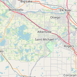
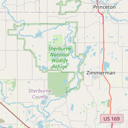
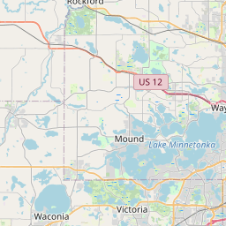
Anoka Map, Satellite view of Anoka, Minnesota
Anoka is a city located in Anoka County, Minnesota, USA.
Location informations of Anoka
Latitude of city of Anoka is 45.19774 and longitude of city of Anoka is -93.38718- What Country is Anoka In? Anoka is located in the United States of America.
- What State is Anoka located in? Anoka is located in Minnesota.
- What County is Anoka In? The County of Anoka is Anoka County
Anoka, Minnesota (MN), USA Geographic Information
| Country | United States |
| Country Code | US |
| State Name | Minnesota |
| Latitude | 45.19774 |
| Longitude | -93.38718 |
| DMS Lat | 45°11'51.864" N |
| DMS Long | 93°23'13.848" W |
| DMS coordinates : | 45°11'51.864" N 93°23'13.848" W |
Current Date and Time in Anoka, Minnesota, USA
| Anoka Time Zone : America/Chicago |
What day is it in Anoka right now?Sunday (May 18, 2025) |
What time is it?Current local time and date at Anoka is 5/18/2025 - 1:38:18 AM |
Postcode / zip code of Anoka
Anoka is the actual or alternate city name associated with 2 ZIP Codes by the US Postal Service.
List of all postal codes in Anoka, Minnesota, United States.
55303 Zip Code 55304 Zip Code
Online Map of Anoka - road map, satellite view and street view


Check out our interactive map of Anoka, Minnesota and you'll easily find your way around the Anoka major roads and highways.
Satellite Map of Anoka, MN, USA
This is online map of the address Anoka, MN, United States. You may use button to move and zoom in / out. The map information is for reference only.
Health One Mercy Hospital Heliport (2.06 Km / 1.28 Miles)
Busch's Fish Lake Seaplane Base (13.05 Km / 8.11 Miles)
Cooks Landing Airport (13.93 Km / 8.65 Miles)
Joyner Airport (14.79 Km / 9.19 Miles)
Anoka County-Blaine (Janes Field) Airport (14.98 Km / 9.31 Miles)
Crystal Airport (15.32 Km / 9.52 Miles)
Prudential Helistop (15.64 Km / 9.72 Miles)
Svard Heliport (17.59 Km / 10.93 Miles)
Kral's Personal Use Landing Field (18.79 Km / 11.67 Miles)
Rosacker's Nr 1 Seaplane Base (19.65 Km / 12.21 Miles)
Vieira Airport (19.90 Km / 12.37 Miles)
Lino Air Park (20.15 Km / 12.52 Miles)
Harry-Walt Airport (20.39 Km / 12.67 Miles)
North Memorial Heliport (21.03 Km / 13.07 Miles)
Surfside Airport (21.84 Km / 13.57 Miles)
Surfside Seaplane Base (21.84 Km / 13.57 Miles)
Peterson Seaplane Base (22.14 Km / 13.75 Miles)
Lexington Heliport (22.41 Km / 13.93 Miles)
Advance Machine Company Heliport (22.72 Km / 14.12 Miles)
Eastmans Medicine Lake Seaplane Base (22.78 Km / 14.16 Miles)
ANOKA MIDDLE SCHOOL FOR THE ARTS (601 m / 0.37 Miles)
FRANKLIN ELEMENTARY (704 m / 0.44 Miles)
LINCOLN ELEMENTARY (943 m / 0.59 Miles)
EARLY CHILDHOOD/SPECIAL EDUCATION (1.26 Km / 0.78 Miles)
Alexandra House (1.29 Km / 0.80 Miles)
ANOKA-HENNEPIN SPECIALTY PROGRAM (1.30 Km / 0.81 Miles)
WILSON ELEMENTARY (2.58 Km / 1.61 Miles)
SECONDARY TECHNICAL ED PROG S.T.E.P (2.99 Km / 1.86 Miles)
STEP AHEAD HIGH SCHOOL (2.99 Km / 1.86 Miles)
ANOKA HIGH SCHOOL (3.01 Km / 1.87 Miles)
Anoka-Hennepin Tech High School (3.16 Km / 1.97 Miles)
BRIDGES (3.52 Km / 2.19 Miles)
DAYTON ELEMENTARY (3.65 Km / 2.27 Miles)
MORRIS BYE ELEMENTARY (4.10 Km / 2.55 Miles)
CROOKED LAKE ELEMENTARY (4.42 Km / 2.75 Miles)
PATHWAYS (4.54 Km / 2.82 Miles)
COMPASS-BELL CENTER (4.57 Km / 2.84 Miles)
Anoka Technical College (3.09 Km / 1.92 Miles)
Anoka-Ramsey Community College (3.91 Km / 2.43 Miles)
List of places near to Anoka
| Name | Distance |
|---|---|
| Champlin | 1.27 Km / 0.79 Miles |
| Dayton | 6.68 Km / 4.15 Miles |
| Andover | 8.48 Km / 5.27 Miles |
| Ramsey | 8.59 Km / 5.34 Miles |
| Osseo | 8.79 Km / 5.46 Miles |
| Coon Rapids | 11.64 Km / 7.23 Miles |
| Brooklyn Park | 11.77 Km / 7.31 Miles |
| Ham Lake | 12.23 Km / 7.60 Miles |
| Rogers | 13.03 Km / 8.10 Miles |
| Brooklyn Center | 14.19 Km / 8.82 Miles |
| Spring Lake Park | 14.38 Km / 8.94 Miles |
| Blaine | 14.51 Km / 9.02 Miles |
| Maple Grove | 14.93 Km / 9.28 Miles |
| Fridley | 15.77 Km / 9.80 Miles |
| Nowthen | 15.88 Km / 9.87 Miles |
| Oak Grove | 16.59 Km / 10.31 Miles |
| Corcoran | 16.97 Km / 10.54 Miles |
| Mounds View | 17.40 Km / 10.81 Miles |
| New Hope | 17.76 Km / 11.04 Miles |
| Otsego | 18.10 Km / 11.25 Miles |
| Elk River | 18.38 Km / 11.42 Miles |
| Crystal | 18.47 Km / 11.48 Miles |
| Lexington | 18.60 Km / 11.56 Miles |
| Robbinsdale | 18.80 Km / 11.68 Miles |
| Circle Pines | 19.26 Km / 11.97 Miles |
| Hilltop | 19.45 Km / 12.09 Miles |
| East Bethel | 19.80 Km / 12.30 Miles |
| Columbia Heights | 19.99 Km / 12.42 Miles |
| New Brighton | 20.67 Km / 12.84 Miles |
| Golden Valley | 21.12 Km / 13.12 Miles |
| Albertville | 21.40 Km / 13.30 Miles |
| Plymouth | 21.50 Km / 13.36 Miles |
| St. Michael | 21.81 Km / 13.55 Miles |
| St. Francis | 21.83 Km / 13.56 Miles |
| Hanover | 22.05 Km / 13.70 Miles |
| Medicine Lake | 22.63 Km / 14.06 Miles |
| St. Anthony | 22.98 Km / 14.28 Miles |
| Shoreview | 22.99 Km / 14.29 Miles |
| Medina | 23.69 Km / 14.72 Miles |
| Lino Lakes | 23.75 Km / 14.76 Miles |
| Arden Hills | 24.42 Km / 15.17 Miles |
| Bethel | 24.75 Km / 15.38 Miles |