Apple River Map, Satellite view of Apple River, Illinois
Apple River is a village located in Jo Daviess County, Illinois, USA.
Location informations of Apple River
Latitude of city of Apple River is 42.50501 and longitude of city of Apple River is -90.09874- What Country is Apple River In? Apple River is located in the United States of America.
- What State is Apple River located in? Apple River is located in Illinois.
- What County is Apple River In? The County of Apple River is Jo Daviess County
Apple River, Illinois (IL), USA Geographic Information
| Country | United States |
| Country Code | US |
| State Name | Illinois |
| Latitude | 42.50501 |
| Longitude | -90.09874 |
| DMS Lat | 42°30'18.036" N |
| DMS Long | 90°5'55.464" W |
| DMS coordinates : | 42°30'18.036" N 90°5'55.464" W |
Current Date and Time in Apple River, Illinois, USA
| Apple River Time Zone : America/Chicago |
What day is it in Apple River right now?Wednesday (April 30, 2025) |
What time is it?Current local time and date at Apple River is 4/30/2025 - 2:46:45 AM |
Postcode / zip code of Apple River
Apple River is the actual or alternate city name associated with 1 ZIP Codes by the US Postal Service.
List of all postal codes in Apple River, Illinois, United States.
61001 Zip Code
Online Map of Apple River - road map, satellite view and street view
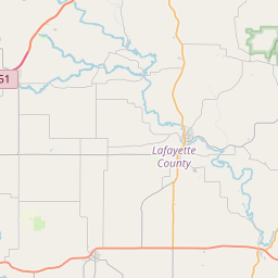
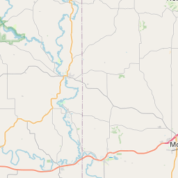
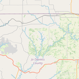
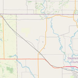
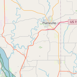
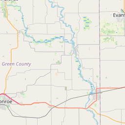
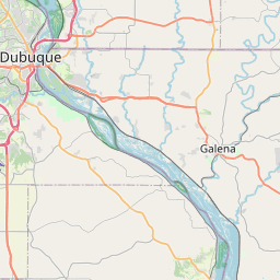


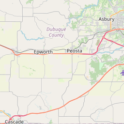
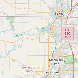

Check out our interactive map of Apple River, Illinois and you'll easily find your way around the Apple River major roads and highways.
Satellite Map of Apple River, IL, USA
This is online map of the address Apple River, IL, United States. You may use button to move and zoom in / out. The map information is for reference only.
Foster Field (7.21 Km / 4.48 Miles)
Shullsburg Airport (12.03 Km / 7.48 Miles)
Memorial Hospital of Lafayette County Heliport (19.95 Km / 12.40 Miles)
Stockton Airport (21.93 Km / 13.63 Miles)
Whoopy Hollow Aerodrome (23.16 Km / 14.39 Miles)
John L Coppernoll Airport (23.83 Km / 14.81 Miles)
Red Shed Field (24.63 Km / 15.30 Miles)
Gerbick Airport (24.91 Km / 15.48 Miles)
List of places near to Apple River
| Name | Distance |
|---|---|
| Apple River (Township) | 4.05 Km / 2.52 Miles |
| Monticello | 4.20 Km / 2.61 Miles |
| Warren (Township) | 6.32 Km / 3.93 Miles |
| Gratiot (Town) | 8.37 Km / 5.20 Miles |
| Warren | 9.00 Km / 5.59 Miles |
| Gratiot | 10.31 Km / 6.41 Miles |
| Apple Canyon Lake | 10.51 Km / 6.53 Miles |
| Thompson | 10.68 Km / 6.64 Miles |
| Rush | 10.97 Km / 6.82 Miles |
| Scales Mound (Township) | 12.42 Km / 7.72 Miles |
| White Oak Springs | 13.01 Km / 8.08 Miles |
| Scales Mound | 13.05 Km / 8.11 Miles |
| Shullsburg (Town) | 13.07 Km / 8.12 Miles |
| Shullsburg | 13.23 Km / 8.22 Miles |
| Nora | 13.71 Km / 8.52 Miles |
| Nora (Township) | 14.38 Km / 8.94 Miles |
| Darlington (Town) | 16.51 Km / 10.26 Miles |
| Guilford | 17.20 Km / 10.69 Miles |
| Wayne | 17.82 Km / 11.07 Miles |
| Stockton | 18.84 Km / 11.71 Miles |
| Wiota (CDP) | 18.91 Km / 11.75 Miles |
| South Wayne | 19.29 Km / 11.99 Miles |
| Darlington | 19.86 Km / 12.34 Miles |
| Stockton (Township) | 20.25 Km / 12.58 Miles |
| Woodbine | 20.30 Km / 12.61 Miles |
| Wiota | 20.36 Km / 12.65 Miles |
| Seymour | 20.65 Km / 12.83 Miles |
| New Diggings | 20.76 Km / 12.90 Miles |
| Council Hill | 20.93 Km / 13.01 Miles |
| West Point | 21.22 Km / 13.19 Miles |
| Winslow (Township) | 21.50 Km / 13.36 Miles |
| The Galena Territory | 22.31 Km / 13.86 Miles |
| Lamont | 22.95 Km / 14.26 Miles |
| Elizabeth | 23.13 Km / 14.37 Miles |
| Wards Grove | 23.16 Km / 14.39 Miles |
| Benton | 24.19 Km / 15.03 Miles |
| East Galena | 24.87 Km / 15.45 Miles |