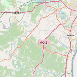
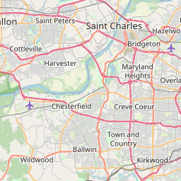
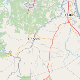
Arnold Map, Satellite view of Arnold, Missouri
Arnold is a city located in Jefferson County, Missouri, USA.
Location informations of Arnold
Latitude of city of Arnold is 38.43283 and longitude of city of Arnold is -90.37762- What Country is Arnold In? Arnold is located in the United States of America.
- What State is Arnold located in? Arnold is located in Missouri.
- What County is Arnold In? The County of Arnold is Jefferson County
Arnold, Missouri (MO), USA Geographic Information
| Country | United States |
| Country Code | US |
| State Name | Missouri |
| Latitude | 38.43283 |
| Longitude | -90.37762 |
| DMS Lat | 38°25'58.188" N |
| DMS Long | 90°22'39.432" W |
| DMS coordinates : | 38°25'58.188" N 90°22'39.432" W |
Current Date and Time in Arnold, Missouri, USA
| Arnold Time Zone : America/Chicago |
What day is it in Arnold right now?Wednesday (May 14, 2025) |
What time is it?Current local time and date at Arnold is 5/14/2025 - 2:05:02 PM |
Postcode / zip code of Arnold
Arnold is the actual or alternate city name associated with 1 ZIP Codes by the US Postal Service.
List of all postal codes in Arnold, Missouri, United States.
63010 Zip Code
Online Map of Arnold - road map, satellite view and street view


Check out our interactive map of Arnold, Missouri and you'll easily find your way around the Arnold major roads and highways.
Satellite Map of Arnold, MO, USA
This is online map of the address Arnold, MO, United States. You may use button to move and zoom in / out. The map information is for reference only.
Ralph Jacobs Airport (8.19 Km / 5.09 Miles)
St Anthony's Medical Center Heliport (8.33 Km / 5.18 Miles)
Fabick-Colmarile Heliport (12.21 Km / 7.59 Miles)
Sackman Field (12.50 Km / 7.77 Miles)
Fabick Heliport (13.19 Km / 8.20 Miles)
King Airport (13.23 Km / 8.22 Miles)
SSM Health St. Clare Hospital-Fenton Heliport (13.77 Km / 8.56 Miles)
St Joseph Hospital Heliport (15.82 Km / 9.83 Miles)
Crook Restricted Landing Area (16.97 Km / 10.55 Miles)
Moders Airport (17.91 Km / 11.13 Miles)
Fox Run Heliport (20.02 Km / 12.44 Miles)
Hermann Ii Heliport (21.02 Km / 13.06 Miles)
Monroe County Ambulance Service Heliport (21.45 Km / 13.33 Miles)
Flight Park Inc Airport (21.52 Km / 13.37 Miles)
Anheuser/Busch Inc Heliport (23.00 Km / 14.29 Miles)
SSM Health St Mary's Hospital-St Louis Heliport (23.02 Km / 14.30 Miles)
Deaconess Hospital Heliport (23.24 Km / 14.44 Miles)
Missouri Baptist Hospital Heliport (23.29 Km / 14.47 Miles)
SSM Health Cardinal Glennon Childrens Hospital Helipad (24.08 Km / 14.96 Miles)
Mercy Hospital St Louis Heliport (24.24 Km / 15.06 Miles)
DON EARL EARLY CHILDHOOD CTR. (1.77 Km / 1.10 Miles)
FOX SR. HIGH (1.98 Km / 1.23 Miles)
FOX MIDDLE (2.06 Km / 1.28 Miles)
FOX ELEM. (2.13 Km / 1.32 Miles)
SHERWOOD ELEM. (2.13 Km / 1.32 Miles)
ROCKPORT HEIGHTS ELEM. (2.86 Km / 1.78 Miles)
LONE DELL ELEM. (3.39 Km / 2.11 Miles)
RICHARD SIMPSON ELEM. (3.54 Km / 2.20 Miles)
ROGERS ELEM. (3.85 Km / 2.39 Miles)
HAGEMANN ELEM. (4.47 Km / 2.78 Miles)
RIDGEWOOD MIDDLE (4.61 Km / 2.87 Miles)
POINT ELEM. (4.97 Km / 3.09 Miles)
RAYMOND NANCY HODGE ELEM. (4.98 Km / 3.10 Miles)
List of places near to Arnold
| Name | Distance |
|---|---|
| Imperial | 7.01 Km / 4.36 Miles |
| Oakville | 7.59 Km / 4.72 Miles |
| Kimmswick | 7.61 Km / 4.73 Miles |
| Mehlville | 9.66 Km / 6.00 Miles |
| Barnhart | 9.95 Km / 6.18 Miles |
| Fenton | 10.27 Km / 6.38 Miles |
| Concord | 10.34 Km / 6.42 Miles |
| Green Park | 10.66 Km / 6.62 Miles |
| Murphy | 11.48 Km / 7.13 Miles |
| Sappington | 11.58 Km / 7.20 Miles |
| Sunset Hills | 12.08 Km / 7.51 Miles |
| Lakeshire | 12.34 Km / 7.67 Miles |
| St. George | 12.78 Km / 7.94 Miles |
| Grantwood Village | 13.22 Km / 8.21 Miles |
| Parkdale | 13.59 Km / 8.44 Miles |
| Affton | 13.66 Km / 8.49 Miles |
| Crestwood | 13.81 Km / 8.58 Miles |
| Lemay | 14.08 Km / 8.75 Miles |
| High Ridge | 14.14 Km / 8.79 Miles |
| Columbia | 14.35 Km / 8.92 Miles |
| Wilbur Park | 14.63 Km / 9.09 Miles |
| Bella Villa | 14.74 Km / 9.16 Miles |
| Peaceful Village | 14.88 Km / 9.25 Miles |
| Marlborough | 15.69 Km / 9.75 Miles |
| Oakland | 15.98 Km / 9.93 Miles |
| Valley Park | 16.36 Km / 10.17 Miles |
| Valmeyer | 16.67 Km / 10.36 Miles |
| Pevely | 16.69 Km / 10.37 Miles |
| Dupo | 16.73 Km / 10.40 Miles |
| Kirkwood | 16.93 Km / 10.52 Miles |
| East Carondelet | 17.49 Km / 10.87 Miles |
| Byrnes Mill | 17.79 Km / 11.05 Miles |
| Webster Groves | 17.85 Km / 11.09 Miles |
| Shrewsbury | 17.87 Km / 11.10 Miles |
| Twin Oaks | 17.95 Km / 11.15 Miles |
| Glendale | 18.13 Km / 11.27 Miles |
| Herculaneum | 18.29 Km / 11.36 Miles |
| Scotsdale | 18.66 Km / 11.59 Miles |
| Horine | 18.92 Km / 11.76 Miles |
| Sugar Loaf | 19.01 Km / 11.81 Miles |
| Des Peres | 19.30 Km / 11.99 Miles |
| Warson Woods | 19.40 Km / 12.05 Miles |
| Rock Hill | 19.43 Km / 12.07 Miles |
| Maplewood | 20.51 Km / 12.74 Miles |
| Huntleigh | 20.56 Km / 12.78 Miles |
| Brentwood | 20.69 Km / 12.86 Miles |
| Town and Country | 21.31 Km / 13.24 Miles |
| Manchester | 21.55 Km / 13.39 Miles |
| Crystal Lake Park | 21.63 Km / 13.44 Miles |
| Winchester | 21.86 Km / 13.58 Miles |