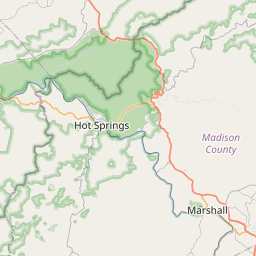
Asheville Map, Satellite view of Asheville, North Carolina
Asheville is a city located in Buncombe County, North Carolina, USA.
Location informations of Asheville
Latitude of city of Asheville is 35.60095 and longitude of city of Asheville is -82.55402- What Country is Asheville In? Asheville is located in the United States of America.
- What State is Asheville located in? Asheville is located in North Carolina.
- What County is Asheville In? The County of Asheville is Buncombe County
Asheville, North Carolina (NC), USA Geographic Information
| Country | United States |
| Country Code | US |
| State Name | North Carolina |
| Latitude | 35.60095 |
| Longitude | -82.55402 |
| DMS Lat | 35°36'3.42" N |
| DMS Long | 82°33'14.472" W |
| DMS coordinates : | 35°36'3.42" N 82°33'14.472" W |
Current Date and Time in Asheville, North Carolina, USA
| Asheville Time Zone : America/New_York |
What day is it in Asheville right now?Tuesday (June 10, 2025) |
What time is it?Current local time and date at Asheville is 6/10/2025 - 7:50:12 PM |
Postcode / zip code of Asheville
Asheville is the actual or alternate city name associated with 15 ZIP Codes by the US Postal Service.
List of all postal codes in Asheville, North Carolina, United States.
28704 Zip Code 28715 Zip Code 28732 Zip Code 28776 Zip Code 28801 Zip Code 28802 Zip Code 28803 Zip Code 28804 Zip Code 28805 Zip Code 28806 Zip Code 28810 Zip Code 28813 Zip Code 28814 Zip Code 28815 Zip Code 28816 Zip Code
Area Codes Asheville, North Carolina, USA
Asheville, North Carolina covers 1 Area Codes
828 Area CodeOnline Map of Asheville - road map, satellite view and street view


Check out our interactive map of Asheville, North Carolina and you'll easily find your way around the Asheville major roads and highways.
Satellite Map of Asheville, NC, USA
This is online map of the address Asheville, NC, United States. You may use button to move and zoom in / out. The map information is for reference only.
Saint Josephs Hospital Heliport (2.36 Km / 1.46 Miles)
Mission Hospitals Heliport (2.90 Km / 1.80 Miles)
Six Oaks Airport (17.43 Km / 10.83 Miles)
Asheville Regional Airport (18.35 Km / 11.40 Miles)
Cane Creek Airport (18.90 Km / 11.74 Miles)
Meyers Heliport (19.41 Km / 12.06 Miles)
Bearwallow Farm Airport (22.74 Km / 14.13 Miles)
Montford North Star Academy (723 m / 0.45 Miles)
Claxton Elementary (764 m / 0.47 Miles)
Isaac Dickson Elementary (1.16 Km / 0.72 Miles)
Asheville Middle (1.67 Km / 1.04 Miles)
Nesbitt Discovery Academy (2.76 Km / 1.72 Miles)
Asheville High (3.12 Km / 1.94 Miles)
School of Inquiry and Life Sciences (3.15 Km / 1.96 Miles)
Ira B Jones Elementary (3.30 Km / 2.05 Miles)
Early College (3.37 Km / 2.09 Miles)
Middle College (3.39 Km / 2.11 Miles)
Emma Elementary (3.44 Km / 2.14 Miles)
Hall Fletcher Elementary (3.45 Km / 2.14 Miles)
Asheville Primary (3.54 Km / 2.20 Miles)
Haw Creek Elementary (4.46 Km / 2.77 Miles)
Woodfin Elementary (4.49 Km / 2.79 Miles)
Francine Delany New School (4.74 Km / 2.94 Miles)
Vance Elementary (4.99 Km / 3.10 Miles)
Evergreen Community Charter (5.00 Km / 3.11 Miles)
Center for Massage (833 m / 0.52 Miles)
Daoist Traditions College of Chinese Medical Arts (1.47 Km / 0.91 Miles)
University of North Carolina at Asheville (2.07 Km / 1.28 Miles)
Asheville-Buncombe Technical Community College (3.39 Km / 2.11 Miles)
Carolina College of Hair Design (4.69 Km / 2.91 Miles)
List of places near to Asheville
| Name | Distance |
|---|---|
| Woodfin | 4.41 Km / 2.74 Miles |
| Biltmore Forest | 7.82 Km / 4.86 Miles |
| Weaverville | 10.70 Km / 6.65 Miles |
| Bent Creek | 11.33 Km / 7.04 Miles |
| Swannanoa | 13.94 Km / 8.66 Miles |
| Royal Pines | 14.41 Km / 8.95 Miles |
| Avery Creek | 15.51 Km / 9.64 Miles |
| Fairview | 17.26 Km / 10.72 Miles |
| Fletcher | 19.53 Km / 12.14 Miles |
| Hoopers Creek | 19.66 Km / 12.22 Miles |
| Black Mountain | 21.13 Km / 13.13 Miles |
| Gerton | 23.02 Km / 14.30 Miles |
| Montreat | 23.20 Km / 14.42 Miles |
| Mills River | 23.66 Km / 14.70 Miles |
| Marshall | 24.79 Km / 15.40 Miles |