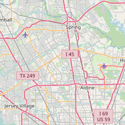
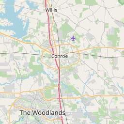
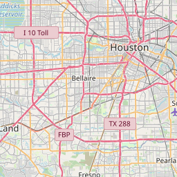
Atascocita Map, Satellite view of Atascocita, Texas
Atascocita is a census-designated place (CDP) located in Harris County, Texas, USA.
Location informations of Atascocita
Latitude of city of Atascocita is 29.99883 and longitude of city of Atascocita is -95.17660- What Country is Atascocita In? Atascocita is located in the United States of America.
- What State is Atascocita located in? Atascocita is located in Texas.
- What County is Atascocita In? The County of Atascocita is Harris County
Atascocita, Texas (TX), USA Geographic Information
| Country | United States |
| Country Code | US |
| State Name | Texas |
| Latitude | 29.99883 |
| Longitude | -95.1766 |
| DMS Lat | 29°59'55.788" N |
| DMS Long | 95°10'35.76" W |
| DMS coordinates : | 29°59'55.788" N 95°10'35.76" W |
Current Date and Time in Atascocita, Texas, USA
| Atascocita Time Zone : America/Chicago |
What day is it in Atascocita right now?Friday (April 25, 2025) |
What time is it?Current local time and date at Atascocita is 4/25/2025 - 8:29:23 AM |
Postcode / zip code of Atascocita
Atascocita is the actual or alternate city name associated with 4 ZIP Codes by the US Postal Service.
List of all postal codes in Atascocita, Texas, United States.
77044 Zip Code 77338 Zip Code 77346 Zip Code 77396 Zip Code
Area Codes Atascocita, Texas, USA
Atascocita, Texas covers 3 Area Codes
281 Area Code 713 Area Code 832 Area CodeOnline Map of Atascocita - road map, satellite view and street view


Check out our interactive map of Atascocita, Texas and you'll easily find your way around the Atascocita major roads and highways.
Satellite Map of Atascocita, TX, USA
This is online map of the address Atascocita, TX, United States. You may use button to move and zoom in / out. The map information is for reference only.
HCA Houston Healthcare Kingwood Heliport (9.49 Km / 5.90 Miles)
Northeast Medical Center Hospital Heliport (9.67 Km / 6.01 Miles)
Humble Airport (11.07 Km / 6.88 Miles)
Dunham Field (14.22 Km / 8.83 Miles)
Flying F Ranch Airport (15.43 Km / 9.59 Miles)
George Bush Intercontinental Houston Airport (15.95 Km / 9.91 Miles)
Loftin Airport (16.39 Km / 10.19 Miles)
Harris County ESD #80 Heliport (16.65 Km / 10.35 Miles)
Gateway Helistop (16.76 Km / 10.42 Miles)
Papa Heliport (17.17 Km / 10.67 Miles)
Fauna Airport (17.36 Km / 10.79 Miles)
Skyhaven Airport (18.57 Km / 11.54 Miles)
Palm Petroleum Corporation Heliport (18.70 Km / 11.62 Miles)
Roeder Airport (18.87 Km / 11.72 Miles)
Aldine Heliport (18.89 Km / 11.74 Miles)
LYB Heliport (19.27 Km / 11.98 Miles)
Jet Ag Inc Airport (20.21 Km / 12.56 Miles)
West Liberty Airport (20.22 Km / 12.56 Miles)
Houston Police Department Northeast Heliport (20.63 Km / 12.82 Miles)
North Houston Airport (22.16 Km / 13.77 Miles)
OAK FOREST EL (136 m / 0.08 Miles)
TIMBERS EL (1.04 Km / 0.64 Miles)
OAKS EL (1.18 Km / 0.73 Miles)
PINEFOREST EL (1.39 Km / 0.86 Miles)
ATASCOCITA MIDDLE (1.65 Km / 1.03 Miles)
TIMBERWOOD MIDDLE (1.74 Km / 1.08 Miles)
EARLY LEARNING WING (1.75 Km / 1.08 Miles)
HUMBLE COMMUNITY LEARNING CENTER (1.76 Km / 1.10 Miles)
MAPLEBROOK EL (2.04 Km / 1.27 Miles)
ATASCOCITA H S (2.20 Km / 1.37 Miles)
EAGLE SPRINGS EL (2.47 Km / 1.54 Miles)
ATASCOCITA SPRINGS EL (3.80 Km / 2.36 Miles)
HUMBLE MIDDLE (3.91 Km / 2.43 Miles)
LAKESHORE EL (4.02 Km / 2.49 Miles)
WHISPERING PINES EL (4.50 Km / 2.80 Miles)
GROVES EL (4.96 Km / 3.08 Miles)
List of places near to Atascocita
| Name | Distance |
|---|---|
| Humble | 8.24 Km / 5.12 Miles |
| Crosby | 14.66 Km / 9.11 Miles |
| Sheldon | 15.28 Km / 9.49 Miles |
| Barrett | 17.16 Km / 10.66 Miles |
| Roman Forest | 20.09 Km / 12.48 Miles |
| Woodbranch | 20.30 Km / 12.61 Miles |
| Aldine | 21.55 Km / 13.39 Miles |
| Patton Village | 21.60 Km / 13.42 Miles |
| Porter Heights | 21.84 Km / 13.57 Miles |
| Highlands | 23.14 Km / 14.38 Miles |
| Cloverleaf | 24.53 Km / 15.24 Miles |
| Spring | 24.85 Km / 15.44 Miles |