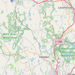
Auburn Map, Satellite view of Auburn, Massachusetts
Auburn is a town located in Worcester County, Massachusetts, USA.
Location informations of Auburn
Latitude of city of Auburn is 42.19887 and longitude of city of Auburn is -71.84572- What Country is Auburn In? Auburn is located in the United States of America.
- What State is Auburn located in? Auburn is located in Massachusetts.
- What County is Auburn In? The County of Auburn is Worcester County
Auburn, Massachusetts (MA), USA Geographic Information
| Country | United States |
| Country Code | US |
| State Name | Massachusetts |
| Latitude | 42.19887 |
| Longitude | -71.84572 |
| DMS Lat | 42°11'55.932" N |
| DMS Long | 71°50'44.592" W |
| DMS coordinates : | 42°11'55.932" N 71°50'44.592" W |
Current Date and Time in Auburn, Massachusetts, USA
| Auburn Time Zone : America/New_York |
What day is it in Auburn right now?Saturday (May 24, 2025) |
What time is it?Current local time and date at Auburn is 23:08:15 (05/24/2025) : (America/New_York) |
Postcode / zip code of Auburn
Auburn is the actual or alternate city name associated with 1 ZIP Codes by the US Postal Service.
List of all postal codes in Auburn, Massachusetts, United States.
01501 Zip Code
Area Codes Auburn, Massachusetts, USA
Auburn, Massachusetts covers 2 Area Codes
508 Area Code 774 Area CodeOnline Map of Auburn - road map, satellite view and street view


Check out our interactive map of Auburn, Massachusetts and you'll easily find your way around the Auburn major roads and highways.
Satellite Map of Auburn, MA, USA
This is online map of the address Auburn, MA, United States. You may use button to move and zoom in / out. The map information is for reference only.
Millbury Savings/West Heliport (6.33 Km / 3.93 Miles)
Worcester Medical Center Heliport (7.32 Km / 4.55 Miles)
Worcester Regional Airport (8.00 Km / 4.97 Miles)
Parker Heliport (9.35 Km / 5.81 Miles)
Atlantic Trade Heliport (9.35 Km / 5.81 Miles)
UMASS Memorial Medical Center-Univ Campus Heliport (11.02 Km / 6.85 Miles)
Waters Airport (11.98 Km / 7.44 Miles)
Spencer Airport (14.13 Km / 8.78 Miles)
Dresser Hill Airport (14.80 Km / 9.20 Miles)
Quantum (Shrewsbury) Heliport (15.06 Km / 9.35 Miles)
Mojarr Heliport (16.92 Km / 10.51 Miles)
Marshall's Airport (18.40 Km / 11.43 Miles)
Hubbard Regional Hospital Heliport (19.05 Km / 11.84 Miles)
Southbridge Municipal Airport (19.26 Km / 11.97 Miles)
Wilsonville Heliport (20.74 Km / 12.89 Miles)
Princess Lane Heliport (23.73 Km / 14.74 Miles)
Pasport Airport (24.53 Km / 15.24 Miles)
Bryn Mawr (655 m / 0.41 Miles)
Swanson Road Intermediate School (984 m / 0.61 Miles)
Auburn Senior High (1.14 Km / 0.71 Miles)
Auburn Middle (2.58 Km / 1.61 Miles)
Heard Street (3.61 Km / 2.24 Miles)
Pakachoag School (3.70 Km / 2.30 Miles)
Gates Lane (4.91 Km / 3.05 Miles)
List of places near to Auburn
| Name | Distance |
|---|---|
| Millbury | 5.66 Km / 3.52 Miles |
| Leicester | 7.03 Km / 4.37 Miles |
| Worcester | 7.94 Km / 4.93 Miles |
| Oxford | 8.05 Km / 5.00 Miles |
| Oxford (CDP) | 9.26 Km / 5.75 Miles |
| Sutton | 10.82 Km / 6.72 Miles |
| Charlton | 12.40 Km / 7.71 Miles |
| Spencer (CDP) | 13.07 Km / 8.12 Miles |
| Spencer | 13.18 Km / 8.19 Miles |
| Grafton | 13.40 Km / 8.33 Miles |
| Shrewsbury | 14.44 Km / 8.97 Miles |
| Paxton | 14.76 Km / 9.17 Miles |
| East Brookfield | 16.06 Km / 9.98 Miles |
| Webster (CDP) | 16.78 Km / 10.43 Miles |
| East Brookfield (CDP) | 16.87 Km / 10.48 Miles |
| Webster | 16.88 Km / 10.49 Miles |
| Northbridge | 17.48 Km / 10.86 Miles |
| Holden | 17.50 Km / 10.87 Miles |
| Whitinsville | 17.72 Km / 11.01 Miles |
| Dudley | 17.74 Km / 11.02 Miles |
| East Douglas | 17.81 Km / 11.07 Miles |
| Douglas | 17.95 Km / 11.15 Miles |
| West Boylston | 19.61 Km / 12.19 Miles |
| North Brookfield | 19.75 Km / 12.27 Miles |
| Upton | 20.10 Km / 12.49 Miles |
| Upton (CDP) | 20.24 Km / 12.58 Miles |
| Boylston | 20.38 Km / 12.66 Miles |
| Westborough (CDP) | 20.47 Km / 12.72 Miles |
| Westborough | 20.64 Km / 12.83 Miles |
| Rutland (CDP) | 20.76 Km / 12.90 Miles |
| North Brookfield (CDP) | 20.93 Km / 13.01 Miles |
| Brookfield (CDP) | 21.20 Km / 13.17 Miles |
| Quinebaug | 21.29 Km / 13.23 Miles |
| Northborough | 21.47 Km / 13.34 Miles |
| Northborough (CDP) | 21.53 Km / 13.38 Miles |
| Sturbridge (CDP) | 21.68 Km / 13.47 Miles |
| Brookfield | 21.69 Km / 13.48 Miles |
| Southbridge Town | 21.91 Km / 13.61 Miles |
| Sturbridge | 22.53 Km / 14.00 Miles |
| Uxbridge | 22.63 Km / 14.06 Miles |
| Thompson | 23.26 Km / 14.45 Miles |
| Rutland | 23.41 Km / 14.55 Miles |
| Oakham | 23.50 Km / 14.60 Miles |
| Fiskdale | 23.90 Km / 14.85 Miles |
| North Grosvenor Dale | 24.11 Km / 14.98 Miles |
| West Brookfield (CDP) | 24.67 Km / 15.33 Miles |