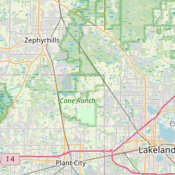
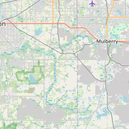
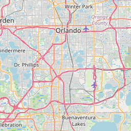
Auburndale Map, Satellite view of Auburndale, Florida
Auburndale is a city located in Polk County, Florida, USA.
Location informations of Auburndale
Latitude of city of Auburndale is 28.06530 and longitude of city of Auburndale is -81.78869- What Country is Auburndale In? Auburndale is located in the United States of America.
- What State is Auburndale located in? Auburndale is located in Florida.
- What County is Auburndale In? The County of Auburndale is Polk County
Auburndale, Florida (FL), USA Geographic Information
| Country | United States |
| Country Code | US |
| State Name | Florida |
| Latitude | 28.0653 |
| Longitude | -81.78869 |
| DMS Lat | 28°3'55.08" N |
| DMS Long | 81°47'19.284" W |
| DMS coordinates : | 28°3'55.08" N 81°47'19.284" W |
Current Date and Time in Auburndale, Florida, USA
| Auburndale Time Zone : America/New_York |
What day is it in Auburndale right now?Thursday (May 22, 2025) |
What time is it?Current local time and date at Auburndale is 5/22/2025 - 12:11:44 PM |
Postcode / zip code of Auburndale
Auburndale is the actual or alternate city name associated with 5 ZIP Codes by the US Postal Service.
List of all postal codes in Auburndale, Florida, United States.
33823 Zip Code 33850 Zip Code 33868 Zip Code 33880 Zip Code 33881 Zip Code
Online Map of Auburndale - road map, satellite view and street view


Check out our interactive map of Auburndale, Florida and you'll easily find your way around the Auburndale major roads and highways.
Satellite Map of Auburndale, FL, USA
This is online map of the address Auburndale, FL, United States. You may use button to move and zoom in / out. The map information is for reference only.
Jack Browns Seaplane Base (2.68 Km / 1.67 Miles)
Market World Airport (2.83 Km / 1.76 Miles)
Winter Haven Regional Airport - Gilbert Field (3.48 Km / 2.16 Miles)
King Seaaero Seaplane Base (4.54 Km / 2.82 Miles)
Garner Landing Seaplane Base (4.58 Km / 2.85 Miles)
Eagles Nest Heliport (6.34 Km / 3.94 Miles)
Winter Haven Hospital Heliport (7.52 Km / 4.67 Miles)
Little's Heliport (10.75 Km / 6.68 Miles)
Orlampa Inc Airport / Fantasy of Flight (11.47 Km / 7.13 Miles)
Oak Harbor Seaplane Base (12.16 Km / 7.55 Miles)
Adams Executive Heliport (12.39 Km / 7.70 Miles)
Cypress Gardens Heliport (12.60 Km / 7.83 Miles)
McCollum Airport (13.25 Km / 8.23 Miles)
Bartow Executive Airport (13.56 Km / 8.43 Miles)
Lazy B I Ranch Heliport (13.75 Km / 8.54 Miles)
Lake Hamilton Seaplane Base (14.81 Km / 9.20 Miles)
Dancing Oaks Heliport (14.93 Km / 9.28 Miles)
Flanders Field (16.15 Km / 10.04 Miles)
Lakeland Regional Medical Center Heliport (16.25 Km / 10.10 Miles)
Gore Airport (16.39 Km / 10.18 Miles)
AUBURNDALE CENTRAL ELEMENTARY SCHOOL (537 m / 0.33 Miles)
JERE L. STAMBAUGH MIDDLE (578 m / 0.36 Miles)
AUBURNDALE SENIOR HIGH SCHOOL (788 m / 0.49 Miles)
WALTER CALDWELL ELEMENTARY SCHOOL (1.45 Km / 0.90 Miles)
LENA VISTA ELEMENTARY SCHOOL (2.95 Km / 1.83 Miles)
FRED G. GARNER ELEMENTARY SCHOOL (3.77 Km / 2.34 Miles)
WESTWOOD MIDDLE SCHOOL (4.11 Km / 2.55 Miles)
HARTRIDGE ACADEMY (4.16 Km / 2.58 Miles)
CLARENCE BOSWELL ELEMENTARY SCHOOL (4.96 Km / 3.08 Miles)
List of places near to Auburndale
| Name | Distance |
|---|---|
| Inwood | 3.91 Km / 2.43 Miles |
| Jan Phyl Village | 5.86 Km / 3.64 Miles |
| Lake Alfred | 7.06 Km / 4.39 Miles |
| Fussels Corner | 7.17 Km / 4.46 Miles |
| Winter Haven | 7.28 Km / 4.52 Miles |
| Eagle Lake | 10.17 Km / 6.32 Miles |
| Combee Settlement | 11.47 Km / 7.13 Miles |
| Crystal Lake | 12.20 Km / 7.58 Miles |
| Cypress Gardens | 12.52 Km / 7.78 Miles |
| Polk City | 13.48 Km / 8.38 Miles |
| Wahneta | 13.90 Km / 8.64 Miles |
| Highland City | 14.15 Km / 8.79 Miles |
| Lake Hamilton | 15.95 Km / 9.91 Miles |
| Lakeland | 16.07 Km / 9.99 Miles |
| Dundee | 17.30 Km / 10.75 Miles |
| Haines City | 17.62 Km / 10.95 Miles |
| Bartow | 19.53 Km / 12.14 Miles |
| Waverly | 19.66 Km / 12.22 Miles |
| Lakeland Highlands | 19.72 Km / 12.25 Miles |
| Medulla | 21.13 Km / 13.13 Miles |
| Davenport | 21.22 Km / 13.19 Miles |
| Alturas | 22.71 Km / 14.11 Miles |
| Grenelefe | 23.74 Km / 14.75 Miles |
| Kathleen | 23.81 Km / 14.79 Miles |