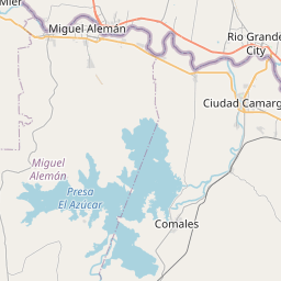
B and E Map, Satellite view of B and E, Texas
B and E is a census-designated place (CDP) located in Starr County, Texas, USA.
Location informations of B and E
Latitude of city of B and E is 26.35653 and longitude of city of B and E is -98.75368- What Country is B and E In? B and E is located in the United States of America.
- What State is B and E located in? B and E is located in Texas.
- What County is B and E In? The County of B and E is Starr County
B and E, Texas (TX), USA Geographic Information
| Country | United States |
| Country Code | US |
| State Name | Texas |
| Latitude | 26.35653 |
| Longitude | -98.75368 |
| DMS Lat | 26°21'23.508" N |
| DMS Long | 98°45'13.248" W |
| DMS coordinates : | 26°21'23.508" N 98°45'13.248" W |
Current Date and Time in B and E, Texas, USA
| B and E Time Zone : America/Chicago |
What day is it in B and E right now?Thursday (April 24, 2025) |
What time is it?Current local time and date at B and E is 4/24/2025 - 4:31:51 AM |
Postcode / zip code of B and E
B and E is the actual or alternate city name associated with 1 ZIP Codes by the US Postal Service.
List of all postal codes in B and E, Texas, United States.
78582 Zip Code
Online Map of B and E - road map, satellite view and street view


Check out our interactive map of B and E, Texas and you'll easily find your way around the B and E major roads and highways.
Satellite Map of B and E, TX, USA
This is online map of the address B and E, TX, United States. You may use button to move and zoom in / out. The map information is for reference only.
Rio Grande City Airport (1949) (5.11 Km / 3.17 Miles)
Starr County Memorial Hospital Heliport (10.66 Km / 6.62 Miles)
Rio Grande City Municipal Airport (11.90 Km / 7.39 Miles)
Rio Grande Field (18.76 Km / 11.66 Miles)
Continental Oil Company Airport (24.66 Km / 15.32 Miles)
Rio Grande City TARS Site (24.81 Km / 15.42 Miles)
JOHN & OLIVE HINOJOSA EL (2.19 Km / 1.36 Miles)
DR MARIO E RAMIREZ EL (2.66 Km / 1.65 Miles)
LA UNION EL (4.90 Km / 3.04 Miles)
List of places near to B and E
| Name | Distance |
|---|---|
| Garza-Salinas II | 0.79 Km / 0.49 Miles |
| Santa Cruz | 1.48 Km / 0.92 Miles |
| La Puerta | 1.59 Km / 0.99 Miles |
| El Chaparral | 1.61 Km / 1.00 Miles |
| El Refugio | 1.81 Km / 1.12 Miles |
| Santa Rosa | 1.84 Km / 1.14 Miles |
| Camargito | 1.94 Km / 1.21 Miles |
| Amada Acres | 2.06 Km / 1.28 Miles |
| Las Lomas | 2.34 Km / 1.45 Miles |
| Chaparrito | 2.53 Km / 1.57 Miles |
| El Mesquite | 3.60 Km / 2.24 Miles |
| Valle Hermoso | 4.39 Km / 2.73 Miles |
| Olivia Lopez de Gutierrez | 4.89 Km / 3.04 Miles |
| La Casita | 5.29 Km / 3.29 Miles |
| El Rancho Vela | 5.48 Km / 3.41 Miles |
| Manuel Garcia | 5.78 Km / 3.59 Miles |
| Netos | 6.05 Km / 3.76 Miles |
| Rio Grande City | 7.12 Km / 4.42 Miles |
| Loma Linda East | 7.14 Km / 4.44 Miles |
| Garciasville | 7.26 Km / 4.51 Miles |
| Martinez | 7.30 Km / 4.54 Miles |
| Victoria Vera | 7.41 Km / 4.60 Miles |
| Ramirez-Perez | 7.48 Km / 4.65 Miles |
| Manuel Garcia II | 7.90 Km / 4.91 Miles |
| Sammy Martinez | 8.49 Km / 5.28 Miles |
| La Carla | 8.87 Km / 5.51 Miles |
| Fernando Salinas | 8.98 Km / 5.58 Miles |
| San Fernando | 9.63 Km / 5.98 Miles |
| Airport Heights | 10.10 Km / 6.28 Miles |
| West Alto Bonito | 10.17 Km / 6.32 Miles |
| Valle Vista | 10.85 Km / 6.74 Miles |
| Olmito and Olmito | 11.28 Km / 7.01 Miles |
| La Victoria | 11.46 Km / 7.12 Miles |
| El Castillo | 11.71 Km / 7.28 Miles |
| El Socio | 11.75 Km / 7.30 Miles |
| Eugenio Saenz | 12.01 Km / 7.46 Miles |
| Alto Bonito Heights | 12.08 Km / 7.51 Miles |
| Gutierrez | 12.17 Km / 7.56 Miles |
| Villarreal | 12.21 Km / 7.59 Miles |
| La Escondida | 12.26 Km / 7.62 Miles |
| Zarate | 12.33 Km / 7.66 Miles |
| Mi Ranchito Estate | 12.42 Km / 7.72 Miles |
| Longoria | 12.61 Km / 7.84 Miles |
| Rivereno | 12.71 Km / 7.90 Miles |
| Ranchitos del Norte | 12.71 Km / 7.90 Miles |
| E. Lopez | 12.71 Km / 7.90 Miles |
| Pablo Pena | 12.72 Km / 7.90 Miles |
| El Brazil | 12.75 Km / 7.92 Miles |
| Narciso Pena | 12.80 Km / 7.95 Miles |
| Rafael Pena | 12.83 Km / 7.97 Miles |