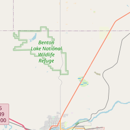
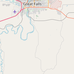
Black Eagle Map, Satellite view of Black Eagle, Montana
Black Eagle is a census-designated place (CDP) located in Cascade County, Montana, USA.
Location informations of Black Eagle
Latitude of city of Black Eagle is 47.52468 and longitude of city of Black Eagle is -111.27831- What Country is Black Eagle In? Black Eagle is located in the United States of America.
- What State is Black Eagle located in? Black Eagle is located in Montana.
- What County is Black Eagle In? The County of Black Eagle is Cascade County
Black Eagle, Montana (MT), USA Geographic Information
| Country | United States |
| Country Code | US |
| State Name | Montana |
| Latitude | 47.52468 |
| Longitude | -111.27831 |
| DMS Lat | 47°31'28.848" N |
| DMS Long | 111°16'41.916" W |
| DMS coordinates : | 47°31'28.848" N 111°16'41.916" W |
Current Date and Time in Black Eagle, Montana, USA
| Black Eagle Time Zone : America/Denver |
What day is it in Black Eagle right now?Tuesday (May 27, 2025) |
What time is it?Current local time and date at Black Eagle is 12:46:04 (05/27/2025) : (America/Denver) |
Postcode / zip code of Black Eagle
Black Eagle is the actual or alternate city name associated with 1 ZIP Codes by the US Postal Service.
List of all postal codes in Black Eagle, Montana, United States.
59414 Zip Code
Online Map of Black Eagle - road map, satellite view and street view


Check out our interactive map of Black Eagle, Montana and you'll easily find your way around the Black Eagle major roads and highways.
Satellite Map of Black Eagle, MT, USA
This is online map of the address Black Eagle, MT, United States. You may use button to move and zoom in / out. The map information is for reference only.
Benefis Healthcare Heliport (3.91 Km / 2.43 Miles)
Columbus Hospital Heliport (4.31 Km / 2.68 Miles)
Ranch Strip (6.78 Km / 4.21 Miles)
Malmstrom Air Force Base (7.21 Km / 4.48 Miles)
Horner Field (7.69 Km / 4.78 Miles)
Great Falls International Airport (8.43 Km / 5.24 Miles)
Agfertilizers Heliport (13.17 Km / 8.18 Miles)
Prill Field (14.60 Km / 9.07 Miles)
Buchanan Ranch Airport (17.23 Km / 10.70 Miles)
Smith Farms Airport (20.02 Km / 12.44 Miles)
Bair Airport (20.26 Km / 12.59 Miles)
North Middle School (1.23 Km / 0.76 Miles)
Sacajawea School (1.75 Km / 1.09 Miles)
Whittier School (2.09 Km / 1.30 Miles)
Roosevelt School (2.17 Km / 1.35 Miles)
Great Falls High School (2.56 Km / 1.59 Miles)
Riverview School (2.74 Km / 1.70 Miles)
Longfellow School (3.04 Km / 1.89 Miles)
C M Russell High School (3.11 Km / 1.93 Miles)
Lincoln School (3.28 Km / 2.04 Miles)
Morningside School (3.47 Km / 2.16 Miles)
MT Sch For Deaf & Blnd El (3.61 Km / 2.24 Miles)
Lewis & Clark School (3.64 Km / 2.26 Miles)
MT Sch For Deaf & Blnd HS (3.72 Km / 2.31 Miles)
Valley View School (3.75 Km / 2.33 Miles)
East Middle School (3.91 Km / 2.43 Miles)
Sunnyside School (4.34 Km / 2.69 Miles)
West Elementary (4.44 Km / 2.76 Miles)
Mountain View School (4.85 Km / 3.01 Miles)
Montana Academy of Salons (3.41 Km / 2.12 Miles)
University of Providence (3.82 Km / 2.37 Miles)
Great Falls College Montana State University (4.40 Km / 2.73 Miles)
List of places near to Black Eagle
| Name | Distance |
|---|---|
| Great Falls | 3.20 Km / 1.99 Miles |
| Gibson Flats | 6.55 Km / 4.07 Miles |
| Malmstrom AFB | 7.49 Km / 4.65 Miles |
| Sun Prairie | 15.31 Km / 9.51 Miles |
| Sand Coulee | 16.22 Km / 10.08 Miles |
| Ulm | 20.14 Km / 12.51 Miles |
| Vaughn | 20.47 Km / 12.72 Miles |
| Stockett | 20.53 Km / 12.76 Miles |