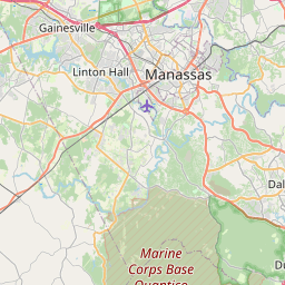
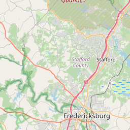
Boswell's Corner Map, Satellite view of Boswell's Corner, Virginia
Boswell's Corner is a census-designated place (CDP) located in Stafford County, Virginia, USA.
Location informations of Boswell's Corner
Latitude of city of Boswell's Corner is 38.50371 and longitude of city of Boswell's Corner is -77.37214- What Country is Boswell's Corner In? Boswell's Corner is located in the United States of America.
- What State is Boswell's Corner located in? Boswell's Corner is located in Virginia.
- What County is Boswell's Corner In? The County of Boswell's Corner is Stafford County
Boswell's Corner, Virginia (VA), USA Geographic Information
| Country | United States |
| Country Code | US |
| State Name | Virginia |
| Latitude | 38.50371 |
| Longitude | -77.37214 |
| DMS Lat | 38°30'13.356" N |
| DMS Long | 77°22'19.704" W |
| DMS coordinates : | 38°30'13.356" N 77°22'19.704" W |
Current Date and Time in Boswell's Corner, Virginia, USA
| Boswell's Corner Time Zone : America/New_York |
What day is it in Boswell's Corner right now?Saturday (May 31, 2025) |
What time is it?Current local time and date at Boswell's Corner is 05:42:38 (05/31/2025) : (America/New_York) |
Postcode / zip code of Boswell's Corner
Boswell's Corner is the actual or alternate city name associated with 1 ZIP Codes by the US Postal Service.
List of all postal codes in Boswell's Corner, Virginia, United States.
22554 Zip Code
Area Codes Boswell's Corner, Virginia, USA
Boswell's Corner, Virginia covers 1 Area Codes
540 Area CodeOnline Map of Boswell's Corner - road map, satellite view and street view


Check out our interactive map of Boswell's Corner, Virginia and you'll easily find your way around the Boswell's Corner major roads and highways.
Satellite Map of Boswell's Corner, VA, USA
This is online map of the address Boswell's Corner, VA, United States. You may use button to move and zoom in / out. The map information is for reference only.
Quantico Marine Corps Airfield / Turner Field (5.82 Km / 3.62 Miles)
Stafford Hospital Center Heliport (10.39 Km / 6.45 Miles)
Buds Ferry Airport (10.64 Km / 6.61 Miles)
Flying T Farm Airport (11.63 Km / 7.23 Miles)
Chimney View Airport (12.17 Km / 7.56 Miles)
Washington Field (12.94 Km / 8.04 Miles)
Stafford Regional Airport (13.81 Km / 8.58 Miles)
Potomac Hospital Helistop (16.52 Km / 10.27 Miles)
Sentara Northern Virginia Medical Center Heliport (16.72 Km / 10.39 Miles)
Dogwood Airpark (17.56 Km / 10.91 Miles)
Beaver Lodge Estate Heliport (17.62 Km / 10.95 Miles)
Holly Springs Farm Airport (20.04 Km / 12.45 Miles)
Breeden Airport (20.68 Km / 12.85 Miles)
Hartwood Airport (21.05 Km / 13.08 Miles)
Aden Field (21.31 Km / 13.24 Miles)
Maples Field (21.69 Km / 13.47 Miles)
Finagin Airfield (21.76 Km / 13.52 Miles)
Burgess Field (22.92 Km / 14.24 Miles)
SHIRLEY C. HEIM MIDDLE (2.24 Km / 1.39 Miles)
WIDEWATER ELEM (2.38 Km / 1.48 Miles)
ANNE E. MONCURE ELEM (4.98 Km / 3.09 Miles)
List of places near to Boswell's Corner
| Name | Distance |
|---|---|
| Aquia Harbour | 4.80 Km / 2.98 Miles |
| Quantico Base | 5.15 Km / 3.20 Miles |
| Triangle | 5.70 Km / 3.54 Miles |
| Quantico | 7.14 Km / 4.44 Miles |
| Dumfries | 8.08 Km / 5.02 Miles |
| Stafford Courthouse | 10.58 Km / 6.57 Miles |
| Cherry Hill | 11.74 Km / 7.29 Miles |
| Montclair | 12.25 Km / 7.61 Miles |
| Neabsco | 13.98 Km / 8.69 Miles |
| Dale City | 15.75 Km / 9.79 Miles |
| Independent Hill | 15.77 Km / 9.80 Miles |
| Potomac Mills | 17.21 Km / 10.69 Miles |
| Marumsco | 17.81 Km / 11.07 Miles |
| Woodbridge | 20.21 Km / 12.56 Miles |
| Southern Gateway | 21.02 Km / 13.06 Miles |
| County Center | 21.07 Km / 13.09 Miles |
| Indian Head | 21.17 Km / 13.15 Miles |
| Lake Ridge | 21.48 Km / 13.35 Miles |
| Falmouth | 21.67 Km / 13.47 Miles |
| Occoquan | 21.99 Km / 13.66 Miles |
| Fairview Beach | 22.16 Km / 13.77 Miles |
| Potomac Heights | 23.28 Km / 14.47 Miles |
| Passapatanzy | 23.50 Km / 14.60 Miles |
| Fredericksburg | 23.59 Km / 14.66 Miles |
| Mason Neck | 23.99 Km / 14.91 Miles |