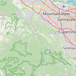
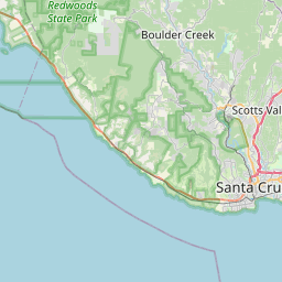
Boulder Creek Map, Satellite view of Boulder Creek, California
Boulder Creek is a census-designated place (CDP) located in Santa Cruz County, California, USA.
Location informations of Boulder Creek
Latitude of city of Boulder Creek is 37.12606 and longitude of city of Boulder Creek is -122.12219- What Country is Boulder Creek In? Boulder Creek is located in the United States of America.
- What State is Boulder Creek located in? Boulder Creek is located in California.
- What County is Boulder Creek In? The County of Boulder Creek is Santa Cruz County
Boulder Creek, California (CA), USA Geographic Information
| Country | United States |
| Country Code | US |
| State Name | California |
| Latitude | 37.12606 |
| Longitude | -122.12219 |
| DMS Lat | 37°7'33.816" N |
| DMS Long | 122°7'19.884" W |
| DMS coordinates : | 37°7'33.816" N 122°7'19.884" W |
Current Date and Time in Boulder Creek, California, USA
| Boulder Creek Time Zone : America/Los_Angeles |
What day is it in Boulder Creek right now?Saturday (June 7, 2025) |
What time is it?Current local time and date at Boulder Creek is 6/7/2025 - 9:11:25 PM |
Postcode / zip code of Boulder Creek
Boulder Creek is the actual or alternate city name associated with 1 ZIP Codes by the US Postal Service.
List of all postal codes in Boulder Creek, California, United States.
95006 Zip Code
Area Codes Boulder Creek, California, USA
Boulder Creek, California covers 1 Area Codes
831 Area CodeOnline Map of Boulder Creek - road map, satellite view and street view


Check out our interactive map of Boulder Creek, California and you'll easily find your way around the Boulder Creek major roads and highways.
Satellite Map of Boulder Creek, CA, USA
This is online map of the address Boulder Creek, CA, United States. You may use button to move and zoom in / out. The map information is for reference only.
Boulder Creek / Hilton Airport (4.51 Km / 2.80 Miles)
Bonny Doon Village Airport (6.19 Km / 3.85 Miles)
Santa Cruz Sky Park (11.65 Km / 7.24 Miles)
Joby Aero, Inc Heliport (11.73 Km / 7.29 Miles)
Cal Fire Alma Helitack Base (13.30 Km / 8.26 Miles)
Las Trancas Airport (14.07 Km / 8.74 Miles)
Dominican Hospital Heliport (19.50 Km / 12.12 Miles)
Lower Helipad (20.91 Km / 12.99 Miles)
Good Samaritan Hospital Heliport (20.96 Km / 13.03 Miles)
Upper Helipad (21.82 Km / 13.56 Miles)
Santa Cruz-Capitola Airport (22.69 Km / 14.10 Miles)
Boulder Creek Elementary (433 m / 0.27 Miles)
List of places near to Boulder Creek
| Name | Distance |
|---|---|
| Brookdale | 2.62 Km / 1.63 Miles |
| Ben Lomond | 5.19 Km / 3.22 Miles |
| Lompico | 6.57 Km / 4.08 Miles |
| Zayante | 7.94 Km / 4.93 Miles |
| Felton | 9.37 Km / 5.82 Miles |
| Bonny Doon | 9.72 Km / 6.04 Miles |
| Mount Hermon | 10.07 Km / 6.26 Miles |
| Scotts Valley | 12.67 Km / 7.87 Miles |
| Lexington Hills | 13.90 Km / 8.64 Miles |
| Davenport | 14.15 Km / 8.79 Miles |
| Paradise Park | 14.65 Km / 9.10 Miles |
| Pasatiempo | 16.01 Km / 9.95 Miles |
| Monte Sereno | 16.81 Km / 10.45 Miles |
| Los Gatos | 17.20 Km / 10.69 Miles |
| Saratoga | 17.66 Km / 10.97 Miles |
| Santa Cruz | 18.74 Km / 11.64 Miles |
| Live Oak | 20.23 Km / 12.57 Miles |
| Twin Lakes | 20.80 Km / 12.92 Miles |
| Soquel | 21.25 Km / 13.20 Miles |
| Cambrian Park | 22.34 Km / 13.88 Miles |
| Capitola | 22.49 Km / 13.97 Miles |
| Pleasure Point | 22.90 Km / 14.23 Miles |
| Loma Mar | 23.08 Km / 14.34 Miles |
| Cupertino | 23.30 Km / 14.48 Miles |
| Campbell | 23.53 Km / 14.62 Miles |
| Seacliff | 24.92 Km / 15.48 Miles |