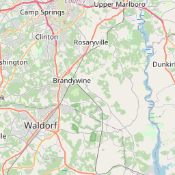
Brock Hall Map, Satellite view of Brock Hall, Maryland
Brock Hall is a census-designated place (CDP) located in Prince George's County, Maryland, USA.
Location informations of Brock Hall
Latitude of city of Brock Hall is 38.85011 and longitude of city of Brock Hall is -76.76108- What Country is Brock Hall In? Brock Hall is located in the United States of America.
- What State is Brock Hall located in? Brock Hall is located in Maryland.
- What County is Brock Hall In? The County of Brock Hall is Prince George's County
Brock Hall, Maryland (MD), USA Geographic Information
| Country | United States |
| Country Code | US |
| State Name | Maryland |
| Latitude | 38.85011 |
| Longitude | -76.76108 |
| DMS Lat | 38°51'0.396" N |
| DMS Long | 76°45'39.888" W |
| DMS coordinates : | 38°51'0.396" N 76°45'39.888" W |
Current Date and Time in Brock Hall, Maryland, USA
| Brock Hall Time Zone : America/New_York |
What day is it in Brock Hall right now?Saturday (April 26, 2025) |
What time is it?Current local time and date at Brock Hall is 21:11:03 (04/26/2025) : (America/New_York) |
Postcode / zip code of Brock Hall
Brock Hall is the actual or alternate city name associated with 2 ZIP Codes by the US Postal Service.
List of all postal codes in Brock Hall, Maryland, United States.
20772 Zip Code 20774 Zip Code
Area Codes Brock Hall, Maryland, USA
Brock Hall, Maryland covers 2 Area Codes
240 Area Code 301 Area CodeOnline Map of Brock Hall - road map, satellite view and street view


Check out our interactive map of Brock Hall, Maryland and you'll easily find your way around the Brock Hall major roads and highways.
Satellite Map of Brock Hall, MD, USA
This is online map of the address Brock Hall, MD, United States. You may use button to move and zoom in / out. The map information is for reference only.
Prince George Regional Medical Center Heliport (9.27 Km / 5.76 Miles)
Joint Base Andrews (10.16 Km / 6.31 Miles)
Freeway Airport (10.20 Km / 6.34 Miles)
Fedex Field Heliport (11.25 Km / 6.99 Miles)
Metroplex Heliport (14.15 Km / 8.79 Miles)
Southern Md Hospital Center Heliport (15.16 Km / 9.42 Miles)
Prince George's Hospital Center Heliport (16.45 Km / 10.22 Miles)
Fairview Airport (17.66 Km / 10.97 Miles)
Deale Airport (18.56 Km / 11.53 Miles)
Washington Executive Hyde Field (18.70 Km / 11.62 Miles)
Lee Airport (19.61 Km / 12.18 Miles)
MPD 5th Metropolitan Police Department Heliport (19.74 Km / 12.27 Miles)
College Park Airport (20.13 Km / 12.51 Miles)
Us Park Police Eagle's Nest Heliport (20.15 Km / 12.52 Miles)
Garner Field (20.24 Km / 12.58 Miles)
Beltsville Airport (20.37 Km / 12.66 Miles)
Potomac Airfield (20.46 Km / 12.72 Miles)
South Capitol Street Heliport (21.51 Km / 13.37 Miles)
Buzzards Point Seaplane Base (21.69 Km / 13.48 Miles)
Bolling Air Force Base (21.74 Km / 13.51 Miles)
List of places near to Brock Hall
| Name | Distance |
|---|---|
| Marlboro Village | 2.30 Km / 1.43 Miles |
| Upper Marlboro | 3.92 Km / 2.44 Miles |
| Marlboro Meadows | 4.28 Km / 2.66 Miles |
| Westphalia | 4.36 Km / 2.71 Miles |
| Kettering | 6.02 Km / 3.74 Miles |
| Queensland | 6.85 Km / 4.26 Miles |
| Largo | 7.98 Km / 4.96 Miles |
| Mitchellville | 8.49 Km / 5.28 Miles |
| Woodmore | 8.70 Km / 5.41 Miles |
| Lake Arbor | 8.75 Km / 5.44 Miles |
| Melwood | 8.80 Km / 5.47 Miles |
| Marlton | 8.85 Km / 5.50 Miles |
| Queen Anne | 8.98 Km / 5.58 Miles |
| Forestville | 9.88 Km / 6.14 Miles |
| Andrews AFB | 10.38 Km / 6.45 Miles |
| Bowie | 10.64 Km / 6.61 Miles |
| Croom | 10.84 Km / 6.74 Miles |
| Summerfield | 11.08 Km / 6.88 Miles |
| District Heights | 11.14 Km / 6.92 Miles |
| Rosaryville | 11.20 Km / 6.96 Miles |
| Walker Mill | 11.37 Km / 7.06 Miles |
| Morningside | 11.50 Km / 7.15 Miles |
| Fairwood | 11.71 Km / 7.28 Miles |
| Springdale | 11.83 Km / 7.35 Miles |
| Peppermill Village | 11.94 Km / 7.42 Miles |
| Glenarden | 12.38 Km / 7.69 Miles |
| Seat Pleasant | 13.60 Km / 8.45 Miles |
| Camp Springs | 13.61 Km / 8.46 Miles |
| Capitol Heights | 13.95 Km / 8.67 Miles |
| Coral Hills | 14.04 Km / 8.72 Miles |
| Suitland | 14.10 Km / 8.76 Miles |
| Fairmount Heights | 14.52 Km / 9.02 Miles |
| Seabrook | 14.97 Km / 9.30 Miles |
| Landover | 14.99 Km / 9.31 Miles |
| Clinton | 15.19 Km / 9.44 Miles |
| Landover Hills | 15.36 Km / 9.54 Miles |
| Lanham | 15.66 Km / 9.73 Miles |
| Woodlawn | 15.79 Km / 9.81 Miles |
| Cheverly | 15.96 Km / 9.92 Miles |
| Silver Hill | 16.02 Km / 9.95 Miles |
| Glenn Dale | 16.13 Km / 10.02 Miles |
| Temple Hills | 16.47 Km / 10.23 Miles |
| Marlow Heights | 16.61 Km / 10.32 Miles |
| Dunkirk | 16.72 Km / 10.39 Miles |
| New Carrollton | 16.82 Km / 10.45 Miles |
| Hillcrest Heights | 17.28 Km / 10.74 Miles |
| Bladensburg | 17.94 Km / 11.15 Miles |
| Crofton | 18.03 Km / 11.20 Miles |
| Edmonston | 18.22 Km / 11.32 Miles |
| Colmar Manor | 18.46 Km / 11.47 Miles |