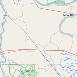
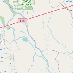
Brusly Map, Satellite view of Brusly, Louisiana
Brusly is a town located in West Baton Rouge Parish, Louisiana, USA.
Location informations of Brusly
Latitude of city of Brusly is 30.39436 and longitude of city of Brusly is -91.25372- What Country is Brusly In? Brusly is located in the United States of America.
- What State is Brusly located in? Brusly is located in Louisiana.
- What County is Brusly In? The County of Brusly is West Baton Rouge Parish
Brusly, Louisiana (LA), USA Geographic Information
| Country | United States |
| Country Code | US |
| State Name | Louisiana |
| Latitude | 30.39436 |
| Longitude | -91.25372 |
| DMS Lat | 30°23'39.696" N |
| DMS Long | 91°15'13.392" W |
| DMS coordinates : | 30°23'39.696" N 91°15'13.392" W |
Current Date and Time in Brusly, Louisiana, USA
| Brusly Time Zone : America/Chicago |
What day is it in Brusly right now?Saturday (May 24, 2025) |
What time is it?Current local time and date at Brusly is 5/24/2025 - 6:21:06 AM |
Postcode / zip code of Brusly
Brusly is the actual or alternate city name associated with 2 ZIP Codes by the US Postal Service.
List of all postal codes in Brusly, Louisiana, United States.
70719 Zip Code 70767 Zip Code
Online Map of Brusly - road map, satellite view and street view


Check out our interactive map of Brusly, Louisiana and you'll easily find your way around the Brusly major roads and highways.
Satellite Map of Brusly, LA, USA
This is online map of the address Brusly, LA, United States. You may use button to move and zoom in / out. The map information is for reference only.
Daniel Airport (4.80 Km / 2.98 Miles)
Spencer Calahan Office Building Helipad (8.07 Km / 5.02 Miles)
Simpson Airport (10.33 Km / 6.42 Miles)
La Dotd Headquarters Heliport (10.34 Km / 6.43 Miles)
Baton Rouge General Hospital Heliport (11.38 Km / 7.07 Miles)
Southern Helicopters Airport (11.46 Km / 7.12 Miles)
La Coste Construction County Airport (12.06 Km / 7.49 Miles)
Louisiana State Police Headquarters Heliport (12.74 Km / 7.92 Miles)
Omni Airport (13.45 Km / 8.36 Miles)
Our Lady of the Lake Regional Medical Center Heliport (14.21 Km / 8.83 Miles)
Ochsner Medical Complex Iberville Heliport (14.69 Km / 9.13 Miles)
Landmark of Plaquemine Heliport (14.81 Km / 9.20 Miles)
Our Lady of the Lake Children's Hospital Heliport (15.04 Km / 9.35 Miles)
Baton Rouge General Medical Center Heliport (15.23 Km / 9.46 Miles)
Wilbert Airport (15.27 Km / 9.49 Miles)
La National Guard Heliport (15.35 Km / 9.54 Miles)
Louisiana State Police Headquarters Heliport (15.38 Km / 9.55 Miles)
Transcontinental Gas Pipeline Corp Heliport (15.42 Km / 9.58 Miles)
Region 1 Headquarters-State Police Heliport (15.61 Km / 9.70 Miles)
Woman's Hospital Heliport (16.47 Km / 10.23 Miles)
Brusly Elementary School (361 m / 0.22 Miles)
Brusly High School (1.44 Km / 0.90 Miles)
Lukeville Upper Elementary (1.49 Km / 0.92 Miles)
Brusly Middle School (2.04 Km / 1.27 Miles)
List of places near to Brusly
| Name | Distance |
|---|---|
| Addis | 4.65 Km / 2.89 Miles |
| Port Allen | 7.67 Km / 4.77 Miles |
| Baton Rouge | 11.39 Km / 7.08 Miles |
| Plaquemine | 11.85 Km / 7.36 Miles |
| Gardere | 12.17 Km / 7.56 Miles |
| Westminster | 16.08 Km / 9.99 Miles |
| Inniswold | 16.37 Km / 10.17 Miles |
| Oak Hills Place | 16.39 Km / 10.18 Miles |
| Crescent | 16.62 Km / 10.33 Miles |
| Grosse Tete | 17.36 Km / 10.79 Miles |
| Village St. George | 18.24 Km / 11.33 Miles |
| Merrydale | 18.31 Km / 11.38 Miles |
| Rosedale | 19.72 Km / 12.25 Miles |
| Brownfields | 20.71 Km / 12.87 Miles |
| Erwinville | 21.20 Km / 13.17 Miles |
| St. Gabriel | 21.23 Km / 13.19 Miles |
| Bayou Goula | 22.06 Km / 13.71 Miles |
| Monticello | 22.30 Km / 13.86 Miles |
| Old Jefferson | 22.74 Km / 14.13 Miles |
| Baker | 23.06 Km / 14.33 Miles |
| Shenandoah | 24.26 Km / 15.07 Miles |