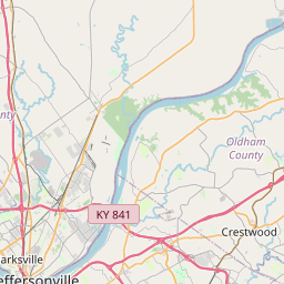
Buckner Map, Satellite view of Buckner, Kentucky
Buckner is a census-designated place (CDP) located in Oldham County, Kentucky, USA.
Location informations of Buckner
Latitude of city of Buckner is 38.38368 and longitude of city of Buckner is -85.43996- What Country is Buckner In? Buckner is located in the United States of America.
- What State is Buckner located in? Buckner is located in Kentucky.
- What County is Buckner In? The County of Buckner is Oldham County
Buckner, Kentucky (KY), USA Geographic Information
| Country | United States |
| Country Code | US |
| State Name | Kentucky |
| Latitude | 38.38368 |
| Longitude | -85.43996 |
| DMS Lat | 38°23'1.248" N |
| DMS Long | 85°26'23.856" W |
| DMS coordinates : | 38°23'1.248" N 85°26'23.856" W |
Current Date and Time in Buckner, Kentucky, USA
| Buckner Time Zone : America/New_York |
What day is it in Buckner right now?Thursday (May 22, 2025) |
What time is it?Current local time and date at Buckner is 05:23:48 (05/22/2025) : (America/New_York) |
Postcode / zip code of Buckner
Buckner is the actual or alternate city name associated with 3 ZIP Codes by the US Postal Service.
List of all postal codes in Buckner, Kentucky, United States.
40010 Zip Code 40014 Zip Code 40031 Zip Code
Online Map of Buckner - road map, satellite view and street view


Check out our interactive map of Buckner, Kentucky and you'll easily find your way around the Buckner major roads and highways.
Satellite Map of Buckner, KY, USA
This is online map of the address Buckner, KY, United States. You may use button to move and zoom in / out. The map information is for reference only.
Baptist Health La Grange Heliport (5.62 Km / 3.49 Miles)
Jeffries Farm Airport (7.18 Km / 4.46 Miles)
Timmons Field (11.42 Km / 7.10 Miles)
Woodledge Farm Airport (11.74 Km / 7.29 Miles)
Norton Brownsboro Hospital Heliport (14.05 Km / 8.73 Miles)
Greener Horizons Heliport (16.12 Km / 10.02 Miles)
Jake's Field (16.40 Km / 10.19 Miles)
Lyndon Fire Protection District Heliport (19.66 Km / 12.22 Miles)
Twin Lakes Airport (19.75 Km / 12.27 Miles)
Papa John's Headquarters Heliport (20.54 Km / 12.76 Miles)
Flying C Farms Airport (20.62 Km / 12.81 Miles)
Rooster Field (22.82 Km / 14.18 Miles)
Holloway Field (23.47 Km / 14.58 Miles)
Marble Hill Heliport (23.48 Km / 14.59 Miles)
Baptist Hospital East Heliport (23.70 Km / 14.73 Miles)
Oldham County Middle School (283 m / 0.18 Miles)
Buckner Elementary School (304 m / 0.19 Miles)
Oldham County Preschool (484 m / 0.30 Miles)
Oldham County High School (667 m / 0.41 Miles)
Buckner Alternative High School (680 m / 0.42 Miles)
The Robert L. Arvin Education Center (708 m / 0.44 Miles)
La Grange Education Center (3.07 Km / 1.90 Miles)
Luther Luckett Education Center (3.52 Km / 2.18 Miles)
Centerfield Elementary School (3.88 Km / 2.41 Miles)
List of places near to Buckner
| Name | Distance |
|---|---|
| La Grange | 5.95 Km / 3.70 Miles |
| Crestwood | 7.19 Km / 4.47 Miles |
| Pewee Valley | 9.12 Km / 5.67 Miles |
| Orchard Grass Hills | 9.74 Km / 6.05 Miles |
| Coldstream | 10.59 Km / 6.58 Miles |
| Westport | 11.02 Km / 6.85 Miles |
| Worthington Hills | 11.25 Km / 6.99 Miles |
| Goshen | 11.89 Km / 7.39 Miles |
| Fincastle | 12.27 Km / 7.62 Miles |
| River Bluff | 13.82 Km / 8.59 Miles |
| Langdon Place | 15.12 Km / 9.40 Miles |
| Creekside | 15.25 Km / 9.48 Miles |
| Prospect | 15.28 Km / 9.49 Miles |
| Anchorage | 15.33 Km / 9.53 Miles |
| Hickory Hill | 15.48 Km / 9.62 Miles |
| Ten Broeck | 15.63 Km / 9.71 Miles |
| Smithfield | 15.96 Km / 9.92 Miles |
| Meadow Vale | 16.05 Km / 9.97 Miles |
| Broeck Pointe | 16.07 Km / 9.99 Miles |
| Rolling Hills | 16.25 Km / 10.10 Miles |
| Brownsboro Farm | 16.31 Km / 10.13 Miles |
| Murray Hill | 16.59 Km / 10.31 Miles |
| Meadowbrook Farm | 16.62 Km / 10.33 Miles |
| Green Spring | 16.92 Km / 10.51 Miles |
| Westwood | 16.97 Km / 10.54 Miles |
| Barbourmeade | 17.18 Km / 10.68 Miles |
| Plantation | 17.26 Km / 10.72 Miles |
| Woodland Hills | 17.55 Km / 10.91 Miles |
| Moorland | 17.62 Km / 10.95 Miles |
| Middletown | 17.64 Km / 10.96 Miles |
| Briarwood | 17.78 Km / 11.05 Miles |
| Spring Valley | 17.79 Km / 11.05 Miles |
| Old Brownsboro Place | 18.33 Km / 11.39 Miles |
| Manor Creek | 18.48 Km / 11.48 Miles |
| Sycamore | 18.49 Km / 11.49 Miles |
| Hills and Dales | 18.54 Km / 11.52 Miles |
| Bancroft | 18.69 Km / 11.61 Miles |
| Wildwood | 18.90 Km / 11.74 Miles |
| Blue Ridge Manor | 18.96 Km / 11.78 Miles |
| Douglass Hills | 18.97 Km / 11.79 Miles |
| Thornhill | 19.36 Km / 12.03 Miles |
| Simpsonville | 19.38 Km / 12.04 Miles |
| Utica | 19.44 Km / 12.08 Miles |
| Goose Creek | 19.68 Km / 12.23 Miles |
| Bellemeade | 19.74 Km / 12.27 Miles |
| Glenview Hills | 19.94 Km / 12.39 Miles |
| Lyndon | 19.95 Km / 12.40 Miles |
| Graymoor-Devondale | 20.15 Km / 12.52 Miles |
| Glenview | 20.16 Km / 12.53 Miles |
| Glenview Manor | 20.23 Km / 12.57 Miles |