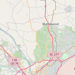
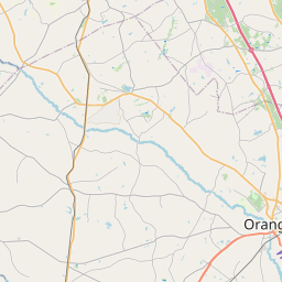
Cayce Map, Satellite view of Cayce, South Carolina
Cayce is a city located in Lexington County, Richland County, South Carolina, USA.
Location informations of Cayce
Latitude of city of Cayce is 33.95050 and longitude of city of Cayce is -81.03981- What Country is Cayce In? Cayce is located in the United States of America.
- What State is Cayce located in? Cayce is located in South Carolina.
- What County is Cayce In? Cayce, South Carolina sits in Two different counties: Lexington County, Richland County
Cayce, South Carolina (SC), USA Geographic Information
| Country | United States |
| Country Code | US |
| State Name | South Carolina |
| Latitude | 33.9505 |
| Longitude | -81.03981 |
| DMS Lat | 33°57'1.8" N |
| DMS Long | 81°2'23.316" W |
| DMS coordinates : | 33°57'1.8" N 81°2'23.316" W |
Current Date and Time in Cayce, South Carolina, USA
| Cayce Time Zone : America/New_York |
What day is it in Cayce right now?Tuesday (May 27, 2025) |
What time is it?Current local time and date at Cayce is 19:20:58 (05/27/2025) : (America/New_York) |
Postcode / zip code of Cayce
Cayce is the actual or alternate city name associated with 5 ZIP Codes by the US Postal Service.
List of all postal codes in Cayce, South Carolina, United States.
29033 Zip Code 29170 Zip Code 29172 Zip Code 29201 Zip Code 29209 Zip Code
Online Map of Cayce - road map, satellite view and street view


Check out our interactive map of Cayce, South Carolina and you'll easily find your way around the Cayce major roads and highways.
Satellite Map of Cayce, SC, USA
This is online map of the address Cayce, SC, United States. You may use button to move and zoom in / out. The map information is for reference only.
Jim Hamilton L.B. Owens Airport (4.68 Km / 2.91 Miles)
Columbia Metropolitan Airport (7.47 Km / 4.64 Miles)
Providence Hospital Heliport (7.57 Km / 4.71 Miles)
Lexington Medical Center Heliport (8.11 Km / 5.04 Miles)
Richland Memorial Hospital Heliport (8.63 Km / 5.36 Miles)
Sled Heliport (14.63 Km / 9.09 Miles)
Fort Jackson Helipad Heliport (15.87 Km / 9.86 Miles)
South Carolina Pipeline Heliport (17.84 Km / 11.08 Miles)
Darden Airport (18.04 Km / 11.21 Miles)
Gaston Airport (18.90 Km / 11.74 Miles)
Mc Entire Joint National Guard Base (22.25 Km / 13.83 Miles)
Gwinn Field (22.56 Km / 14.02 Miles)
Cyril B. Busbee Creative Arts Academy (785 m / 0.49 Miles)
Cayce Elementary (981 m / 0.61 Miles)
Brookland-Cayce Senior High (3.86 Km / 2.40 Miles)
A. C. Moore Elementary (4.86 Km / 3.02 Miles)
List of places near to Cayce
| Name | Distance |
|---|---|
| West Columbia | 5.73 Km / 3.56 Miles |
| Springdale | 6.45 Km / 4.01 Miles |
| Pine Ridge | 7.45 Km / 4.63 Miles |
| Forest Acres | 8.93 Km / 5.55 Miles |
| South Congaree | 9.87 Km / 6.13 Miles |
| Oak Grove | 9.89 Km / 6.15 Miles |
| St. Andrews | 12.39 Km / 7.70 Miles |
| Arcadia Lakes | 13.58 Km / 8.44 Miles |
| Dentsville | 14.70 Km / 9.13 Miles |
| Seven Oaks | 14.70 Km / 9.13 Miles |
| Woodfield | 15.72 Km / 9.77 Miles |
| Gaston | 15.87 Km / 9.86 Miles |
| Hopkins | 15.87 Km / 9.86 Miles |
| Columbia | 15.88 Km / 9.87 Miles |
| Red Bank | 18.44 Km / 11.46 Miles |
| Lexington | 18.44 Km / 11.46 Miles |
| Irmo | 22.12 Km / 13.74 Miles |
| Swansea | 24.21 Km / 15.04 Miles |