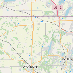
Chemung (Township) Map, Satellite view of Chemung (Township), Illinois
Chemung (Township) is a township located in McHenry County, Illinois, USA.
Location informations of Chemung (Township)
Latitude of city of Chemung (Township) is 42.45485 and longitude of city of Chemung (Township) is -88.64768- What Country is Chemung (Township) In? Chemung (Township) is located in the United States of America.
- What State is Chemung (Township) located in? Chemung (Township) is located in Illinois.
- What County is Chemung (Township) In? The County of Chemung (Township) is McHenry County
Chemung (Township), Illinois (IL), USA Geographic Information
| Country | United States |
| Country Code | US |
| State Name | Illinois |
| Latitude | 42.45485 |
| Longitude | -88.64768 |
| DMS Lat | 42°27'17.46" N |
| DMS Long | 88°38'51.648" W |
| DMS coordinates : | 42°27'17.46" N 88°38'51.648" W |
Current Date and Time in Chemung (Township), Illinois, USA
| Chemung (Township) Time Zone : America/Chicago |
What day is it in Chemung (Township) right now?Saturday (July 26, 2025) |
What time is it?Current local time and date at Chemung (Township) is 14:10:31 (07/26/2025) : (America/Chicago) |
Postcode / zip code of Chemung (Township)
Chemung (Township) is the actual or alternate city name associated with 1 ZIP Codes by the US Postal Service.
List of all postal codes in Chemung (Township), Illinois, United States.
60033 Zip Code
Area Codes Chemung (Township), Illinois, USA
Chemung (Township), Illinois covers 2 Area Codes
779 Area Code 815 Area CodeOnline Map of Chemung (Township) - road map, satellite view and street view


Check out our interactive map of Chemung (Township), Illinois and you'll easily find your way around the Chemung (Township) major roads and highways.
Satellite Map of Chemung (Township), IL, USA
This is online map of the address Chemung (Township), IL, United States. You may use button to move and zoom in / out. The map information is for reference only.
Motorola Csg-Harvard Heliport (4.07 Km / 2.53 Miles)
Mercy Harvard Hospital Heliport (4.55 Km / 2.82 Miles)
Kirkpatrick Airport (5.12 Km / 3.18 Miles)
Twin Gardens Airport (5.18 Km / 3.22 Miles)
Dacy Airport (5.95 Km / 3.70 Miles)
Sd Aero Airport (6.21 Km / 3.86 Miles)
Munch Heliport (7.73 Km / 4.80 Miles)
Big Foot Airfield (7.89 Km / 4.90 Miles)
Pine Hill Airport (7.97 Km / 4.95 Miles)
Mary's Landing Airport (8.42 Km / 5.23 Miles)
Big Foot Farms Heliport (9.37 Km / 5.82 Miles)
Barten Airport (10.62 Km / 6.60 Miles)
Adkins RLA Restricted Landing Area (11.40 Km / 7.08 Miles)
Bingham Airport (13.12 Km / 8.15 Miles)
Hilbert Airport (14.07 Km / 8.74 Miles)
Smilin' Sam's Airport (14.74 Km / 9.16 Miles)
Hunter Airport (15.94 Km / 9.90 Miles)
Bob Walberg Field (17.45 Km / 10.84 Miles)
Lee Creek Airport (18.67 Km / 11.60 Miles)
Lake Lawn Airport (20.29 Km / 12.61 Miles)
Jefferson Elem School (4.12 Km / 2.56 Miles)
Harvard High School (4.30 Km / 2.67 Miles)
Harvard Jr High School (4.34 Km / 2.69 Miles)
Washington Elem School (4.50 Km / 2.80 Miles)
List of places near to Chemung (Township)
| Name | Distance |
|---|---|
| Harvard | 4.57 Km / 2.84 Miles |
| Chemung | 4.67 Km / 2.90 Miles |
| Sharon | 8.52 Km / 5.29 Miles |
| Alden | 9.18 Km / 5.70 Miles |
| LeRoy | 9.20 Km / 5.72 Miles |
| Walworth | 9.36 Km / 5.82 Miles |
| Dunham | 9.55 Km / 5.93 Miles |
| Capron | 9.77 Km / 6.07 Miles |
| Walworth (Town) | 9.89 Km / 6.15 Miles |
| Sharon (Town) | 10.80 Km / 6.71 Miles |
| Boone | 12.05 Km / 7.49 Miles |
| Fontana-on-Geneva Lake | 12.07 Km / 7.50 Miles |
| Hartland | 13.39 Km / 8.32 Miles |
| Delavan Lake | 14.43 Km / 8.97 Miles |
| Linn | 15.79 Km / 9.81 Miles |
| Williams Bay | 16.26 Km / 10.10 Miles |
| Darien | 17.05 Km / 10.59 Miles |
| Poplar Grove (Township) | 17.22 Km / 10.70 Miles |
| Poplar Grove | 17.25 Km / 10.72 Miles |
| Delavan (Town) | 17.74 Km / 11.02 Miles |
| Hebron | 17.76 Km / 11.04 Miles |
| Marengo (Township) | 18.22 Km / 11.32 Miles |
| Clinton (Town) | 18.71 Km / 11.63 Miles |
| Hebron (Township) | 19.21 Km / 11.94 Miles |
| Darien (Town) | 19.61 Km / 12.19 Miles |
| Delavan | 19.82 Km / 12.32 Miles |
| Bonus | 19.88 Km / 12.35 Miles |
| Manchester | 20.46 Km / 12.71 Miles |
| Seneca | 20.81 Km / 12.93 Miles |
| Candlewick Lake | 20.96 Km / 13.02 Miles |
| Clinton | 21.18 Km / 13.16 Miles |
| Bloomfield (Town) | 21.21 Km / 13.18 Miles |
| Greenwood (Township) | 21.89 Km / 13.60 Miles |
| Timberlane | 22.04 Km / 13.70 Miles |
| Como | 22.13 Km / 13.75 Miles |
| Caledonia | 22.24 Km / 13.82 Miles |
| Greenwood | 22.32 Km / 13.87 Miles |
| Woodstock | 22.58 Km / 14.03 Miles |
| Caledonia (Township) | 22.81 Km / 14.17 Miles |
| Marengo | 23.16 Km / 14.39 Miles |
| Lake Geneva | 23.23 Km / 14.43 Miles |
| Garden Prairie | 23.29 Km / 14.47 Miles |
| Geneva | 23.69 Km / 14.72 Miles |
| Bradford | 23.70 Km / 14.73 Miles |