Cherokee Strip Map, Satellite view of Cherokee Strip, California
Cherokee Strip is a census-designated place (CDP) located in Kern County, California, USA.
Location informations of Cherokee Strip
Latitude of city of Cherokee Strip is 35.46718 and longitude of city of Cherokee Strip is -119.26066- What Country is Cherokee Strip In? Cherokee Strip is located in the United States of America.
- What State is Cherokee Strip located in? Cherokee Strip is located in California.
- What County is Cherokee Strip In? The County of Cherokee Strip is Kern County
Cherokee Strip, California (CA), USA Geographic Information
| Country | United States |
| Country Code | US |
| State Name | California |
| Latitude | 35.46718 |
| Longitude | -119.26066 |
| DMS Lat | 35°28'1.848" N |
| DMS Long | 119°15'38.376" W |
| DMS coordinates : | 35°28'1.848" N 119°15'38.376" W |
Current Date and Time in Cherokee Strip, California, USA
| Cherokee Strip Time Zone : America/Los_Angeles |
What day is it in Cherokee Strip right now?Tuesday (June 10, 2025) |
What time is it?Current local time and date at Cherokee Strip is 19:14:18 (06/10/2025) : (America/Los_Angeles) |
Postcode / zip code of Cherokee Strip
Cherokee Strip is the actual or alternate city name associated with 1 ZIP Codes by the US Postal Service.
List of all postal codes in Cherokee Strip, California, United States.
93263 Zip Code
Area Codes Cherokee Strip, California, USA
Cherokee Strip, California covers 1 Area Codes
661 Area CodeOnline Map of Cherokee Strip - road map, satellite view and street view


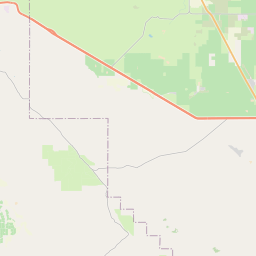


Check out our interactive map of Cherokee Strip, California and you'll easily find your way around the Cherokee Strip major roads and highways.
Satellite Map of Cherokee Strip, CA, USA
This is online map of the address Cherokee Strip, CA, United States. You may use button to move and zoom in / out. The map information is for reference only.
Greeley Airport (5.61 Km / 3.48 Miles)
Shafter Airport - Minter Field (7.66 Km / 4.76 Miles)
Joe Gottlieb Field (12.53 Km / 7.79 Miles)
Majors Airport (15.79 Km / 9.81 Miles)
Buttonwillow Land & Cattle Airport (16.04 Km / 9.96 Miles)
Mercy Hospital Southwest Heliport (18.73 Km / 11.64 Miles)
Poso Kern County Airport (18.74 Km / 11.64 Miles)
Meadows Field (18.82 Km / 11.69 Miles)
Wasco Kern County Airport (18.95 Km / 11.77 Miles)
Famoso Field (19.81 Km / 12.31 Miles)
Interstate Ag Airport (20.79 Km / 12.92 Miles)
Elk Hills Buttonwillow Airport (23.53 Km / 14.62 Miles)
San Joaquin Community Hospital Heliport (23.70 Km / 14.73 Miles)
Memorial Hospital Heliport (24.58 Km / 15.27 Miles)
Semitropic Field (24.74 Km / 15.37 Miles)
Golden Oak Elementary (3.97 Km / 2.46 Miles)
Redwood Elementary (4.37 Km / 2.72 Miles)
Richland Junior High (4.46 Km / 2.77 Miles)
Central Valley High (Continuation) (4.61 Km / 2.87 Miles)
Shafter High (4.64 Km / 2.88 Miles)
List of places near to Cherokee Strip
| Name | Distance |
|---|---|
| Mexican Colony | 0.75 Km / 0.47 Miles |
| Smith Corner | 2.05 Km / 1.27 Miles |
| Shafter | 3.84 Km / 2.39 Miles |
| Rosedale | 13.98 Km / 8.69 Miles |
| Wasco | 15.88 Km / 9.87 Miles |
| Greenacres | 16.55 Km / 10.28 Miles |
| Buttonwillow | 20.33 Km / 12.63 Miles |
| Tupman | 20.52 Km / 12.75 Miles |
| Oildale | 22.47 Km / 13.96 Miles |
| McFarland | 23.61 Km / 14.67 Miles |
| Bakersfield | 24.28 Km / 15.09 Miles |