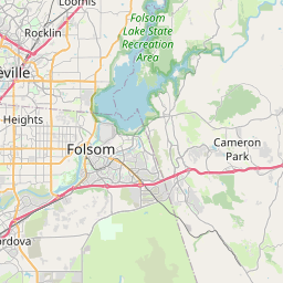
Cold Springs Map, Satellite view of Cold Springs, California
Cold Springs is a census-designated place (CDP) located in El Dorado County, California, USA.
Location informations of Cold Springs
Latitude of city of Cold Springs is 38.74185 and longitude of city of Cold Springs is -120.87022- What Country is Cold Springs In? Cold Springs is located in the United States of America.
- What State is Cold Springs located in? Cold Springs is located in California.
- What County is Cold Springs In? The County of Cold Springs is El Dorado County
Cold Springs, California (CA), USA Geographic Information
| Country | United States |
| Country Code | US |
| State Name | California |
| Latitude | 38.74185 |
| Longitude | -120.87022 |
| DMS Lat | 38°44'30.66" N |
| DMS Long | 120°52'12.792" W |
| DMS coordinates : | 38°44'30.66" N 120°52'12.792" W |
Current Date and Time in Cold Springs, California, USA
| Cold Springs Time Zone : America/Los_Angeles |
What day is it in Cold Springs right now?Saturday (June 7, 2025) |
What time is it?Current local time and date at Cold Springs is 6/7/2025 - 4:39:51 AM |
Postcode / zip code of Cold Springs
Cold Springs is the actual or alternate city name associated with 1 ZIP Codes by the US Postal Service.
List of all postal codes in Cold Springs, California, United States.
95667 Zip Code
Online Map of Cold Springs - road map, satellite view and street view


Check out our interactive map of Cold Springs, California and you'll easily find your way around the Cold Springs major roads and highways.
Satellite Map of Cold Springs, CA, USA
This is online map of the address Cold Springs, CA, United States. You may use button to move and zoom in / out. The map information is for reference only.
Akin Airport (2.84 Km / 1.77 Miles)
Pg & E Co. Placerville Svc Center Heliport (6.43 Km / 3.99 Miles)
Bacchi Valley Industries Airport (9.52 Km / 5.92 Miles)
Placerville Airport (10.36 Km / 6.43 Miles)
Cameron Park Airport (12.08 Km / 7.50 Miles)
Dubey Airport (12.42 Km / 7.72 Miles)
Perryman Airport (12.94 Km / 8.04 Miles)
High Hill Ranch Heliport (13.20 Km / 8.20 Miles)
Swansboro Country Airport (13.46 Km / 8.36 Miles)
Georgetown Airport (19.94 Km / 12.39 Miles)
Folsom Lake Seaplane Base (23.12 Km / 14.37 Miles)
Skyridge Airport (23.30 Km / 14.48 Miles)
Pg&E Auburn Service Center Heliport (24.06 Km / 14.95 Miles)
Mercy Hospital of Folsom Heliport (24.94 Km / 15.50 Miles)
Special Education (2.25 Km / 1.40 Miles)
Central Sierra ROP (2.32 Km / 1.44 Miles)
Indian Creek Elementary (2.36 Km / 1.47 Miles)
Charter Community School Home Study Academy (2.37 Km / 1.47 Miles)
Gold Trail (3.78 Km / 2.35 Miles)
Golden Ridge (4.02 Km / 2.50 Miles)
Edwin Markham Middle (4.72 Km / 2.93 Miles)
List of places near to Cold Springs
| Name | Distance |
|---|---|
| Placerville | 6.36 Km / 3.95 Miles |
| Coloma | 6.68 Km / 4.15 Miles |
| Diamond Springs | 7.11 Km / 4.42 Miles |
| Shingle Springs | 9.75 Km / 6.06 Miles |
| Cameron Park | 13.00 Km / 8.08 Miles |
| Camino | 16.94 Km / 10.53 Miles |
| Georgetown | 18.55 Km / 11.53 Miles |
| El Dorado Hills | 19.42 Km / 12.07 Miles |
| Auburn Lake Trails | 20.46 Km / 12.71 Miles |
| River Pines | 24.35 Km / 15.13 Miles |
| Pollock Pines | 24.69 Km / 15.34 Miles |
| Auburn | 24.83 Km / 15.43 Miles |