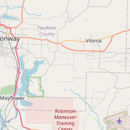
College Station Map, Satellite view of College Station, Arkansas
College Station is a census-designated place (CDP) located in Pulaski County, Arkansas, USA.
Location informations of College Station
Latitude of city of College Station is 34.70815 and longitude of city of College Station is -92.22126- What Country is College Station In? College Station is located in the United States of America.
- What State is College Station located in? College Station is located in Arkansas.
- What County is College Station In? The County of College Station is Pulaski County
College Station, Arkansas (AR), USA Geographic Information
| Country | United States |
| Country Code | US |
| State Name | Arkansas |
| Latitude | 34.70815 |
| Longitude | -92.22126 |
| DMS Lat | 34°42'29.34" N |
| DMS Long | 92°13'16.536" W |
| DMS coordinates : | 34°42'29.34" N 92°13'16.536" W |
Current Date and Time in College Station, Arkansas, USA
| College Station Time Zone : America/Chicago |
What day is it in College Station right now?Sunday (June 1, 2025) |
What time is it?Current local time and date at College Station is 22:17:35 (06/01/2025) : (America/Chicago) |
Postcode / zip code of College Station
College Station is the actual or alternate city name associated with 2 ZIP Codes by the US Postal Service.
List of all postal codes in College Station, Arkansas, United States.
72053 Zip Code 72206 Zip Code
Area Codes College Station, Arkansas, USA
College Station, Arkansas covers 1 Area Codes
501 Area CodeOnline Map of College Station - road map, satellite view and street view


Check out our interactive map of College Station, Arkansas and you'll easily find your way around the College Station major roads and highways.
Satellite Map of College Station, AR, USA
This is online map of the address College Station, AR, United States. You may use button to move and zoom in / out. The map information is for reference only.
Bill & Hillary Clinton National Airport/Adams Field (2.39 Km / 1.49 Miles)
Adams Field Heliport (3.07 Km / 1.90 Miles)
Arkansas Children's Hospital Heliport (7.65 Km / 4.76 Miles)
Pumpkin Patch Field (7.94 Km / 4.94 Miles)
UAMS Alpha Heliport (10.08 Km / 6.26 Miles)
UAMS Bravo Heliport (10.16 Km / 6.31 Miles)
Little Rock Police DepartmentHeliport (10.66 Km / 6.62 Miles)
St Vincent North Hospital Heliport (11.79 Km / 7.32 Miles)
CHI Saint Vincent Infirmary Heliport (11.88 Km / 7.38 Miles)
R.V. Stewart Field (12.49 Km / 7.76 Miles)
North Little Rock Municipal Airport (14.21 Km / 8.83 Miles)
Baptist Health Extended Care Heliport (15.11 Km / 9.39 Miles)
Robert Chris Mc Intosh Airport (15.99 Km / 9.94 Miles)
Arkansas Heart Hospital Heliport (16.06 Km / 9.98 Miles)
Robinson Army Air Field (17.35 Km / 10.78 Miles)
Southwest Hospital Heliport (17.71 Km / 11.00 Miles)
Bredlow Farm Airport (20.94 Km / 13.01 Miles)
Tango 7 Airport (21.15 Km / 13.14 Miles)
Franke Field (22.56 Km / 14.02 Miles)
Moore Farm Airport (23.51 Km / 14.61 Miles)
COLLEGE STATION ELEM. SCHOOL (138 m / 0.09 Miles)
ALTERNATIVE AGENCIES (3.99 Km / 2.48 Miles)
MANN MAGNET MIDDLE SCHOOL (4.25 Km / 2.64 Miles)
BOOKER ARTS MAGNET ELEM. SCH. (4.36 Km / 2.71 Miles)
CARVER MAGNET ELEM. SCHOOL (4.45 Km / 2.76 Miles)
WILBUR D. MILLS HIGH SCHOOL (4.83 Km / 3.00 Miles)
ROCKEFELLER INCENTIVE ELEM. (4.83 Km / 3.00 Miles)
List of places near to College Station
| Name | Distance |
|---|---|
| Sweet Home | 3.09 Km / 1.92 Miles |
| Little Rock | 7.56 Km / 4.70 Miles |
| North Little Rock | 8.01 Km / 4.98 Miles |
| Scott | 11.70 Km / 7.27 Miles |
| McAlmont | 11.72 Km / 7.28 Miles |
| Wrightsville | 11.77 Km / 7.31 Miles |
| Sherwood | 11.89 Km / 7.39 Miles |
| Cammack Village | 14.03 Km / 8.72 Miles |
| Landmark | 14.04 Km / 8.72 Miles |
| Shannon Hills | 18.70 Km / 11.62 Miles |
| Gibson | 19.63 Km / 12.20 Miles |
| Woodson | 19.91 Km / 12.37 Miles |
| Jacksonville | 20.29 Km / 12.61 Miles |
| East End | 20.66 Km / 12.84 Miles |
| Hensley | 22.59 Km / 14.04 Miles |
| Keo | 22.67 Km / 14.09 Miles |
| Alexander | 23.27 Km / 14.46 Miles |
| Maumelle | 24.30 Km / 15.10 Miles |