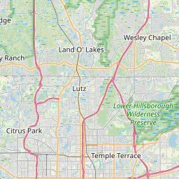
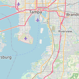
Dover Map, Satellite view of Dover, Florida
Dover is a census-designated place (CDP) located in Hillsborough County, Florida, USA.
Location informations of Dover
Latitude of city of Dover is 27.99419 and longitude of city of Dover is -82.21953- What Country is Dover In? Dover is located in the United States of America.
- What State is Dover located in? Dover is located in Florida.
- What County is Dover In? The County of Dover is Hillsborough County
Dover, Florida (FL), USA Geographic Information
| Country | United States |
| Country Code | US |
| State Name | Florida |
| Latitude | 27.99419 |
| Longitude | -82.21953 |
| DMS Lat | 27°59'39.084" N |
| DMS Long | 82°13'10.308" W |
| DMS coordinates : | 27°59'39.084" N 82°13'10.308" W |
Current Date and Time in Dover, Florida, USA
| Dover Time Zone : America/New_York |
What day is it in Dover right now?Thursday (May 15, 2025) |
What time is it?Current local time and date at Dover is 11:36:09 (05/15/2025) : (America/New_York) |
Postcode / zip code of Dover
Dover is the actual or alternate city name associated with 1 ZIP Codes by the US Postal Service.
List of all postal codes in Dover, Florida, United States.
33527 Zip Code
Online Map of Dover - road map, satellite view and street view


Check out our interactive map of Dover, Florida and you'll easily find your way around the Dover major roads and highways.
Satellite Map of Dover, FL, USA
This is online map of the address Dover, FL, United States. You may use button to move and zoom in / out. The map information is for reference only.
Plant City Municipal Airport (5.47 Km / 3.40 Miles)
Baycare South Florida Baptist Hospital Heliport (8.29 Km / 5.15 Miles)
Hospital Brandon Helistop (9.66 Km / 6.00 Miles)
Lewis Airport (11.23 Km / 6.98 Miles)
Tampa Executive Airport (12.54 Km / 7.79 Miles)
Hillsborough County Fire Rescue Heliport (12.67 Km / 7.87 Miles)
Midway Lake Airport (13.57 Km / 8.43 Miles)
Tampa General Hospital Brandon Healthplex Heliport (13.60 Km / 8.45 Miles)
Tampa Hard Rock Helipad (14.79 Km / 9.19 Miles)
Blackwater Creek Ultralightport (17.42 Km / 10.82 Miles)
Mezrah Seaplane Base (17.61 Km / 10.94 Miles)
South Lakeland Airport (18.52 Km / 11.51 Miles)
Kearney Construction Heliport (18.93 Km / 11.76 Miles)
Lakeland Linder International Airport (19.74 Km / 12.26 Miles)
Academy Heliport (20.41 Km / 12.68 Miles)
EMS Heliport (20.59 Km / 12.79 Miles)
AdventHealth Tampa Heliport (21.63 Km / 13.44 Miles)
James A Haley Veterans Hospital Heliport (21.97 Km / 13.65 Miles)
Stanchester Airport (22.27 Km / 13.84 Miles)
Teco Plaza Heliport (24.14 Km / 15.00 Miles)
WILLIS PETERS EXCEPTIONAL CENTER (976 m / 0.61 Miles)
DOVER ELEMENTARY SCHOOL (1.00 Km / 0.62 Miles)
BAILEY ELEMENTARY SCHOOL (3.39 Km / 2.11 Miles)
INDEPENDENCE ACADEMY (3.47 Km / 2.16 Miles)
STRAWBERRY CREST HIGH SCHOOL (3.60 Km / 2.23 Miles)
List of places near to Dover
| Name | Distance |
|---|---|
| Seffner | 5.63 Km / 3.50 Miles |
| Valrico | 6.48 Km / 4.03 Miles |
| Mango | 8.69 Km / 5.40 Miles |
| Brandon | 9.05 Km / 5.62 Miles |
| Plant City | 10.82 Km / 6.72 Miles |
| Thonotosassa | 11.04 Km / 6.86 Miles |
| Bloomingdale | 11.37 Km / 7.06 Miles |
| East Lake-Orient Park | 14.30 Km / 8.89 Miles |
| Fish Hawk | 15.99 Km / 9.94 Miles |
| Temple Terrace | 17.28 Km / 10.74 Miles |
| Palm River-Clair Mel | 17.51 Km / 10.88 Miles |
| Progress Village | 17.66 Km / 10.97 Miles |
| Riverview | 17.70 Km / 11.00 Miles |
| Pebble Creek | 21.14 Km / 13.14 Miles |
| Willow Oak | 21.63 Km / 13.44 Miles |
| Crystal Springs | 21.69 Km / 13.48 Miles |
| Gibsonton | 22.38 Km / 13.91 Miles |
| University | 22.91 Km / 14.24 Miles |
| Fuller Heights | 23.71 Km / 14.73 Miles |
| Kathleen | 23.87 Km / 14.83 Miles |
| Tampa | 24.03 Km / 14.93 Miles |
| Medulla | 24.34 Km / 15.12 Miles |
| Zephyrhills South | 24.76 Km / 15.39 Miles |