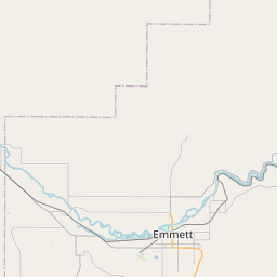
Eagle Map, Satellite view of Eagle, Idaho
Eagle is a city located in Ada County, Idaho, USA.
Location informations of Eagle
Latitude of city of Eagle is 43.69544 and longitude of city of Eagle is -116.35401- What Country is Eagle In? Eagle is located in the United States of America.
- What State is Eagle located in? Eagle is located in Idaho.
- What County is Eagle In? The County of Eagle is Ada County
Eagle, Idaho (ID), USA Geographic Information
| Country | United States |
| Country Code | US |
| State Name | Idaho |
| Latitude | 43.69544 |
| Longitude | -116.35401 |
| DMS Lat | 43°41'43.584" N |
| DMS Long | 116°21'14.436" W |
| DMS coordinates : | 43°41'43.584" N 116°21'14.436" W |
Current Date and Time in Eagle, Idaho, USA
| Eagle Time Zone : America/Boise |
What day is it in Eagle right now?Sunday (April 13, 2025) |
What time is it?Current local time and date at Eagle is 4/13/2025 - 8:08:50 AM |
Postcode / zip code of Eagle
Eagle is the actual or alternate city name associated with 3 ZIP Codes by the US Postal Service.
List of all postal codes in Eagle, Idaho, United States.
83616 Zip Code 83646 Zip Code 83714 Zip Code
Online Map of Eagle - road map, satellite view and street view


Check out our interactive map of Eagle, Idaho and you'll easily find your way around the Eagle major roads and highways.
Satellite Map of Eagle, ID, USA
This is online map of the address Eagle, ID, United States. You may use button to move and zoom in / out. The map information is for reference only.
Young Heliport (3.67 Km / 2.28 Miles)
St Luke'S Meridian Medical Center Heliport (10.82 Km / 6.73 Miles)
St Alphonsus Heliport (11.57 Km / 7.19 Miles)
Peaceful Cove Airport (12.25 Km / 7.61 Miles)
Boise Plaza Heliport (12.80 Km / 7.95 Miles)
Nampa Valley Heliport (13.16 Km / 8.18 Miles)
Foster Field - Dzone Skydiving Airport (14.08 Km / 8.75 Miles)
St Luke's Boise Medical Center Heliport (15.95 Km / 9.91 Miles)
Boise Air Terminal/Gowen Field (17.99 Km / 11.18 Miles)
Nampa Municipal Airport (18.60 Km / 11.56 Miles)
Ashley Airport (19.50 Km / 12.12 Miles)
Sands Airport (19.78 Km / 12.29 Miles)
Loomis Airport (20.52 Km / 12.75 Miles)
Hubler Field (22.83 Km / 14.19 Miles)
Emmett Municipal Airport (22.92 Km / 14.24 Miles)
Walter Knox Memorial Hospital Heliport (23.12 Km / 14.36 Miles)
Mercy Heliport (23.41 Km / 14.55 Miles)
Treasure Valley Executive Airport at Caldwell (23.45 Km / 14.57 Miles)
Indian Creek Ranch Airport (24.73 Km / 15.37 Miles)
Green Acres Airport (24.92 Km / 15.49 Miles)
EAGLE ELEMENTARY SCHOOL OF THE ARTS (331 m / 0.21 Miles)
EAGLE HILLS ELEMENTARY SCHOOL (1.14 Km / 0.71 Miles)
EAGLE ACADEMY (1.38 Km / 0.86 Miles)
EAGLE MIDDLE SCHOOL (1.65 Km / 1.02 Miles)
SEVEN OAKS ELEMENTARY (2.77 Km / 1.72 Miles)
IDAHO FINE ARTS ACADEMY (3.43 Km / 2.13 Miles)
ROLLING HILLS PUBLIC CHARTER (3.43 Km / 2.13 Miles)
EAGLE HIGH SCHOOL (3.84 Km / 2.38 Miles)
IDAHO CONNECTS ONLINE ALTERNATIVE SCHOOL (3.85 Km / 2.39 Miles)
CECIL D ANDRUS ELEMENTARY (3.96 Km / 2.46 Miles)
iSUCCEED VIRTUAL HIGH SCHOOL (4.01 Km / 2.49 Miles)
CENTRAL ACADEMY HIGH SCHOOL (4.31 Km / 2.68 Miles)
GALILEO MAGNET SCHOOL (4.69 Km / 2.92 Miles)
JOPLIN ELEMENTARY SCHOOL (4.87 Km / 3.02 Miles)
NORTH STAR CHARTER SCHOOL (4.93 Km / 3.06 Miles)
List of places near to Eagle
| Name | Distance |
|---|---|
| Hidden Springs | 7.96 Km / 4.95 Miles |
| Meridian | 9.74 Km / 6.05 Miles |
| Star | 12.00 Km / 7.46 Miles |
| Garden City | 12.38 Km / 7.69 Miles |
| Boise City | 15.16 Km / 9.42 Miles |
| Middleton | 21.43 Km / 13.32 Miles |
| Emmett | 22.98 Km / 14.28 Miles |
| Kuna | 23.26 Km / 14.45 Miles |
| Nampa | 24.09 Km / 14.97 Miles |