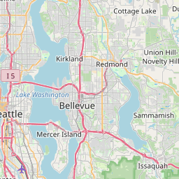
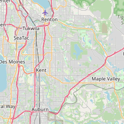
East Renton Highlands Map, Satellite view of East Renton Highlands, Washington
East Renton Highlands is a census-designated place (CDP) located in King County, Washington, USA.
Location informations of East Renton Highlands
Latitude of city of East Renton Highlands is 47.48482 and longitude of city of East Renton Highlands is -122.11234- What Country is East Renton Highlands In? East Renton Highlands is located in the United States of America.
- What State is East Renton Highlands located in? East Renton Highlands is located in Washington.
- What County is East Renton Highlands In? The County of East Renton Highlands is King County
East Renton Highlands, Washington (WA), USA Geographic Information
| Country | United States |
| Country Code | US |
| State Name | Washington |
| Latitude | 47.48482 |
| Longitude | -122.11234 |
| DMS Lat | 47°29'5.352" N |
| DMS Long | 122°6'44.424" W |
| DMS coordinates : | 47°29'5.352" N 122°6'44.424" W |
Current Date and Time in East Renton Highlands, Washington, USA
| East Renton Highlands Time Zone : America/Los_Angeles |
What day is it in East Renton Highlands right now?Tuesday (July 29, 2025) |
What time is it?Current local time and date at East Renton Highlands is 08:55:47 (07/29/2025) : (America/Los_Angeles) |
Postcode / zip code of East Renton Highlands
East Renton Highlands is the actual or alternate city name associated with 4 ZIP Codes by the US Postal Service.
List of all postal codes in East Renton Highlands, Washington, United States.
98027 Zip Code 98038 Zip Code 98058 Zip Code 98059 Zip Code
Area Codes East Renton Highlands, Washington, USA
East Renton Highlands, Washington covers 1 Area Codes
425 Area CodeOnline Map of East Renton Highlands - road map, satellite view and street view


Check out our interactive map of East Renton Highlands, Washington and you'll easily find your way around the East Renton Highlands major roads and highways.
Satellite Map of East Renton Highlands, WA, USA
This is online map of the address East Renton Highlands, WA, United States. You may use button to move and zoom in / out. The map information is for reference only.
Boeing Renton Ramp Site Nr 2 Heliport (6.77 Km / 4.21 Miles)
Kelly Ranch Heliport (6.99 Km / 4.35 Miles)
Renton Municipal Airport (7.84 Km / 4.87 Miles)
Will Rogers Wiley Post Memorial Seaplane Base (8.19 Km / 5.09 Miles)
Odyssey Heliport (8.28 Km / 5.15 Miles)
Conner Heliport (8.72 Km / 5.42 Miles)
Valley Medical Center Heliport (9.03 Km / 5.61 Miles)
I-90/Bellevue Busi Pk Boeing Comp Svcs Hdq Heliport (11.17 Km / 6.94 Miles)
Tukwila Operations Center Heliport (11.39 Km / 7.07 Miles)
Everett I Heliport (11.72 Km / 7.28 Miles)
Kent Benaroya Heliport (11.81 Km / 7.34 Miles)
Gaffney's Lake Wilderness Resort Airport (12.83 Km / 7.97 Miles)
Flying 'O' Ranch Heliport (13.26 Km / 8.24 Miles)
Boeing Kent Heliport (13.38 Km / 8.31 Miles)
Boeing Military Airplanes Heliport (15.07 Km / 9.36 Miles)
Boeing Field King County International Airport (15.11 Km / 9.39 Miles)
Seattle Tacoma International Airport (15.31 Km / 9.51 Miles)
Boeing Plant 2 Heliport (16.17 Km / 10.05 Miles)
Overlake Hospital EMS Heliport (16.24 Km / 10.09 Miles)
Norman Grier Field (16.44 Km / 10.21 Miles)
Briarwood Elementary (219 m / 0.14 Miles)
Liberty Sr High School (686 m / 0.43 Miles)
Maywood Middle School (1.51 Km / 0.94 Miles)
Issaquah Head Start (2.43 Km / 1.51 Miles)
Apollo Elementary (2.44 Km / 1.51 Miles)
Maplewood Heights Elementary School (2.63 Km / 1.64 Miles)
Hazen Senior High School (3.54 Km / 2.20 Miles)
Honey Dew Elementary (4.04 Km / 2.51 Miles)
Fairwood Elementary School (4.10 Km / 2.55 Miles)
Maple Hills Elementary (4.25 Km / 2.64 Miles)
Youthsource (4.89 Km / 3.04 Miles)
Ridgewood Elementary School (4.99 Km / 3.10 Miles)
Renton Technical College (4.83 Km / 3.00 Miles)
List of places near to East Renton Highlands
| Name | Distance |
|---|---|
| Fairwood | 5.27 Km / 3.27 Miles |
| Maple Heights-Lake Desire | 5.52 Km / 3.43 Miles |
| Newcastle | 6.85 Km / 4.26 Miles |
| Issaquah | 7.82 Km / 4.86 Miles |
| Renton | 7.87 Km / 4.89 Miles |
| Mirrormont | 9.12 Km / 5.67 Miles |
| Shadow Lake | 9.81 Km / 6.10 Miles |
| Bryn Mawr-Skyway | 9.96 Km / 6.19 Miles |
| Tukwila | 11.23 Km / 6.98 Miles |
| Maple Valley | 11.38 Km / 7.07 Miles |
| Mercer Island | 12.61 Km / 7.84 Miles |
| Hobart | 12.61 Km / 7.84 Miles |
| Beaux Arts Village | 12.91 Km / 8.02 Miles |
| Covington | 14.10 Km / 8.76 Miles |
| Kent | 14.78 Km / 9.18 Miles |
| Boulevard Park | 15.25 Km / 9.48 Miles |
| Bellevue | 15.46 Km / 9.61 Miles |
| SeaTac | 16.12 Km / 10.02 Miles |
| Lake Morton-Berrydale | 16.91 Km / 10.51 Miles |
| Medina | 17.43 Km / 10.83 Miles |
| Sammamish | 17.62 Km / 10.95 Miles |
| Ravensdale | 17.63 Km / 10.95 Miles |
| Burien | 17.69 Km / 10.99 Miles |
| Normandy Park | 18.00 Km / 11.18 Miles |
| Clyde Hill | 18.16 Km / 11.28 Miles |
| Des Moines | 18.42 Km / 11.45 Miles |
| White Center | 18.57 Km / 11.54 Miles |
| Fall City | 19.13 Km / 11.89 Miles |
| Yarrow Point | 19.60 Km / 12.18 Miles |
| Hunts Point | 19.73 Km / 12.26 Miles |
| Ames Lake | 19.78 Km / 12.29 Miles |
| Lake Holm | 19.88 Km / 12.35 Miles |
| Lakeland North | 20.80 Km / 12.92 Miles |
| Redmond | 21.05 Km / 13.08 Miles |
| Black Diamond | 21.24 Km / 13.20 Miles |
| Seattle | 21.31 Km / 13.24 Miles |
| Auburn | 21.43 Km / 13.32 Miles |
| Snoqualmie | 22.10 Km / 13.73 Miles |
| Union Hill-Novelty Hill | 22.96 Km / 14.27 Miles |
| Kirkland | 23.03 Km / 14.31 Miles |
| Carnation | 23.46 Km / 14.58 Miles |
| Federal Way | 23.53 Km / 14.62 Miles |
| North Bend | 24.49 Km / 15.22 Miles |