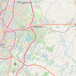
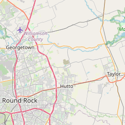
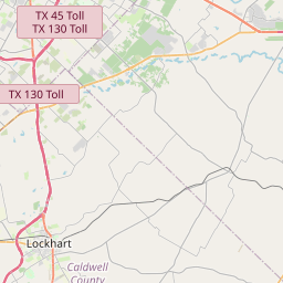
Elgin Map, Satellite view of Elgin, Texas
Elgin is a city located in Bastrop County, Travis County, Texas, USA.
Location informations of Elgin
Latitude of city of Elgin is 30.35193 and longitude of city of Elgin is -97.38783- What Country is Elgin In? Elgin is located in the United States of America.
- What State is Elgin located in? Elgin is located in Texas.
- What County is Elgin In? Elgin, Texas sits in Two different counties: Bastrop County, Travis County
Elgin, Texas (TX), USA Geographic Information
| Country | United States |
| Country Code | US |
| State Name | Texas |
| Latitude | 30.35193 |
| Longitude | -97.38783 |
| DMS Lat | 30°21'6.948" N |
| DMS Long | 97°23'16.188" W |
| DMS coordinates : | 30°21'6.948" N 97°23'16.188" W |
Current Date and Time in Elgin, Texas, USA
| Elgin Time Zone : America/Chicago |
What day is it in Elgin right now?Sunday (April 13, 2025) |
What time is it?Current local time and date at Elgin is 4/13/2025 - 9:45:02 AM |
Postcode / zip code of Elgin
Elgin is the actual or alternate city name associated with 1 ZIP Codes by the US Postal Service.
List of all postal codes in Elgin, Texas, United States.
78621 Zip Code
Online Map of Elgin - road map, satellite view and street view


Check out our interactive map of Elgin, Texas and you'll easily find your way around the Elgin major roads and highways.
Satellite Map of Elgin, TX, USA
This is online map of the address Elgin, TX, United States. You may use button to move and zoom in / out. The map information is for reference only.
Elgin Intracontinental Airport (4.11 Km / 2.56 Miles)
Skye Dance Airport (5.15 Km / 3.20 Miles)
Baker's Place Airport (7.24 Km / 4.50 Miles)
Hawken Air One Airport (7.94 Km / 4.93 Miles)
Crosswinds Airfield (9.34 Km / 5.80 Miles)
Prewitt Airport (9.62 Km / 5.98 Miles)
Lite-Flite Austin Airfield (9.64 Km / 5.99 Miles)
Sundbeck Ranch Airport (10.48 Km / 6.51 Miles)
Chan-C Airport (15.57 Km / 9.68 Miles)
Camp Swift Heliport (16.13 Km / 10.02 Miles)
Barton Field (16.99 Km / 10.56 Miles)
Luv Field (17.37 Km / 10.79 Miles)
Austin Executive Airport (17.93 Km / 11.14 Miles)
Utley Field (18.41 Km / 11.44 Miles)
Wood Triple D Airport (18.76 Km / 11.66 Miles)
Macho Grande Airport (20.53 Km / 12.76 Miles)
Camelot Airport (21.54 Km / 13.38 Miles)
Walter E Long Metropolitan Park Auxiliary Helicopter Landing Zone (22.09 Km / 13.72 Miles)
Baylor Scott & White Pflugerville Medical Center Emergency Helipad (22.37 Km / 13.90 Miles)
Bud Dryden Airport (24.96 Km / 15.51 Miles)
ELGIN MIDDLE (756 m / 0.47 Miles)
ELGIN EL (819 m / 0.51 Miles)
PHOENIX H S (944 m / 0.59 Miles)
BASTROP COUNTY JUVENILE BOOT CAMP (1.00 Km / 0.62 Miles)
NEIDIG EL (2.19 Km / 1.36 Miles)
ELGIN H S (2.26 Km / 1.40 Miles)
BOOKER T WASHINGTON EL (2.43 Km / 1.51 Miles)
List of places near to Elgin
| Name | Distance |
|---|---|
| Coupland | 12.01 Km / 7.46 Miles |
| McDade | 16.27 Km / 10.11 Miles |
| Manor | 16.28 Km / 10.12 Miles |
| Webberville | 18.27 Km / 11.35 Miles |
| Camp Swift | 20.14 Km / 12.51 Miles |
| Hornsby Bend | 22.07 Km / 13.71 Miles |
| Pflugerville | 23.15 Km / 14.38 Miles |
| Taylor | 24.42 Km / 15.17 Miles |
| Garfield | 24.51 Km / 15.23 Miles |