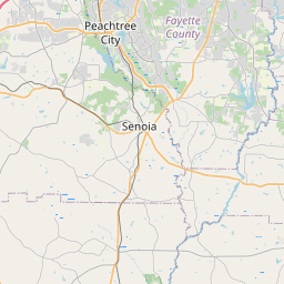
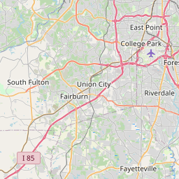
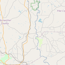
Experiment Map, Satellite view of Experiment, Georgia
Experiment is a census-designated place (CDP) located in Spalding County, Georgia, USA.
Location informations of Experiment
Latitude of city of Experiment is 33.26539 and longitude of city of Experiment is -84.28159- What Country is Experiment In? Experiment is located in the United States of America.
- What State is Experiment located in? Experiment is located in Georgia.
- What County is Experiment In? The County of Experiment is Spalding County
Experiment, Georgia (GA), USA Geographic Information
| Country | United States |
| Country Code | US |
| State Name | Georgia |
| Latitude | 33.26539 |
| Longitude | -84.28159 |
| DMS Lat | 33°15'55.404" N |
| DMS Long | 84°16'53.724" W |
| DMS coordinates : | 33°15'55.404" N 84°16'53.724" W |
Current Date and Time in Experiment, Georgia, USA
| Experiment Time Zone : America/New_York |
What day is it in Experiment right now?Sunday (May 18, 2025) |
What time is it?Current local time and date at Experiment is 05:19:54 (05/18/2025) : (America/New_York) |
Postcode / zip code of Experiment
Experiment is the actual or alternate city name associated with 2 ZIP Codes by the US Postal Service.
List of all postal codes in Experiment, Georgia, United States.
30212 Zip Code 30223 Zip Code
Online Map of Experiment - road map, satellite view and street view


Check out our interactive map of Experiment, Georgia and you'll easily find your way around the Experiment major roads and highways.
Satellite Map of Experiment, GA, USA
This is online map of the address Experiment, GA, United States. You may use button to move and zoom in / out. The map information is for reference only.
Spalding Regional Medical Center Heliport (3.17 Km / 1.97 Miles)
Griffin Spalding County Airport (4.31 Km / 2.68 Miles)
Pinebrook Estates Airport (6.34 Km / 3.94 Miles)
Beaverbrook Aerodrome (6.82 Km / 4.24 Miles)
Pecan Patch Airstrip (7.47 Km / 4.64 Miles)
Cedar Ridge Airport (11.09 Km / 6.89 Miles)
3-M's Airport (11.96 Km / 7.43 Miles)
Brook Bridge Aerodrome (12.08 Km / 7.50 Miles)
S & S Landing Strip (12.12 Km / 7.53 Miles)
Peach State Aerodrome (12.78 Km / 7.94 Miles)
Halls Flying Ranch Airport (12.85 Km / 7.98 Miles)
Toland Airport (13.17 Km / 8.18 Miles)
Chigger Hill Airport (13.45 Km / 8.35 Miles)
Rust Airstrip (13.45 Km / 8.36 Miles)
Atlanta Motor Speedway Heliport (13.55 Km / 8.42 Miles)
Eagles Landing Airport (14.06 Km / 8.73 Miles)
River Bend Airport (14.14 Km / 8.78 Miles)
Atlanta Speedway Airport (14.58 Km / 9.06 Miles)
Kitchens Field (14.78 Km / 9.19 Miles)
Mallards Landing Airport (15.25 Km / 9.48 Miles)
Orrs Elementary School (1.77 Km / 1.10 Miles)
Moore Elementary School (2.07 Km / 1.29 Miles)
Atkinson Elementary School (2.17 Km / 1.35 Miles)
AZ Kelsey Academy (2.35 Km / 1.46 Miles)
Cowan Road Middle School (2.71 Km / 1.69 Miles)
Cowan Road Elementary School (2.82 Km / 1.75 Miles)
Griffin High School (3.06 Km / 1.90 Miles)
Anne Street Elementary School (3.09 Km / 1.92 Miles)
Jordan Hill Road Elementary School (3.84 Km / 2.38 Miles)
Jackson Road Elementary School (4.02 Km / 2.50 Miles)
Crescent Road Elementary School (4.02 Km / 2.50 Miles)
Kennedy Road Middle School (4.32 Km / 2.68 Miles)
Southern Crescent Technical College (1.45 Km / 0.90 Miles)
List of places near to Experiment
| Name | Distance |
|---|---|
| Griffin | 2.63 Km / 1.63 Miles |
| East Griffin | 5.47 Km / 3.40 Miles |
| Sunny Side | 8.41 Km / 5.23 Miles |
| Orchard Hill | 10.94 Km / 6.80 Miles |
| Heron Bay | 11.67 Km / 7.25 Miles |
| Williamson | 11.86 Km / 7.37 Miles |
| Hampton | 13.53 Km / 8.41 Miles |
| Woolsey | 16.23 Km / 10.08 Miles |
| Brooks | 16.77 Km / 10.42 Miles |
| Milner | 18.32 Km / 11.38 Miles |
| Locust Grove | 18.36 Km / 11.41 Miles |
| Zebulon | 19.00 Km / 11.81 Miles |
| Lovejoy | 19.24 Km / 11.96 Miles |
| Bonanza | 22.85 Km / 14.20 Miles |
| Hilltop | 22.99 Km / 14.29 Miles |
| Jenkinsburg | 23.78 Km / 14.78 Miles |
| McDonough | 23.79 Km / 14.78 Miles |
| Meansville | 24.14 Km / 15.00 Miles |
| Concord | 24.19 Km / 15.03 Miles |
| Irondale | 24.99 Km / 15.53 Miles |