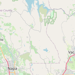
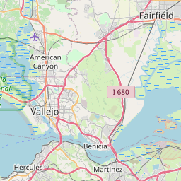
Fairfield Map, Satellite view of Fairfield, California
Fairfield is a city located in Solano County, California, USA.
Location informations of Fairfield
Latitude of city of Fairfield is 38.24936 and longitude of city of Fairfield is -122.03997- What Country is Fairfield In? Fairfield is located in the United States of America.
- What State is Fairfield located in? Fairfield is located in California.
- What County is Fairfield In? The County of Fairfield is Solano County
Fairfield, California (CA), USA Geographic Information
| Country | United States |
| Country Code | US |
| State Name | California |
| Latitude | 38.24936 |
| Longitude | -122.03997 |
| DMS Lat | 38°14'57.696" N |
| DMS Long | 122°2'23.892" W |
| DMS coordinates : | 38°14'57.696" N 122°2'23.892" W |
Current Date and Time in Fairfield, California, USA
| Fairfield Time Zone : America/Los_Angeles |
What day is it in Fairfield right now?Monday (June 2, 2025) |
What time is it?Current local time and date at Fairfield is 6/2/2025 - 1:25:50 PM |
Postcode / zip code of Fairfield
Fairfield is the actual or alternate city name associated with 6 ZIP Codes by the US Postal Service.
List of all postal codes in Fairfield, California, United States.
94533 Zip Code 94534 Zip Code 94535 Zip Code 94585 Zip Code 94591 Zip Code 95687 Zip Code
Online Map of Fairfield - road map, satellite view and street view


Check out our interactive map of Fairfield, California and you'll easily find your way around the Fairfield major roads and highways.
Satellite Map of Fairfield, CA, USA
This is online map of the address Fairfield, CA, United States. You may use button to move and zoom in / out. The map information is for reference only.
Fairfield Suisun Airpark (1.29 Km / 0.80 Miles)
NorthBay Medical Center Heliport (1.51 Km / 0.94 Miles)
Travis Air Force Base Aero Club (6.34 Km / 3.94 Miles)
David Grant USAF Medical Center Heliport (6.46 Km / 4.02 Miles)
Vacaville Gliderport (8.62 Km / 5.35 Miles)
Travis Air Force Base (9.97 Km / 6.20 Miles)
Garibaldi Brothers Airport (11.36 Km / 7.06 Miles)
Vaca Valley Hospital Heliport (14.15 Km / 8.79 Miles)
Nut Tree Airport (15.72 Km / 9.77 Miles)
Kaiser Permanente Vacaville Heliport (17.76 Km / 11.03 Miles)
Vaca-Dixon Airport (21.34 Km / 13.26 Miles)
Napa County Airport (21.43 Km / 13.32 Miles)
Vallejo Sky Harbor (21.94 Km / 13.64 Miles)
Q Area Heliport (22.92 Km / 14.24 Miles)
Blake Sky Park Airport (23.25 Km / 14.45 Miles)
Benicia Airport (23.43 Km / 14.56 Miles)
Stan's Airpark (23.78 Km / 14.78 Miles)
Maine Prairie Airport (23.88 Km / 14.84 Miles)
Queen of the Valley Hospital Heliport (23.93 Km / 14.87 Miles)
Armijo High (274 m / 0.17 Miles)
Fairview Elementary (1.05 Km / 0.65 Miles)
Anna Kyle Elementary (1.42 Km / 0.88 Miles)
Crystal Middle (1.49 Km / 0.93 Miles)
Weir Preparatory Academy (2.06 Km / 1.28 Miles)
Mary Bird Early Childhood Education Center (2.06 Km / 1.28 Miles)
E. Ruth Sheldon Academy of Innovative Learning (2.11 Km / 1.31 Miles)
Solano Co Juve Detention Facility - Evergreen Acad (2.12 Km / 1.32 Miles)
Cleo Gordon Elementary (2.36 Km / 1.46 Miles)
Crescent Elementary (2.42 Km / 1.51 Miles)
Suisun Elementary (2.45 Km / 1.52 Miles)
Dover Academy for International Studies (2.57 Km / 1.60 Miles)
Grange Middle (2.66 Km / 1.65 Miles)
K. I. Jones Elementary (2.72 Km / 1.69 Miles)
Sem Yeto Continuation High (2.90 Km / 1.80 Miles)
Fairfield High (3.01 Km / 1.87 Miles)
Matt Garcia Career and College Academy (3.05 Km / 1.90 Miles)
Public Safety Academy (3.06 Km / 1.90 Miles)
Fairfield-Suisun Elementary Community Day (3.09 Km / 1.92 Miles)
H. Glenn Richardson (3.09 Km / 1.92 Miles)
Milan Institute of Cosmetology-Fairfield (493 m / 0.31 Miles)
List of places near to Fairfield
| Name | Distance |
|---|---|
| Suisun City | 1.24 Km / 0.77 Miles |
| Green Valley | 10.68 Km / 6.64 Miles |
| Vacaville | 12.76 Km / 7.93 Miles |
| Elmira | 15.80 Km / 9.82 Miles |
| Hartley | 20.34 Km / 12.64 Miles |
| American Canyon | 20.99 Km / 13.04 Miles |
| Napa | 22.08 Km / 13.72 Miles |
| Silverado Resort | 22.31 Km / 13.86 Miles |
| Allendale | 23.30 Km / 14.48 Miles |
| Benicia | 24.54 Km / 15.25 Miles |
| Vallejo | 24.89 Km / 15.47 Miles |
| Clyde | 24.91 Km / 15.48 Miles |