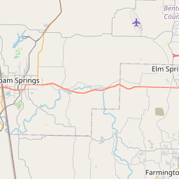
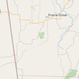
Fayetteville Map, Satellite view of Fayetteville, Arkansas
Fayetteville is a city located in Washington County, Arkansas, USA.
Location informations of Fayetteville
Latitude of city of Fayetteville is 36.06258 and longitude of city of Fayetteville is -94.15743- What Country is Fayetteville In? Fayetteville is located in the United States of America.
- What State is Fayetteville located in? Fayetteville is located in Arkansas.
- What County is Fayetteville In? The County of Fayetteville is Washington County
Fayetteville, Arkansas (AR), USA Geographic Information
| Country | United States |
| Country Code | US |
| State Name | Arkansas |
| Latitude | 36.06258 |
| Longitude | -94.15743 |
| DMS Lat | 36°3'45.288" N |
| DMS Long | 94°9'26.748" W |
| DMS coordinates : | 36°3'45.288" N 94°9'26.748" W |
Current Date and Time in Fayetteville, Arkansas, USA
| Fayetteville Time Zone : America/Chicago |
What day is it in Fayetteville right now?Wednesday (June 4, 2025) |
What time is it?Current local time and date at Fayetteville is 6/4/2025 - 3:38:26 AM |
Postcode / zip code of Fayetteville
Fayetteville is the actual or alternate city name associated with 7 ZIP Codes by the US Postal Service.
List of all postal codes in Fayetteville, Arkansas, United States.
72701 Zip Code 72702 Zip Code 72703 Zip Code 72704 Zip Code 72730 Zip Code 72764 Zip Code 72774 Zip Code
Area Codes Fayetteville, Arkansas, USA
Fayetteville, Arkansas covers 2 Area Codes
479 Area Code 501 Area CodeOnline Map of Fayetteville - road map, satellite view and street view


Check out our interactive map of Fayetteville, Arkansas and you'll easily find your way around the Fayetteville major roads and highways.
Satellite Map of Fayetteville, AR, USA
This is online map of the address Fayetteville, AR, United States. You may use button to move and zoom in / out. The map information is for reference only.
Veterans Administration Heliport (1.85 Km / 1.15 Miles)
Washington Regional Landing Heliport (5.06 Km / 3.15 Miles)
Henson Farm Airport (5.41 Km / 3.36 Miles)
Mount Comfort Airpark (5.63 Km / 3.50 Miles)
Drake Field (6.49 Km / 4.03 Miles)
Willow Creek Women's Hospital Heliport (8.43 Km / 5.24 Miles)
ACH Springdale Heliport (11.40 Km / 7.09 Miles)
Springdale Municipal Airport (13.11 Km / 8.15 Miles)
Northwest Medical Center Springdale Heliport (13.35 Km / 8.29 Miles)
Foggy River Airport (13.45 Km / 8.36 Miles)
Wedington Woods Airport (14.04 Km / 8.73 Miles)
Circle S Farms Airport (21.36 Km / 13.27 Miles)
ASP Lowell Heliport (21.51 Km / 13.37 Miles)
Gunem Field (23.60 Km / 14.66 Miles)
Elder Airstrip (24.20 Km / 15.04 Miles)
WASHINGTON ELEMENTARY SCHOOL (776 m / 0.48 Miles)
FAYETTEVILLE HIGH SCHOOL EAST (1.63 Km / 1.01 Miles)
LEVERETT ELEMENTARY SCHOOL (2.16 Km / 1.34 Miles)
FAYETTEVILLE VIRTUAL ACADEMY- DIST CONVERSION CHARTER SCH (2.31 Km / 1.44 Miles)
HAPPY HOLLOW ELEMENTARY SCHOOL (2.44 Km / 1.52 Miles)
ROOT ELEMENTARY SCHOOL (2.56 Km / 1.59 Miles)
WOODLAND JUNIOR HIGH SCHOOL (2.80 Km / 1.74 Miles)
RAMAY JUNIOR HIGH SCHOOL (2.99 Km / 1.85 Miles)
NWA COMMUNITY COLLEGE REG CENTER (3.24 Km / 2.01 Miles)
AGEE LIERLY LIFE PREPARATION SERVICES SCHOOL (3.24 Km / 2.01 Miles)
ASBELL ELEMENTARY SCHOOL (3.52 Km / 2.18 Miles)
MCNAIR MIDDLE SCHOOL (4.58 Km / 2.84 Miles)
VANDERGRIFF ELEMENTARY SCHOOL (4.86 Km / 3.02 Miles)
University of Arkansas (1.94 Km / 1.21 Miles)
List of places near to Fayetteville
| Name | Distance |
|---|---|
| Greenland | 7.76 Km / 4.82 Miles |
| Johnson | 7.85 Km / 4.88 Miles |
| Farmington | 8.38 Km / 5.21 Miles |
| Springdale | 14.18 Km / 8.81 Miles |
| Tontitown | 14.53 Km / 9.03 Miles |
| Elkins | 15.04 Km / 9.35 Miles |
| Goshen | 15.53 Km / 9.65 Miles |
| West Fork | 15.63 Km / 9.71 Miles |
| Bethel Heights | 17.05 Km / 10.59 Miles |
| Prairie Grove | 17.34 Km / 10.77 Miles |
| Elm Springs | 17.53 Km / 10.89 Miles |
| Lowell | 21.57 Km / 13.40 Miles |
| Cave Springs | 23.31 Km / 14.48 Miles |