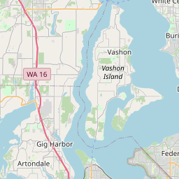
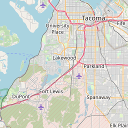
Fife Heights Map, Satellite view of Fife Heights, Washington
Fife Heights is a census-designated place (CDP) located in Pierce County, Washington, USA.
Location informations of Fife Heights
Latitude of city of Fife Heights is 47.25899 and longitude of city of Fife Heights is -122.34568- What Country is Fife Heights In? Fife Heights is located in the United States of America.
- What State is Fife Heights located in? Fife Heights is located in Washington.
- What County is Fife Heights In? The County of Fife Heights is Pierce County
Fife Heights, Washington (WA), USA Geographic Information
| Country | United States |
| Country Code | US |
| State Name | Washington |
| Latitude | 47.25899 |
| Longitude | -122.34568 |
| DMS Lat | 47°15'32.364" N |
| DMS Long | 122°20'44.448" W |
| DMS coordinates : | 47°15'32.364" N 122°20'44.448" W |
Current Date and Time in Fife Heights, Washington, USA
| Fife Heights Time Zone : America/Los_Angeles |
What day is it in Fife Heights right now?Saturday (June 7, 2025) |
What time is it?Current local time and date at Fife Heights is 6/7/2025 - 9:26:28 AM |
Postcode / zip code of Fife Heights
Fife Heights is the actual or alternate city name associated with 2 ZIP Codes by the US Postal Service.
List of all postal codes in Fife Heights, Washington, United States.
98422 Zip Code 98424 Zip Code
Online Map of Fife Heights - road map, satellite view and street view


Check out our interactive map of Fife Heights, Washington and you'll easily find your way around the Fife Heights major roads and highways.
Satellite Map of Fife Heights, WA, USA
This is online map of the address Fife Heights, WA, United States. You may use button to move and zoom in / out. The map information is for reference only.
Ben Barry's Sky Harbor (3.87 Km / 2.41 Miles)
City View Airport (4.17 Km / 2.59 Miles)
Evergreen Industrial Airport (5.37 Km / 3.33 Miles)
Weyerhaeuser Heliport (5.44 Km / 3.38 Miles)
Crossings Heliport (6.57 Km / 4.08 Miles)
St Joseph Hospital Heliport (7.86 Km / 4.88 Miles)
Mary Bridge Heliport (8.04 Km / 4.99 Miles)
Boeing - Auburn Complex Heliport (8.44 Km / 5.24 Miles)
J. J. H. Heliport (9.01 Km / 5.60 Miles)
Good Samaritan Hospital Heliport (9.87 Km / 6.13 Miles)
Private H/C PAD Heliport (10.64 Km / 6.61 Miles)
Personal 500 Sales Co. Heliport (11.05 Km / 6.87 Miles)
Auburn Fire Department Heliport (11.63 Km / 7.23 Miles)
South Tacoma Airport (11.71 Km / 7.27 Miles)
Auburn Municipal Airport (11.77 Km / 7.31 Miles)
Auburn Airfield (12.00 Km / 7.46 Miles)
Tacoma Airport (13.89 Km / 8.63 Miles)
Auburn Academy Airport (14.96 Km / 9.30 Miles)
Mueller-Harkins Airport / Clover Park Technical College Airfield (15.05 Km / 9.35 Miles)
Quartermaster Harbor Seaplane Base (15.37 Km / 9.55 Miles)
Illahee Middle School (2.18 Km / 1.36 Miles)
Fife High School (2.36 Km / 1.47 Miles)
Birth to Three Development Center (2.60 Km / 1.62 Miles)
Endeavour Intermediate (2.88 Km / 1.79 Miles)
Discovery Primary School (2.90 Km / 1.80 Miles)
Surprise Lake Middle School (3.02 Km / 1.88 Miles)
Todd Beamer High School (3.12 Km / 1.94 Miles)
Enterprise Elementary School (3.15 Km / 1.96 Miles)
Columbia Junior High School (3.19 Km / 1.98 Miles)
Northeast Tacoma (3.35 Km / 2.08 Miles)
Sherwood Forest Elementary School (3.69 Km / 2.29 Miles)
Federal Way Public Academy (3.80 Km / 2.36 Miles)
Panther Lake Elementary School (3.86 Km / 2.40 Miles)
Rainier View Elementary School (4.08 Km / 2.54 Miles)
Northwood Elementary (4.26 Km / 2.65 Miles)
TAFA at Saghalie (4.35 Km / 2.70 Miles)
Lakeland Elementary School (4.62 Km / 2.87 Miles)
Riverside Elementary (4.65 Km / 2.89 Miles)
Sequoyah Middle School (4.82 Km / 3.00 Miles)
List of places near to Fife Heights
| Name | Distance |
|---|---|
| Milton | 2.28 Km / 1.42 Miles |
| Fife | 2.36 Km / 1.47 Miles |
| Edgewood | 4.04 Km / 2.51 Miles |
| Lakeland South | 4.98 Km / 3.09 Miles |
| Waller | 6.73 Km / 4.18 Miles |
| Pacific | 7.04 Km / 4.37 Miles |
| Algona | 7.41 Km / 4.60 Miles |
| Federal Way | 7.47 Km / 4.64 Miles |
| Tacoma | 7.47 Km / 4.64 Miles |
| North Puyallup | 7.52 Km / 4.67 Miles |
| Browns Point | 8.55 Km / 5.31 Miles |
| Dash Point | 9.04 Km / 5.62 Miles |
| Puyallup | 9.10 Km / 5.65 Miles |
| Lakeland North | 9.93 Km / 6.17 Miles |
| Sumner | 10.09 Km / 6.27 Miles |
| Summit | 10.84 Km / 6.74 Miles |
| Midland | 11.16 Km / 6.93 Miles |
| Auburn | 11.38 Km / 7.07 Miles |
| Lake Tapps | 11.80 Km / 7.33 Miles |
| Fircrest | 13.03 Km / 8.10 Miles |
| Ruston | 13.05 Km / 8.11 Miles |
| Clover Creek | 13.13 Km / 8.16 Miles |
| Alderton | 13.27 Km / 8.25 Miles |
| Parkland | 13.31 Km / 8.27 Miles |
| Summit View | 13.65 Km / 8.48 Miles |
| South Hill | 14.29 Km / 8.88 Miles |
| Bonney Lake | 15.08 Km / 9.37 Miles |
| McMillin | 15.61 Km / 9.70 Miles |
| University Place | 15.67 Km / 9.74 Miles |
| Kent | 15.93 Km / 9.90 Miles |
| Des Moines | 15.96 Km / 9.92 Miles |
| Lakewood | 16.26 Km / 10.10 Miles |
| Lake Holm | 17.11 Km / 10.63 Miles |
| McChord AFB | 17.87 Km / 11.10 Miles |
| Wollochet | 18.02 Km / 11.20 Miles |
| Frederickson | 18.13 Km / 11.27 Miles |
| Spanaway | 18.50 Km / 11.50 Miles |
| Gig Harbor | 19.33 Km / 12.01 Miles |
| Normandy Park | 19.71 Km / 12.25 Miles |
| Lake Morton-Berrydale | 19.99 Km / 12.42 Miles |
| Prairie Ridge | 20.09 Km / 12.48 Miles |
| Covington | 20.14 Km / 12.51 Miles |
| Orting | 20.86 Km / 12.96 Miles |
| Artondale | 21.23 Km / 13.19 Miles |
| Fox Island | 21.36 Km / 13.27 Miles |
| Prairie Heights | 21.61 Km / 13.43 Miles |
| SeaTac | 21.73 Km / 13.50 Miles |
| Steilacoom | 21.79 Km / 13.54 Miles |
| Canterwood | 22.45 Km / 13.95 Miles |
| Maplewood | 22.49 Km / 13.97 Miles |