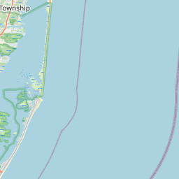
Florence (Township) Map, Satellite view of Florence (Township), New Jersey
Florence (Township) is a township located in Burlington County, New Jersey, USA.
Location informations of Florence (Township)
Latitude of city of Florence (Township) is 40.09469 and longitude of city of Florence (Township) is -74.78394- What Country is Florence (Township) In? Florence (Township) is located in the United States of America.
- What State is Florence (Township) located in? Florence (Township) is located in New Jersey.
- What County is Florence (Township) In? The County of Florence (Township) is Burlington County
Florence (Township), New Jersey (NJ), USA Geographic Information
| Country | United States |
| Country Code | US |
| State Name | New Jersey |
| Latitude | 40.09469 |
| Longitude | -74.78394 |
| DMS Lat | 40°5'40.884" N |
| DMS Long | 74°47'2.184" W |
| DMS coordinates : | 40°5'40.884" N 74°47'2.184" W |
Current Date and Time in Florence (Township), New Jersey, USA
| Florence (Township) Time Zone : America/New_York |
What day is it in Florence (Township) right now?Friday (July 25, 2025) |
What time is it?Current local time and date at Florence (Township) is 09:11:38 (07/25/2025) : (America/New_York) |
Postcode / zip code of Florence (Township)
Florence (Township) is the actual or alternate city name associated with 4 ZIP Codes by the US Postal Service.
List of all postal codes in Florence (Township), New Jersey, United States.
08016 Zip Code 08505 Zip Code 08518 Zip Code 08554 Zip Code
Area Codes Florence (Township), New Jersey, USA
Florence (Township), New Jersey covers 1 Area Codes
609 Area CodeOnline Map of Florence (Township) - road map, satellite view and street view
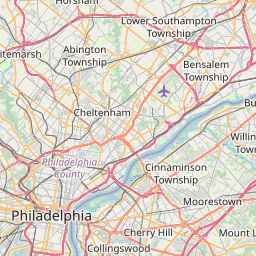
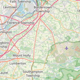
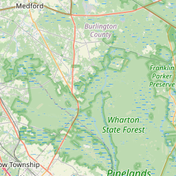


Check out our interactive map of Florence (Township), New Jersey and you'll easily find your way around the Florence (Township) major roads and highways.
Satellite Map of Florence (Township), NJ, USA
This is online map of the address Florence (Township), NJ, United States. You may use button to move and zoom in / out. The map information is for reference only.
Burlington Generating Station Heliport (8.06 Km / 5.01 Miles)
Colgate Palmolive Heliport (8.15 Km / 5.06 Miles)
Sterling Heliport (9.50 Km / 5.90 Miles)
Lourdes Medical Center Of Burlington Cty Heliport (9.93 Km / 6.17 Miles)
Bristol Usar Center Heliport (10.08 Km / 6.26 Miles)
Inductotherm Airport (10.17 Km / 6.32 Miles)
Redwing Airport (10.85 Km / 6.74 Miles)
Sportland Pier Heliport (11.74 Km / 7.29 Miles)
Blue Jay Heliport (11.89 Km / 7.39 Miles)
Jefferson Health Bucks County Campus Heliport (12.12 Km / 7.53 Miles)
Our Lady's Heliport (13.00 Km / 8.08 Miles)
Total Rf Heliport (13.01 Km / 8.08 Miles)
Trenton Heliport (13.34 Km / 8.29 Miles)
St Francis M C Helistop (14.28 Km / 8.87 Miles)
Mount Holly Heliport (14.28 Km / 8.88 Miles)
Pemberton Airport (14.73 Km / 9.15 Miles)
Eayrestown Helistop (15.28 Km / 9.49 Miles)
Hamilton Headquarter Troop C Heliport (16.61 Km / 10.32 Miles)
St Mary Hospital Heliport (16.80 Km / 10.44 Miles)
St Mary Medical Center Heliport (16.80 Km / 10.44 Miles)
Florence Township Memorial High School (743 m / 0.46 Miles)
Roebling Elementary School (2.34 Km / 1.45 Miles)
Riverbank Charter School of Excellence (2.36 Km / 1.47 Miles)
Florence Riverfront School (2.89 Km / 1.80 Miles)
B. Bernice Young Elementary School (3.45 Km / 2.14 Miles)
List of places near to Florence (Township)
| Name | Distance |
|---|---|
| Roebling | 2.37 Km / 1.47 Miles |
| Florence | 3.31 Km / 2.06 Miles |
| Bordentown (Township) | 4.37 Km / 2.72 Miles |
| Tullytown | 5.60 Km / 3.48 Miles |
| Bristol | 5.81 Km / 3.61 Miles |
| Burlington (Township) | 5.82 Km / 3.62 Miles |
| Mansfield | 6.15 Km / 3.82 Miles |
| Fieldsboro | 6.60 Km / 4.10 Miles |
| Burlington | 7.36 Km / 4.57 Miles |
| Levittown | 7.72 Km / 4.80 Miles |
| Bristol (Township) | 7.79 Km / 4.84 Miles |
| Bordentown | 8.39 Km / 5.21 Miles |
| Springfield | 8.65 Km / 5.37 Miles |
| Westampton | 9.22 Km / 5.73 Miles |
| Falls | 9.41 Km / 5.85 Miles |
| Croydon | 10.20 Km / 6.34 Miles |
| Chesterfield | 10.65 Km / 6.62 Miles |
| Eastampton | 10.75 Km / 6.68 Miles |
| Mount Holly | 11.05 Km / 6.87 Miles |
| Fairless Hills | 11.21 Km / 6.97 Miles |
| Willingboro | 11.49 Km / 7.14 Miles |
| Beverly | 11.95 Km / 7.43 Miles |
| Hulmeville | 12.07 Km / 7.50 Miles |
| Edgewater Park | 12.33 Km / 7.66 Miles |
| Groveville | 12.69 Km / 7.89 Miles |
| White Horse | 12.73 Km / 7.91 Miles |
| Penndel | 12.96 Km / 8.05 Miles |
| Morrisville | 12.99 Km / 8.07 Miles |
| Juliustown | 13.33 Km / 8.28 Miles |
| Bensalem | 13.65 Km / 8.48 Miles |
| Hainesport | 13.72 Km / 8.53 Miles |
| Eddington | 13.74 Km / 8.54 Miles |
| Langhorne Manor | 13.93 Km / 8.66 Miles |
| Delanco | 13.98 Km / 8.69 Miles |
| Yardville | 14.00 Km / 8.70 Miles |
| Trenton | 14.04 Km / 8.72 Miles |
| Woodbourne | 14.05 Km / 8.73 Miles |
| Middletown | 14.08 Km / 8.75 Miles |
| Cornwells Heights | 14.16 Km / 8.80 Miles |
| Langhorne | 14.76 Km / 9.17 Miles |
| Lumberton | 15.19 Km / 9.44 Miles |
| Hamilton | 15.47 Km / 9.61 Miles |
| Wrightstown | 15.55 Km / 9.66 Miles |
| Fort Dix | 15.82 Km / 9.83 Miles |
| Riverside | 16.03 Km / 9.96 Miles |
| Pemberton | 16.12 Km / 10.02 Miles |
| Woodside | 16.13 Km / 10.02 Miles |
| Lower Makefield | 16.40 Km / 10.19 Miles |
| Delran | 16.62 Km / 10.33 Miles |
| North Hanover | 16.89 Km / 10.49 Miles |