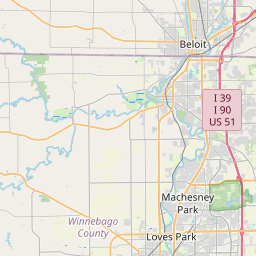
Franklin Map, Satellite view of Franklin, Illinois
Franklin is a township located in DeKalb County, Illinois, USA.
Location informations of Franklin
Latitude of city of Franklin is 42.10857 and longitude of city of Franklin is -88.88729- What Country is Franklin In? Franklin is located in the United States of America.
- What State is Franklin located in? Franklin is located in Illinois.
- What County is Franklin In? The County of Franklin is DeKalb County
Franklin, Illinois (IL), USA Geographic Information
| Country | United States |
| Country Code | US |
| State Name | Illinois |
| Latitude | 42.10857 |
| Longitude | -88.88729 |
| DMS Lat | 42°6'30.852" N |
| DMS Long | 88°53'14.244" W |
| DMS coordinates : | 42°6'30.852" N 88°53'14.244" W |
Current Date and Time in Franklin, Illinois, USA
| Franklin Time Zone : America/Chicago |
What day is it in Franklin right now?Monday (April 28, 2025) |
What time is it?Current local time and date at Franklin is 4/28/2025 - 9:35:04 PM |
Postcode / zip code of Franklin
Franklin is the actual or alternate city name associated with 2 ZIP Codes by the US Postal Service.
List of all postal codes in Franklin, Illinois, United States.
60145 Zip Code 60146 Zip Code
Area Codes Franklin, Illinois, USA
Franklin, Illinois covers 2 Area Codes
779 Area Code 815 Area CodeOnline Map of Franklin - road map, satellite view and street view


Check out our interactive map of Franklin, Illinois and you'll easily find your way around the Franklin major roads and highways.
Satellite Map of Franklin, IL, USA
This is online map of the address Franklin, IL, United States. You may use button to move and zoom in / out. The map information is for reference only.
Rotstein Airport (4.15 Km / 2.58 Miles)
Harold Bunger Airport (6.44 Km / 4.00 Miles)
Vodden Airport (8.55 Km / 5.31 Miles)
Cheechako Airport (8.97 Km / 5.57 Miles)
Bauer Airport (9.43 Km / 5.86 Miles)
Somers Blossom Airport (11.09 Km / 6.89 Miles)
Eudy Airport (11.69 Km / 7.26 Miles)
Alcock Restricted Landing Area (13.41 Km / 8.33 Miles)
Idlas Restricted Landing Area (15.67 Km / 9.74 Miles)
Henderson Field (15.94 Km / 9.90 Miles)
Untied Acres Airport (16.52 Km / 10.26 Miles)
Maple Hurst Farms Airport (17.37 Km / 10.79 Miles)
Willis Airport (17.60 Km / 10.93 Miles)
Anderson Airport (17.82 Km / 11.07 Miles)
Hendrickson Flying Service Airport (18.41 Km / 11.44 Miles)
Hoffman Airport (19.06 Km / 11.84 Miles)
Chicago Rockford International Airport (19.82 Km / 12.31 Miles)
Sycamore Fire Department Heliport (20.26 Km / 12.59 Miles)
St Anthony Medical Center Heliport (20.29 Km / 12.61 Miles)
Kishwaukee Community Hospital Heliport (21.42 Km / 13.31 Miles)
Hiawatha Jr/Sr High School (4.29 Km / 2.66 Miles)
Hiawatha Elem Sch PreK-5 (4.29 Km / 2.66 Miles)
List of places near to Franklin
| Name | Distance |
|---|---|
| Kirkland | 3.47 Km / 2.16 Miles |
| Monroe Center | 9.42 Km / 5.85 Miles |
| Monroe | 9.49 Km / 5.90 Miles |
| South Grove | 9.96 Km / 6.19 Miles |
| Kingston (Township) | 10.13 Km / 6.29 Miles |
| Kingston | 10.63 Km / 6.61 Miles |
| Flora | 10.85 Km / 6.74 Miles |
| Lynnville | 13.25 Km / 8.23 Miles |
| Cherry Valley (Township) | 13.26 Km / 8.24 Miles |
| Mayfield | 13.56 Km / 8.43 Miles |
| Spring | 14.54 Km / 9.03 Miles |
| Cherry Valley | 15.83 Km / 9.84 Miles |
| Genoa | 16.09 Km / 10.00 Miles |
| Davis Junction | 17.00 Km / 10.56 Miles |
| New Milford | 17.25 Km / 10.72 Miles |
| Belvidere | 17.63 Km / 10.95 Miles |
| Scott | 18.74 Km / 11.64 Miles |
| Genoa (Township) | 19.08 Km / 11.86 Miles |
| Belvidere (Township) | 19.27 Km / 11.97 Miles |
| Malta (Township) | 19.50 Km / 12.12 Miles |
| Dement | 19.58 Km / 12.17 Miles |
| Malta | 20.00 Km / 12.43 Miles |
| Creston | 20.77 Km / 12.91 Miles |
| Garden Prairie | 20.94 Km / 13.01 Miles |
| White Rock | 21.17 Km / 13.15 Miles |
| Sycamore | 21.24 Km / 13.20 Miles |
| DeKalb (Township) | 21.48 Km / 13.35 Miles |
| Riley | 21.71 Km / 13.49 Miles |
| Rockford (Township) | 21.93 Km / 13.63 Miles |
| Sycamore (Township) | 22.04 Km / 13.70 Miles |
| Rockford | 22.17 Km / 13.78 Miles |
| Hillcrest | 22.82 Km / 14.18 Miles |
| DeKalb | 22.90 Km / 14.23 Miles |
| Bonus | 23.38 Km / 14.53 Miles |
| Stillman Valley | 24.09 Km / 14.97 Miles |