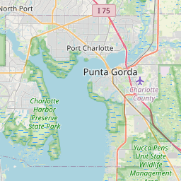
Gateway Map, Satellite view of Gateway, Florida
Gateway is a census-designated place (CDP) located in Lee County, Florida, USA.
Location informations of Gateway
Latitude of city of Gateway is 26.57757 and longitude of city of Gateway is -81.75036- What Country is Gateway In? Gateway is located in the United States of America.
- What State is Gateway located in? Gateway is located in Florida.
- What County is Gateway In? The County of Gateway is Lee County
Gateway, Florida (FL), USA Geographic Information
| Country | United States |
| Country Code | US |
| State Name | Florida |
| Latitude | 26.57757 |
| Longitude | -81.75036 |
| DMS Lat | 26°34'39.252" N |
| DMS Long | 81°45'1.296" W |
| DMS coordinates : | 26°34'39.252" N 81°45'1.296" W |
Current Date and Time in Gateway, Florida, USA
| Gateway Time Zone : America/New_York |
What day is it in Gateway right now?Thursday (April 10, 2025) |
What time is it?Current local time and date at Gateway is 4/10/2025 - 2:51:45 AM |
Postcode / zip code of Gateway
Gateway is the actual or alternate city name associated with 1 ZIP Codes by the US Postal Service.
List of all postal codes in Gateway, Florida, United States.
33913 Zip Code
Online Map of Gateway - road map, satellite view and street view


Check out our interactive map of Gateway, Florida and you'll easily find your way around the Gateway major roads and highways.
Satellite Map of Gateway, FL, USA
This is online map of the address Gateway, FL, United States. You may use button to move and zoom in / out. The map information is for reference only.
Southwest Florida International Airport (4.63 Km / 2.87 Miles)
Buckingham Field (8.33 Km / 5.17 Miles)
Strayhorn Ranch Airport (9.69 Km / 6.02 Miles)
Lehigh Acres Regional Medical Center Heliport (10.05 Km / 6.25 Miles)
Southern Machine & Steel Yard Heliport (10.43 Km / 6.48 Miles)
Gulf Coast Medical Center Heliport (10.48 Km / 6.51 Miles)
Gulf Coast Hospital Heliport (10.58 Km / 6.58 Miles)
Page Field (11.28 Km / 7.01 Miles)
Southwest Florida Regional Medical Center Heliport (11.28 Km / 7.01 Miles)
Wink Tv Heliport (13.26 Km / 8.24 Miles)
Lee Memorial Hospital Emergency Heliport (13.61 Km / 8.46 Miles)
Caloosa Downtown Seaplane Base (13.94 Km / 8.66 Miles)
Healthpark of Florida Emergency Helistop (17.95 Km / 11.15 Miles)
Winkler Helistop (18.07 Km / 11.23 Miles)
Telegraph Creek Airport (18.15 Km / 11.28 Miles)
Corkscrew Airport (19.12 Km / 11.88 Miles)
Williams Road Helistop (19.24 Km / 11.96 Miles)
Cape Coral Hospital Heliport (20.17 Km / 12.53 Miles)
Corkscrew Trace Airpark (20.46 Km / 12.71 Miles)
Pine Ridge Helistop (20.63 Km / 12.82 Miles)
GATEWAY ELEMENTARY SCHOOL (1.47 Km / 0.91 Miles)
GATEWAY CHARTER HIGH SCHOOL (2.12 Km / 1.32 Miles)
GATEWAY CHARTER ELEMENTARY SCHOOL (2.83 Km / 1.76 Miles)
GATEWAY CHARTER INTERMEDIATE SCHOOL (2.84 Km / 1.77 Miles)
TREELINE ELEMENTARY SCHOOL (3.57 Km / 2.22 Miles)
List of places near to Gateway
| Name | Distance |
|---|---|
| Buckingham | 10.99 Km / 6.83 Miles |
| Page Park | 11.11 Km / 6.90 Miles |
| Villas | 12.15 Km / 7.55 Miles |
| Tice | 12.58 Km / 7.82 Miles |
| Three Oaks | 12.72 Km / 7.90 Miles |
| Pine Manor | 12.72 Km / 7.90 Miles |
| San Carlos Park | 13.27 Km / 8.25 Miles |
| Lehigh Acres | 13.57 Km / 8.43 Miles |
| Whiskey Creek | 13.91 Km / 8.64 Miles |
| Fort Myers | 14.01 Km / 8.71 Miles |
| Fort Myers Shores | 14.65 Km / 9.10 Miles |
| Cypress Lake | 15.44 Km / 9.59 Miles |
| Olga | 16.17 Km / 10.05 Miles |
| North Fort Myers | 16.30 Km / 10.13 Miles |
| McGregor | 16.43 Km / 10.21 Miles |
| Estero | 16.49 Km / 10.25 Miles |
| Lochmoor Waterway Estates | 17.50 Km / 10.87 Miles |
| Palmona Park | 18.91 Km / 11.75 Miles |
| Harlem Heights | 18.93 Km / 11.76 Miles |
| Suncoast Estates | 19.01 Km / 11.81 Miles |
| Cape Coral | 19.88 Km / 12.35 Miles |
| Alva | 20.74 Km / 12.89 Miles |
| Charleston Park | 22.10 Km / 13.73 Miles |
| Iona | 22.18 Km / 13.78 Miles |
| Fort Myers Beach | 24.13 Km / 14.99 Miles |