Georgetown Map, Satellite view of Georgetown, Massachusetts
Georgetown is a town located in Essex County, Massachusetts, USA.
Location informations of Georgetown
Latitude of city of Georgetown is 42.72623 and longitude of city of Georgetown is -70.98332- What Country is Georgetown In? Georgetown is located in the United States of America.
- What State is Georgetown located in? Georgetown is located in Massachusetts.
- What County is Georgetown In? The County of Georgetown is Essex County
Georgetown, Massachusetts (MA), USA Geographic Information
| Country | United States |
| Country Code | US |
| State Name | Massachusetts |
| Latitude | 42.72623 |
| Longitude | -70.98332 |
| DMS Lat | 42°43'34.428" N |
| DMS Long | 70°58'59.952" W |
| DMS coordinates : | 42°43'34.428" N 70°58'59.952" W |
Current Date and Time in Georgetown, Massachusetts, USA
| Georgetown Time Zone : America/New_York |
What day is it in Georgetown right now?Sunday (June 15, 2025) |
What time is it?Current local time and date at Georgetown is 18:10:48 (06/15/2025) : (America/New_York) |
Postcode / zip code of Georgetown
Georgetown is the actual or alternate city name associated with 1 ZIP Codes by the US Postal Service.
List of all postal codes in Georgetown, Massachusetts, United States.
01833 Zip Code
Area Codes Georgetown, Massachusetts, USA
Georgetown, Massachusetts covers 2 Area Codes
351 Area Code 978 Area CodeOnline Map of Georgetown - road map, satellite view and street view
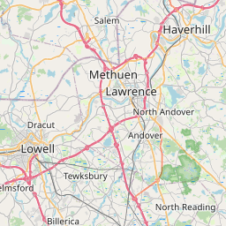
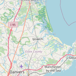


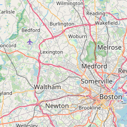
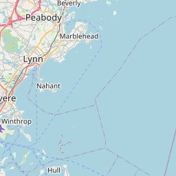


Check out our interactive map of Georgetown, Massachusetts and you'll easily find your way around the Georgetown major roads and highways.
Satellite Map of Georgetown, MA, USA
This is online map of the address Georgetown, MA, United States. You may use button to move and zoom in / out. The map information is for reference only.
Bentley Heliport (6.99 Km / 4.34 Miles)
Grandview Farm Heliport (9.51 Km / 5.91 Miles)
Lawrence Municipal Airport (11.49 Km / 7.14 Miles)
Anna Jaques Hospital Heliport (12.38 Km / 7.69 Miles)
Snow Airport (12.55 Km / 7.80 Miles)
Hat Factory Heliport (12.83 Km / 7.97 Miles)
Rider Heliport (13.60 Km / 8.45 Miles)
Lawrence General Hospital Heliport (13.79 Km / 8.57 Miles)
Plum Island Airport (13.95 Km / 8.67 Miles)
Ames Heliport (14.30 Km / 8.88 Miles)
Ferncroft Village Heliport (14.38 Km / 8.93 Miles)
Devon Glen Heliport (14.91 Km / 9.27 Miles)
Meadowbrook Airport (14.93 Km / 9.27 Miles)
Holy Family Hospital Heliport (15.11 Km / 9.39 Miles)
Lorden Heliport (15.20 Km / 9.44 Miles)
Lake Gardner Seaplane Base (15.39 Km / 9.56 Miles)
Sagamore Hill Heliport (15.86 Km / 9.86 Miles)
Goddard Field (15.94 Km / 9.91 Miles)
Beverly Regional Airport (16.71 Km / 10.38 Miles)
Dynasty Farms Heliport (18.41 Km / 11.44 Miles)
Georgetown Middle School (348 m / 0.22 Miles)
Georgetown High School (350 m / 0.22 Miles)
Perley Elementary (446 m / 0.28 Miles)
Penn Brook (1.48 Km / 0.92 Miles)
Elmer S Bagnall (3.79 Km / 2.36 Miles)
Spofford Pond (4.27 Km / 2.66 Miles)
List of places near to Georgetown
| Name | Distance |
|---|---|
| Groveland | 4.07 Km / 2.53 Miles |
| Boxford | 5.99 Km / 3.72 Miles |
| Boxford (CDP) | 7.31 Km / 4.54 Miles |
| Rowley | 7.92 Km / 4.92 Miles |
| West Newbury | 8.30 Km / 5.16 Miles |
| Rowley (CDP) | 8.61 Km / 5.35 Miles |
| Haverhill | 9.47 Km / 5.88 Miles |
| Topsfield | 9.98 Km / 6.20 Miles |
| Topsfield (CDP) | 10.24 Km / 6.36 Miles |
| Newbury | 10.30 Km / 6.40 Miles |
| North Andover | 10.57 Km / 6.57 Miles |
| Ipswich | 12.53 Km / 7.79 Miles |
| Merrimac | 12.71 Km / 7.90 Miles |
| Ipswich (CDP) | 12.74 Km / 7.92 Miles |
| Newburyport | 12.93 Km / 8.03 Miles |
| Middleton | 13.01 Km / 8.08 Miles |
| Amesbury Town | 14.09 Km / 8.76 Miles |
| Andover (CDP) | 14.65 Km / 9.10 Miles |
| Lawrence | 14.84 Km / 9.22 Miles |
| Hamilton | 15.16 Km / 9.42 Miles |
| Plaistow | 16.02 Km / 9.95 Miles |
| Methuen Town | 16.06 Km / 9.98 Miles |
| Wenham | 16.18 Km / 10.05 Miles |
| Salisbury (CDP) | 16.29 Km / 10.12 Miles |
| Newton | 16.82 Km / 10.45 Miles |
| Andover | 16.98 Km / 10.55 Miles |
| Danvers | 17.12 Km / 10.64 Miles |
| Danvers (CDP) | 17.36 Km / 10.79 Miles |
| Salisbury | 17.54 Km / 10.90 Miles |
| South Hampton | 18.29 Km / 11.36 Miles |
| North Reading | 18.40 Km / 11.43 Miles |
| Essex (CDP) | 19.45 Km / 12.09 Miles |
| Atkinson | 19.56 Km / 12.15 Miles |
| Essex | 19.79 Km / 12.30 Miles |
| Seabrook | 20.11 Km / 12.50 Miles |
| Beverly | 20.48 Km / 12.73 Miles |
| Salem | 20.65 Km / 12.83 Miles |
| Lynnfield (CDP) | 21.49 Km / 13.35 Miles |
| Lynnfield | 21.83 Km / 13.56 Miles |
| Kingston | 22.11 Km / 13.74 Miles |
| East Kingston | 22.25 Km / 13.83 Miles |
| Seabrook Beach | 22.49 Km / 13.97 Miles |
| Peabody | 22.51 Km / 13.99 Miles |
| Kensington | 23.03 Km / 14.31 Miles |
| Hampstead | 23.09 Km / 14.35 Miles |
| Wilmington | 23.29 Km / 14.47 Miles |
| Hampton Falls | 23.46 Km / 14.58 Miles |
| Reading | 23.48 Km / 14.59 Miles |
| Tewksbury | 23.68 Km / 14.71 Miles |
| Salem | 24.05 Km / 14.94 Miles |