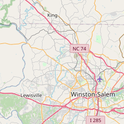
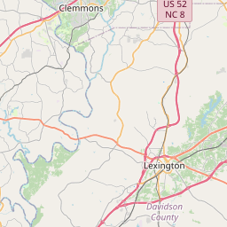
Germanton Map, Satellite view of Germanton, North Carolina
Germanton is a census-designated place (CDP) located in Forsyth County, Stokes County, North Carolina, USA.
Location informations of Germanton
Latitude of city of Germanton is 36.25014 and longitude of city of Germanton is -80.23908- What Country is Germanton In? Germanton is located in the United States of America.
- What State is Germanton located in? Germanton is located in North Carolina.
- What County is Germanton In? Germanton, North Carolina sits in Two different counties: Forsyth County, Stokes County
Germanton, North Carolina (NC), USA Geographic Information
| Country | United States |
| Country Code | US |
| State Name | North Carolina |
| Latitude | 36.25014 |
| Longitude | -80.23908 |
| DMS Lat | 36°15'0.504" N |
| DMS Long | 80°14'20.688" W |
| DMS coordinates : | 36°15'0.504" N 80°14'20.688" W |
Current Date and Time in Germanton, North Carolina, USA
| Germanton Time Zone : America/New_York |
What day is it in Germanton right now?Tuesday (June 3, 2025) |
What time is it?Current local time and date at Germanton is 6/3/2025 - 11:02:19 PM |
Postcode / zip code of Germanton
Germanton is the actual or alternate city name associated with 1 ZIP Codes by the US Postal Service.
List of all postal codes in Germanton, North Carolina, United States.
27019 Zip Code
Area Codes Germanton, North Carolina, USA
Germanton, North Carolina covers 1 Area Codes
336 Area CodeOnline Map of Germanton - road map, satellite view and street view


Check out our interactive map of Germanton, North Carolina and you'll easily find your way around the Germanton major roads and highways.
Satellite Map of Germanton, NC, USA
This is online map of the address Germanton, NC, United States. You may use button to move and zoom in / out. The map information is for reference only.
Dusenbury Field (8.69 Km / 5.40 Miles)
Meadow Brook Field (9.93 Km / 6.17 Miles)
Smith Reynolds Airport (13.04 Km / 8.10 Miles)
Robertson Field (13.69 Km / 8.50 Miles)
Lewis Airstrip (15.55 Km / 9.66 Miles)
Nc Baptist Hospital Heliport (17.99 Km / 11.18 Miles)
DS Butler Farm and Airfield (21.85 Km / 13.57 Miles)
Scenic Overlook B & B Heliport (22.15 Km / 13.77 Miles)
Rural Hall Elementary (4.72 Km / 2.93 Miles)
List of places near to Germanton
| Name | Distance |
|---|---|
| Rural Hall | 4.99 Km / 3.10 Miles |
| Walnut Cove | 10.08 Km / 6.26 Miles |
| King | 10.91 Km / 6.78 Miles |
| Tobaccoville | 11.08 Km / 6.88 Miles |
| Walkertown | 11.34 Km / 7.05 Miles |
| Bethania | 11.65 Km / 7.24 Miles |
| Winston-Salem | 16.72 Km / 10.39 Miles |
| Danbury | 17.95 Km / 11.15 Miles |
| Pinnacle | 19.49 Km / 12.11 Miles |
| Kernersville | 21.17 Km / 13.15 Miles |
| Stokesdale | 23.33 Km / 14.50 Miles |
| Lewisville | 23.48 Km / 14.59 Miles |
| Oak Ridge | 24.01 Km / 14.92 Miles |
| East Bend | 24.81 Km / 15.42 Miles |