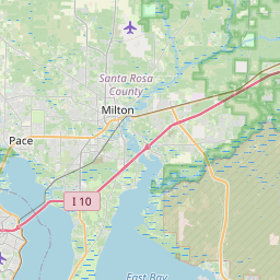
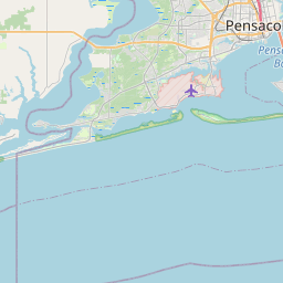
Goulding Map, Satellite view of Goulding, Florida
Goulding is a census-designated place (CDP) located in Escambia County, Florida, USA.
Location informations of Goulding
Latitude of city of Goulding is 30.44298 and longitude of city of Goulding is -87.22247- What Country is Goulding In? Goulding is located in the United States of America.
- What State is Goulding located in? Goulding is located in Florida.
- What County is Goulding In? The County of Goulding is Escambia County
Goulding, Florida (FL), USA Geographic Information
| Country | United States |
| Country Code | US |
| State Name | Florida |
| Latitude | 30.44298 |
| Longitude | -87.22247 |
| DMS Lat | 30°26'34.728" N |
| DMS Long | 87°13'20.892" W |
| DMS coordinates : | 30°26'34.728" N 87°13'20.892" W |
Current Date and Time in Goulding, Florida, USA
| Goulding Time Zone : America/Chicago |
What day is it in Goulding right now?Thursday (April 24, 2025) |
What time is it?Current local time and date at Goulding is 4/24/2025 - 6:08:36 PM |
Postcode / zip code of Goulding
Goulding is the actual or alternate city name associated with 3 ZIP Codes by the US Postal Service.
List of all postal codes in Goulding, Florida, United States.
32501 Zip Code 32503 Zip Code 32505 Zip Code
Online Map of Goulding - road map, satellite view and street view


Check out our interactive map of Goulding, Florida and you'll easily find your way around the Goulding major roads and highways.
Satellite Map of Goulding, FL, USA
This is online map of the address Goulding, FL, United States. You may use button to move and zoom in / out. The map information is for reference only.
Baptist Hospital Heliport (1.72 Km / 1.07 Miles)
Sacred Heart Hospital Heliport (3.70 Km / 2.30 Miles)
Pensacola International Airport (4.82 Km / 3.00 Miles)
West Florida Regional Medical Center Heliport (6.89 Km / 4.28 Miles)
West Florida Hospital Helipad (8.18 Km / 5.08 Miles)
Naval Air Station Pensacola Corry Field (8.20 Km / 5.09 Miles)
Corry Field Heliport (8.60 Km / 5.34 Miles)
Naval Air Station Pensacola Chevalier Field (10.77 Km / 6.69 Miles)
Gulf Breeze Hospital Heliport (11.14 Km / 6.92 Miles)
Saufley Naval Outlying Landing Field (11.76 Km / 7.31 Miles)
Ferguson Airport (13.05 Km / 8.11 Miles)
Naval Air Station Pensacola Forrest Sherman Field (13.63 Km / 8.47 Miles)
Garcon Field (14.26 Km / 8.86 Miles)
Site 8 NOLF (17.84 Km / 11.09 Miles)
Coastal Airport (18.47 Km / 11.48 Miles)
Naval Outlying Landing Field Bronson (18.93 Km / 11.76 Miles)
Lillian Community Heliport (21.40 Km / 13.30 Miles)
Spencer Nolf Airport (21.76 Km / 13.52 Miles)
Shields Airport (22.53 Km / 14.00 Miles)
Faircloth Naval Outlying Landing Field (23.42 Km / 14.55 Miles)
ESCAMBIA VIRTUAL INSTRUCTION PROGRAM (423 m / 0.26 Miles)
ESCAMBIA VIRTUAL ACADEMY FRANCHISE (423 m / 0.26 Miles)
ESCAMBIA VIRTUAL INSTRUCTIONAL PROGRAM (DISTRICT PROVIDED) (423 m / 0.26 Miles)
ESCAMBIA VIRTUAL INSTRUCTION (COURSE OFFERINGS) (423 m / 0.26 Miles)
TAP PK BABIES (443 m / 0.28 Miles)
PENSACOLA HIGH SCHOOL (951 m / 0.59 Miles)
ESCAMBIA JUVENILE DETENTION (959 m / 0.60 Miles)
COUNTY ADMINISTRATIVE ANNEX (1.30 Km / 0.81 Miles)
HOSPITAL & HOMEBOUND (1.30 Km / 0.81 Miles)
MCMILLIAN LEARNING CENTER (1.30 Km / 0.81 Miles)
ESCAMBIA SCH. DIST. JAIL PROG. (1.39 Km / 0.86 Miles)
LAKEVIEW DROPOUT PREVENTION (1.59 Km / 0.99 Miles)
LAKEVIEW SPECIAL EDUCATION (1.64 Km / 1.02 Miles)
O. J. SEMMES ELEMENTARY SCHOOL (1.67 Km / 1.04 Miles)
C. A. WEIS ELEMENTARY SCHOOL (2.02 Km / 1.25 Miles)
N. B. COOK ELEMENTARY SCHOOL (2.45 Km / 1.52 Miles)
BRENTWOOD ELEMENTARY SCHOOL (2.74 Km / 1.70 Miles)
CORDOVA PARK ELEMENTARY SCHOOL (3.50 Km / 2.17 Miles)
MONTCLAIR ELEMENTARY SCHOOL (3.65 Km / 2.27 Miles)
GLOBAL LEARNING ACADEMY (3.69 Km / 2.29 Miles)
Adrian H. Wallace Barber Academy (1.45 Km / 0.90 Miles)
Pensacola State College (4.56 Km / 2.83 Miles)
List of places near to Goulding
| Name | Distance |
|---|---|
| Pensacola | 2.47 Km / 1.53 Miles |
| Brent | 3.15 Km / 1.96 Miles |
| West Pensacola | 5.78 Km / 3.59 Miles |
| Ferry Pass | 7.54 Km / 4.69 Miles |
| Warrington | 8.26 Km / 5.13 Miles |
| Myrtle Grove | 8.51 Km / 5.29 Miles |
| Bellview | 9.10 Km / 5.65 Miles |
| Ensley | 9.71 Km / 6.03 Miles |
| Gulf Breeze | 11.08 Km / 6.88 Miles |
| Garcon Point | 13.60 Km / 8.45 Miles |
| Oriole Beach | 14.74 Km / 9.16 Miles |
| Avalon | 15.33 Km / 9.53 Miles |
| Mulat | 15.34 Km / 9.53 Miles |
| Dickerson City | 16.23 Km / 10.08 Miles |
| Floridatown | 16.70 Km / 10.38 Miles |
| Gonzalez | 16.77 Km / 10.42 Miles |
| Tiger Point | 17.54 Km / 10.90 Miles |
| Pace | 18.36 Km / 11.41 Miles |
| Lillian | 20.83 Km / 12.94 Miles |
| Midway | 20.84 Km / 12.95 Miles |
| Pea Ridge | 20.97 Km / 13.03 Miles |
| Woodlawn Beach | 23.03 Km / 14.31 Miles |