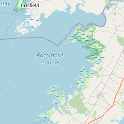
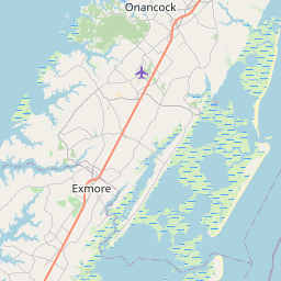
Greenbush Map, Satellite view of Greenbush, Virginia
Greenbush is a census-designated place (CDP) located in Accomack County, Virginia, USA.
Location informations of Greenbush
Latitude of city of Greenbush is 37.74096 and longitude of city of Greenbush is -75.68104- What Country is Greenbush In? Greenbush is located in the United States of America.
- What State is Greenbush located in? Greenbush is located in Virginia.
- What County is Greenbush In? The County of Greenbush is Accomack County
Greenbush, Virginia (VA), USA Geographic Information
| Country | United States |
| Country Code | US |
| State Name | Virginia |
| Latitude | 37.74096 |
| Longitude | -75.68104 |
| DMS Lat | 37°44'27.456" N |
| DMS Long | 75°40'51.744" W |
| DMS coordinates : | 37°44'27.456" N 75°40'51.744" W |
Current Date and Time in Greenbush, Virginia, USA
| Greenbush Time Zone : America/New_York |
What day is it in Greenbush right now?Sunday (May 18, 2025) |
What time is it?Current local time and date at Greenbush is 5/18/2025 - 12:04:57 PM |
Postcode / zip code of Greenbush
Greenbush is the actual or alternate city name associated with 1 ZIP Codes by the US Postal Service.
List of all postal codes in Greenbush, Virginia, United States.
23357 Zip Code
Online Map of Greenbush - road map, satellite view and street view


Check out our interactive map of Greenbush, Virginia and you'll easily find your way around the Greenbush major roads and highways.
Satellite Map of Greenbush, VA, USA
This is online map of the address Greenbush, VA, United States. You may use button to move and zoom in / out. The map information is for reference only.
Johnson Field (5.67 Km / 3.52 Miles)
Riverside Shore Memorial Hospital Heliport (6.20 Km / 3.85 Miles)
Onley Airport (7.75 Km / 4.82 Miles)
Peace and Plenty Farm Airport (9.44 Km / 5.87 Miles)
Crippen Creek Farm Airport (9.90 Km / 6.15 Miles)
Midway Airport (10.17 Km / 6.32 Miles)
Accomack County Airport (12.61 Km / 7.84 Miles)
The Salmon Farm Airport (Pvt) (17.64 Km / 10.96 Miles)
Painter Field (21.77 Km / 13.53 Miles)
Taylor Airport (21.86 Km / 13.58 Miles)
High Hopes Airport (22.42 Km / 13.93 Miles)
List of places near to Greenbush
| Name | Distance |
|---|---|
| Chase Crossing | 2.69 Km / 1.67 Miles |
| Accomac | 2.74 Km / 1.70 Miles |
| Bayside | 3.29 Km / 2.04 Miles |
| Tasley | 3.80 Km / 2.36 Miles |
| Lee Mont | 4.20 Km / 2.61 Miles |
| Pastoria | 4.58 Km / 2.85 Miles |
| Whitesville | 4.87 Km / 3.03 Miles |
| Parksley | 5.17 Km / 3.21 Miles |
| Onley | 6.36 Km / 3.95 Miles |
| Onancock | 6.81 Km / 4.23 Miles |
| Deep Creek | 6.95 Km / 4.32 Miles |
| Metompkin | 7.57 Km / 4.70 Miles |
| Southside Chesconessex | 8.59 Km / 5.34 Miles |
| Savageville | 9.43 Km / 5.86 Miles |
| Gargatha | 9.83 Km / 6.11 Miles |
| Bloxom | 11.08 Km / 6.88 Miles |
| Melfa | 11.49 Km / 7.14 Miles |
| Nelsonia | 12.04 Km / 7.48 Miles |
| Modest Town | 12.97 Km / 8.06 Miles |
| Bobtown | 14.06 Km / 8.74 Miles |
| Wachapreague | 15.21 Km / 9.45 Miles |
| Keller | 15.36 Km / 9.54 Miles |
| Mappsville | 15.41 Km / 9.58 Miles |
| Harborton | 15.82 Km / 9.83 Miles |
| Pungoteague | 16.94 Km / 10.53 Miles |
| Hallwood | 17.21 Km / 10.69 Miles |
| Mappsburg | 19.56 Km / 12.15 Miles |
| Painter | 19.57 Km / 12.16 Miles |
| Boston | 20.42 Km / 12.69 Miles |
| Sanford | 20.53 Km / 12.76 Miles |
| Temperanceville | 20.59 Km / 12.79 Miles |
| Saxis | 20.67 Km / 12.84 Miles |
| Makemie Park | 21.02 Km / 13.06 Miles |
| Quinby | 21.33 Km / 13.25 Miles |
| Cats Bridge | 22.83 Km / 14.19 Miles |
| Atlantic | 23.39 Km / 14.53 Miles |
| Savage Town | 23.52 Km / 14.61 Miles |
| Belle Haven | 24.23 Km / 15.06 Miles |
| Oak Hall | 24.77 Km / 15.39 Miles |