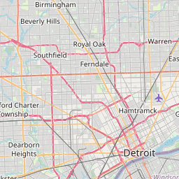
Grosse Pointe Farms Map, Satellite view of Grosse Pointe Farms, Michigan
Grosse Pointe Farms is a city located in Wayne County, Michigan, USA.
Location informations of Grosse Pointe Farms
Latitude of city of Grosse Pointe Farms is 42.40920 and longitude of city of Grosse Pointe Farms is -82.89186- What Country is Grosse Pointe Farms In? Grosse Pointe Farms is located in the United States of America.
- What State is Grosse Pointe Farms located in? Grosse Pointe Farms is located in Michigan.
- What County is Grosse Pointe Farms In? The County of Grosse Pointe Farms is Wayne County
Grosse Pointe Farms, Michigan (MI), USA Geographic Information
| Country | United States |
| Country Code | US |
| State Name | Michigan |
| Latitude | 42.4092 |
| Longitude | -82.89186 |
| DMS Lat | 42°24'33.12" N |
| DMS Long | 82°53'30.696" W |
| DMS coordinates : | 42°24'33.12" N 82°53'30.696" W |
Current Date and Time in Grosse Pointe Farms, Michigan, USA
| Grosse Pointe Farms Time Zone : America/Detroit |
What day is it in Grosse Pointe Farms right now?Thursday (June 19, 2025) |
What time is it?Current local time and date at Grosse Pointe Farms is 6/19/2025 - 4:23:42 PM |
Postcode / zip code of Grosse Pointe Farms
Grosse Pointe Farms is the actual or alternate city name associated with 1 ZIP Codes by the US Postal Service.
List of all postal codes in Grosse Pointe Farms, Michigan, United States.
48236 Zip Code
Area Codes Grosse Pointe Farms, Michigan, USA
Grosse Pointe Farms, Michigan covers 1 Area Codes
313 Area CodeOnline Map of Grosse Pointe Farms - road map, satellite view and street view


Check out our interactive map of Grosse Pointe Farms, Michigan and you'll easily find your way around the Grosse Pointe Farms major roads and highways.
Satellite Map of Grosse Pointe Farms, MI, USA
This is online map of the address Grosse Pointe Farms, MI, United States. You may use button to move and zoom in / out. The map information is for reference only.
St John Hospital & Medical Center Heliport (2.37 Km / 1.48 Miles)
Detroit Border Patrol Heliport (7.77 Km / 4.83 Miles)
Coleman A. Young Municipal Airport (9.69 Km / 6.02 Miles)
Acme Heliport (11.90 Km / 7.39 Miles)
Detroit Medical Center Heliport (14.81 Km / 9.20 Miles)
Grant Pad Heliport (15.31 Km / 9.51 Miles)
Cobo Hall Heliport (15.82 Km / 9.83 Miles)
Wdiv-Tv Channel 4 Heliport (15.95 Km / 9.91 Miles)
Henry Ford Hospital Heliport (16.48 Km / 10.24 Miles)
McLaren Macomb Hospital Heliport (19.97 Km / 12.41 Miles)
Selfridge Air National Guard Base Airport (23.16 Km / 14.39 Miles)
Dan's Apple Farm Heliport (23.65 Km / 14.69 Miles)
Grace Hospital Heliport (23.92 Km / 14.86 Miles)
Kerby Elementary School (799 m / 0.50 Miles)
Brownell Middle School (1.32 Km / 0.82 Miles)
Barnes Early Childhood Center (1.86 Km / 1.16 Miles)
Richard Elementary School (1.90 Km / 1.18 Miles)
John Monteith Elementary School (2.07 Km / 1.28 Miles)
Grosse Pointe South High School (2.23 Km / 1.39 Miles)
Marquette ElementaryMiddle School (2.78 Km / 1.73 Miles)
East English Village Preparatory Academy (3.05 Km / 1.90 Miles)
Grosse Pointe North High School (3.05 Km / 1.90 Miles)
Lewis Maire Elementary School (3.05 Km / 1.90 Miles)
Diann BanksWilliamson Educational Center (3.11 Km / 1.93 Miles)
Tyrone Elementary School (3.27 Km / 2.03 Miles)
Distinctive College Prep (3.39 Km / 2.11 Miles)
Stevens T Mason Elementary School (3.83 Km / 2.38 Miles)
Parcells Middle School (3.85 Km / 2.39 Miles)
Ferry Elementary School (3.90 Km / 2.43 Miles)
J E Clark Preparatory Academy (4.38 Km / 2.72 Miles)
Charles A Poupard Elem School (4.58 Km / 2.85 Miles)
Marvin L Winans Academy Middle School (4.61 Km / 2.87 Miles)
Marvin L Winans Academy Elementary (4.61 Km / 2.87 Miles)
List of places near to Grosse Pointe Farms
| Name | Distance |
|---|---|
| Grosse Pointe | 3.04 Km / 1.89 Miles |
| Harper Woods | 3.75 Km / 2.33 Miles |
| Grosse Pointe Woods | 4.02 Km / 2.50 Miles |
| Village of Grosse Pointe Shores | 5.00 Km / 3.11 Miles |
| Grosse Pointe Park | 5.27 Km / 3.27 Miles |
| Eastpointe | 8.40 Km / 5.22 Miles |
| St. Clair Shores | 9.76 Km / 6.06 Miles |
| Roseville | 10.47 Km / 6.51 Miles |
| Hamtramck | 13.08 Km / 8.13 Miles |
| Warren | 13.73 Km / 8.53 Miles |
| Center Line | 13.98 Km / 8.69 Miles |
| Fraser | 15.21 Km / 9.45 Miles |
| Detroit | 15.32 Km / 9.52 Miles |
| Highland Park | 16.84 Km / 10.46 Miles |
| Hazel Park | 18.40 Km / 11.43 Miles |
| Madison Heights | 19.47 Km / 12.10 Miles |
| Clinton | 20.25 Km / 12.58 Miles |
| Harrison | 20.71 Km / 12.87 Miles |
| Ferndale | 20.73 Km / 12.88 Miles |
| Mount Clemens | 20.94 Km / 13.01 Miles |
| Pleasant Ridge | 21.66 Km / 13.46 Miles |
| Sterling Heights | 22.15 Km / 13.76 Miles |
| Royal Oak | 22.58 Km / 14.03 Miles |
| Royal Oak (Charter Township) | 22.66 Km / 14.08 Miles |
| Huntington Woods | 23.92 Km / 14.86 Miles |
| Oak Park | 24.52 Km / 15.24 Miles |