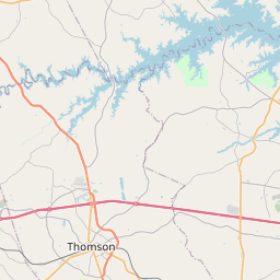
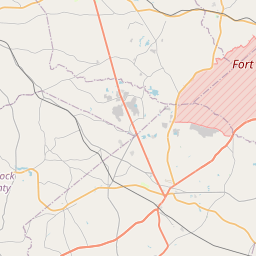
Grovetown Map, Satellite view of Grovetown, Georgia
Grovetown is a city located in Columbia County, Georgia, USA.
Location informations of Grovetown
Latitude of city of Grovetown is 33.45042 and longitude of city of Grovetown is -82.19818- What Country is Grovetown In? Grovetown is located in the United States of America.
- What State is Grovetown located in? Grovetown is located in Georgia.
- What County is Grovetown In? The County of Grovetown is Columbia County
Grovetown, Georgia (GA), USA Geographic Information
| Country | United States |
| Country Code | US |
| State Name | Georgia |
| Latitude | 33.45042 |
| Longitude | -82.19818 |
| DMS Lat | 33°27'1.512" N |
| DMS Long | 82°11'53.448" W |
| DMS coordinates : | 33°27'1.512" N 82°11'53.448" W |
Current Date and Time in Grovetown, Georgia, USA
| Grovetown Time Zone : America/New_York |
What day is it in Grovetown right now?Friday (May 23, 2025) |
What time is it?Current local time and date at Grovetown is 5/23/2025 - 8:14:59 AM |
Postcode / zip code of Grovetown
Grovetown is the actual or alternate city name associated with 1 ZIP Codes by the US Postal Service.
List of all postal codes in Grovetown, Georgia, United States.
30813 Zip Code
Area Codes Grovetown, Georgia, USA
Grovetown, Georgia covers 2 Area Codes
706 Area Code 762 Area CodeOnline Map of Grovetown - road map, satellite view and street view


Check out our interactive map of Grovetown, Georgia and you'll easily find your way around the Grovetown major roads and highways.
Satellite Map of Grovetown, GA, USA
This is online map of the address Grovetown, GA, United States. You may use button to move and zoom in / out. The map information is for reference only.
Fort Gordon Hqs Helipad Heliport (6.38 Km / 3.96 Miles)
Dwight David Eisenhower Army Medical Ctr Heliport (7.49 Km / 4.65 Miles)
Doctors Hospital Heliport (10.37 Km / 6.45 Miles)
Doctors Hospital Heliport (10.47 Km / 6.51 Miles)
Daniel Field (14.84 Km / 9.22 Miles)
Pea Patch Aerodrome (16.70 Km / 10.38 Miles)
Carpenter Airport (17.94 Km / 11.14 Miles)
Morris Seaplane Base (18.63 Km / 11.58 Miles)
Medical College of Georgia Heliport (19.61 Km / 12.18 Miles)
University Hospital Heliport (20.01 Km / 12.44 Miles)
Augusta Regional At Bush Field (23.47 Km / 14.58 Miles)
Grovetown Elementary School (560 m / 0.35 Miles)
Cedar Ridge Elementary School (2.03 Km / 1.26 Miles)
Grovetown Middle School (2.10 Km / 1.30 Miles)
List of places near to Grovetown
| Name | Distance |
|---|---|
| Evans | 11.18 Km / 6.95 Miles |
| Harlem | 11.34 Km / 7.05 Miles |
| Martinez | 13.58 Km / 8.44 Miles |
| Augusta | 15.12 Km / 9.40 Miles |
| Appling | 15.24 Km / 9.47 Miles |
| Blythe | 16.41 Km / 10.20 Miles |
| Dearing | 17.84 Km / 11.09 Miles |
| Hephzibah | 17.85 Km / 11.09 Miles |
| North Augusta | 23.91 Km / 14.86 Miles |
| Keysville | 24.30 Km / 15.10 Miles |
| Clarks Hill | 24.64 Km / 15.31 Miles |