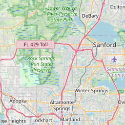
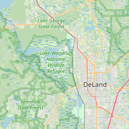
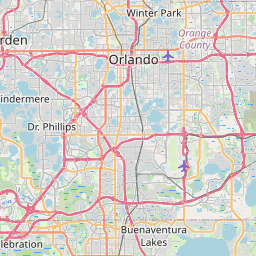
Heathrow Map, Satellite view of Heathrow, Florida
Heathrow is a census-designated place (CDP) located in Seminole County, Florida, USA.
Location informations of Heathrow
Latitude of city of Heathrow is 28.76333 and longitude of city of Heathrow is -81.37225- What Country is Heathrow In? Heathrow is located in the United States of America.
- What State is Heathrow located in? Heathrow is located in Florida.
- What County is Heathrow In? The County of Heathrow is Seminole County
Heathrow, Florida (FL), USA Geographic Information
| Country | United States |
| Country Code | US |
| State Name | Florida |
| Latitude | 28.76333 |
| Longitude | -81.37225 |
| DMS Lat | 28°45'47.988" N |
| DMS Long | 81°22'20.1" W |
| DMS coordinates : | 28°45'47.988" N 81°22'20.1" W |
Current Date and Time in Heathrow, Florida, USA
| Heathrow Time Zone : America/New_York |
What day is it in Heathrow right now?Friday (May 16, 2025) |
What time is it?Current local time and date at Heathrow is 20:36:30 (05/16/2025) : (America/New_York) |
Postcode / zip code of Heathrow
Heathrow is the actual or alternate city name associated with 1 ZIP Codes by the US Postal Service.
List of all postal codes in Heathrow, Florida, United States.
32746 Zip Code
Online Map of Heathrow - road map, satellite view and street view


Check out our interactive map of Heathrow, Florida and you'll easily find your way around the Heathrow major roads and highways.
Satellite Map of Heathrow, FL, USA
This is online map of the address Heathrow, FL, United States. You may use button to move and zoom in / out. The map information is for reference only.
Orlando Health Lake Mary Heliport (2.26 Km / 1.40 Miles)
Advent Health Lake Mary ER Heliport (3.23 Km / 2.00 Miles)
Central Florida Regional Hospital Heliport (10.31 Km / 6.41 Miles)
Advent Health Altamonte Springs Heliport (10.75 Km / 6.68 Miles)
Ferguson Seaplane Base (11.33 Km / 7.04 Miles)
Prairie Lake Private Residential Seaplane Base (12.00 Km / 7.46 Miles)
Paradise Landing Seaplane Base (12.18 Km / 7.57 Miles)
Sanford Seaplane Base (12.51 Km / 7.77 Miles)
Orlando Sanford International Airport (13.23 Km / 8.22 Miles)
Lake Jessup Seaplane Base (14.52 Km / 9.02 Miles)
Florida Hospital Apopka Heliport (16.02 Km / 9.95 Miles)
Wesh-Tv Channel 2 Heliport (16.82 Km / 10.45 Miles)
Britt Brown & Porter Ranch Airport (16.83 Km / 10.46 Miles)
Wcpx Tv-6 Heliport (17.63 Km / 10.95 Miles)
Oviedo Medical Center Heliport (18.27 Km / 11.35 Miles)
AdventHealth Fish Memorial Hospital Heliport (18.87 Km / 11.72 Miles)
Timberlachen Seaplane Base (19.21 Km / 11.94 Miles)
Alligator Drink Seaplane Base (20.46 Km / 12.71 Miles)
Pine Lakes Farm Airport (20.47 Km / 12.72 Miles)
AdventHealth Apopka Heliport (20.79 Km / 12.92 Miles)
UCP SEMINOLE CHILD DEVELOPMENT (2.13 Km / 1.32 Miles)
HEATHROW ELEMENTARY SCHOOL (2.45 Km / 1.52 Miles)
MARKHAM WOODS MIDDLE SCHOOL (2.66 Km / 1.65 Miles)
CRYSTAL LAKE ELEMENTARY SCHOOL (2.75 Km / 1.71 Miles)
SEMINOLE COUNTY VIRTUAL FRANCHISE (SCVS) (3.20 Km / 1.99 Miles)
SEMINOLE ACADEMY OF DIGITAL LEARNING (3.20 Km / 1.99 Miles)
HOSPITAL HOMEBOUND PROGRAM (3.20 Km / 1.99 Miles)
GREENWOOD LAKES MIDDLE SCHOOL (4.35 Km / 2.70 Miles)
WILSON ELEMENTARY SCHOOL (4.39 Km / 2.73 Miles)
LAKE MARY HIGH SCHOOL (4.55 Km / 2.83 Miles)
LAKE MARY ELEMENTARY SCHOOL (4.85 Km / 3.01 Miles)
Remington College-Heathrow Campus (2.69 Km / 1.67 Miles)
List of places near to Heathrow
| Name | Distance |
|---|---|
| Lake Mary | 5.33 Km / 3.31 Miles |
| Longwood | 7.47 Km / 4.64 Miles |
| Wekiwa Springs | 8.88 Km / 5.52 Miles |
| Winter Springs | 9.51 Km / 5.91 Miles |
| Casselberry | 10.45 Km / 6.49 Miles |
| Sanford | 10.51 Km / 6.53 Miles |
| Altamonte Springs | 11.38 Km / 7.07 Miles |
| Forest City | 12.78 Km / 7.94 Miles |
| Fern Park | 12.86 Km / 7.99 Miles |
| Midway | 14.10 Km / 8.76 Miles |
| DeBary | 14.68 Km / 9.12 Miles |
| Maitland | 15.10 Km / 9.38 Miles |
| Apopka | 16.25 Km / 10.10 Miles |
| Mount Plymouth | 16.45 Km / 10.22 Miles |
| Eatonville | 16.54 Km / 10.28 Miles |
| Lockhart | 17.41 Km / 10.82 Miles |
| South Apopka | 17.50 Km / 10.87 Miles |
| Winter Park | 18.44 Km / 11.46 Miles |
| Deltona | 18.56 Km / 11.53 Miles |
| Goldenrod | 18.60 Km / 11.56 Miles |
| Oviedo | 19.08 Km / 11.86 Miles |
| Fairview Shores | 19.27 Km / 11.97 Miles |
| Sorrento | 19.30 Km / 11.99 Miles |
| Black Hammock | 20.05 Km / 12.46 Miles |
| Pine Lakes | 20.55 Km / 12.77 Miles |
| Clarcona | 20.79 Km / 12.92 Miles |
| Orange City | 21.84 Km / 13.57 Miles |
| Zellwood | 22.60 Km / 14.04 Miles |
| Paradise Heights | 22.84 Km / 14.19 Miles |
| Union Park | 23.28 Km / 14.47 Miles |
| Pine Hills | 24.19 Km / 15.03 Miles |