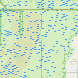
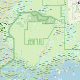
Homestead Base Map, Satellite view of Homestead Base, Florida
Homestead Base is a census-designated place (CDP) located in Miami-Dade County, Florida, USA.
Location informations of Homestead Base
Latitude of city of Homestead Base is 25.49328 and longitude of city of Homestead Base is -80.39022- What Country is Homestead Base In? Homestead Base is located in the United States of America.
- What State is Homestead Base located in? Homestead Base is located in Florida.
- What County is Homestead Base In? The County of Homestead Base is Miami-Dade County
Homestead Base, Florida (FL), USA Geographic Information
| Country | United States |
| Country Code | US |
| State Name | Florida |
| Latitude | 25.49328 |
| Longitude | -80.39022 |
| DMS Lat | 25°29'35.808" N |
| DMS Long | 80°23'24.792" W |
| DMS coordinates : | 25°29'35.808" N 80°23'24.792" W |
Current Date and Time in Homestead Base, Florida, USA
| Homestead Base Time Zone : America/New_York |
What day is it in Homestead Base right now?Saturday (May 31, 2025) |
What time is it?Current local time and date at Homestead Base is 01:46:28 (05/31/2025) : (America/New_York) |
Postcode / zip code of Homestead Base
Homestead Base is the actual or alternate city name associated with 3 ZIP Codes by the US Postal Service.
List of all postal codes in Homestead Base, Florida, United States.
33032 Zip Code 33033 Zip Code 33039 Zip Code
Area Codes Homestead Base, Florida, USA
Homestead Base, Florida covers 2 Area Codes
305 Area Code 786 Area CodeOnline Map of Homestead Base - road map, satellite view and street view


Check out our interactive map of Homestead Base, Florida and you'll easily find your way around the Homestead Base major roads and highways.
Satellite Map of Homestead Base, FL, USA
This is online map of the address Homestead Base, FL, United States. You may use button to move and zoom in / out. The map information is for reference only.
Homestead ARB Airport (844 m / 0.52 Miles)
Baptist Health South Florida Helipad (4.37 Km / 2.72 Miles)
Motorsports Complex EMS Heliport (4.69 Km / 2.91 Miles)
Motorsports Complex VIP Heliport (5.35 Km / 3.32 Miles)
Homestead Municipal Airport (7.78 Km / 4.83 Miles)
Burrs Strip (8.42 Km / 5.23 Miles)
F P & L Turkey Point Helistop (8.69 Km / 5.40 Miles)
South Dade Community Health Center Heliport (9.00 Km / 5.59 Miles)
Mac's Field (9.60 Km / 5.97 Miles)
Davis Airport (10.07 Km / 6.26 Miles)
Tom Werner Airport (11.99 Km / 7.45 Miles)
Grove Airport (12.35 Km / 7.67 Miles)
The Wright Place STOLport (12.61 Km / 7.84 Miles)
Naval Air Station Richmond (13.49 Km / 8.38 Miles)
US Naval Reservation Homestead Heliport (13.91 Km / 8.64 Miles)
US Coast Guard Miami Communication Station Heliport (14.27 Km / 8.86 Miles)
Richards Field (14.49 Km / 9.00 Miles)
Pitts Aviation Airport (14.59 Km / 9.06 Miles)
B & L Farms Airport (14.78 Km / 9.18 Miles)
Miami Gliderport Landing Strip (15.33 Km / 9.53 Miles)
CHAPMAN PARTNERSHIP EARLY CHILDHOOD CENTER SOUTH (1.45 Km / 0.90 Miles)
TITLE I MIGRANT EDUCATION PROGRAM (1.45 Km / 0.90 Miles)
MANDARIN LAKES K-8 ACADEMY (1.59 Km / 0.99 Miles)
ASPIRA LEADERSHIP AND COLLEGE PREPARATORY ACADEMY (1.72 Km / 1.07 Miles)
AIR BASE K-8 CENTER FOR INTERNATIONAL EDUCATION (2.58 Km / 1.60 Miles)
CATAPULT ACADEMY (2.77 Km / 1.72 Miles)
THE CHARTER SCHOOL AT WATERSTONE (3.31 Km / 2.06 Miles)
ADVANTAGE ACADEMY OF MATH AND SCIENCE AT WATERSTONE (3.31 Km / 2.06 Miles)
DR. WILLIAM A. CHAPMAN ELEMENTARY SCHOOL (3.63 Km / 2.26 Miles)
MIAMI MACARTHUR EDUCATIONAL CENTER (4.17 Km / 2.59 Miles)
LEISURE CITY K-8 CENTER (4.42 Km / 2.74 Miles)
South Dade Technical College (4.88 Km / 3.03 Miles)
List of places near to Homestead Base
| Name | Distance |
|---|---|
| Leisure City | 3.92 Km / 2.44 Miles |
| Naranja | 4.29 Km / 2.67 Miles |
| Princeton | 5.36 Km / 3.33 Miles |
| Goulds | 7.75 Km / 4.82 Miles |
| Homestead | 9.18 Km / 5.70 Miles |
| Florida City | 10.26 Km / 6.38 Miles |
| Cutler Bay | 10.82 Km / 6.72 Miles |
| South Miami Heights | 11.64 Km / 7.23 Miles |
| West Perrine | 12.83 Km / 7.97 Miles |
| Richmond West | 13.49 Km / 8.38 Miles |
| Palmetto Estates | 14.53 Km / 9.03 Miles |
| Richmond Heights | 15.52 Km / 9.64 Miles |
| Palmetto Bay | 15.72 Km / 9.77 Miles |
| Country Walk | 16.21 Km / 10.07 Miles |
| Three Lakes | 16.56 Km / 10.29 Miles |
| The Crossings | 19.75 Km / 12.27 Miles |
| The Hammocks | 20.55 Km / 12.77 Miles |
| Pinecrest | 21.00 Km / 13.05 Miles |
| Kendall | 21.94 Km / 13.63 Miles |
| Sunset | 23.95 Km / 14.88 Miles |
| Kendale Lakes | 23.95 Km / 14.88 Miles |
| Kendall West | 24.28 Km / 15.09 Miles |
| Glenvar Heights | 24.70 Km / 15.35 Miles |