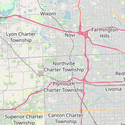
Huron Map, Satellite view of Huron, Michigan
Huron is a charter-township located in Wayne County, Michigan, USA.
Location informations of Huron
Latitude of city of Huron is 42.14368 and longitude of city of Huron is -83.35813- What Country is Huron In? Huron is located in the United States of America.
- What State is Huron located in? Huron is located in Michigan.
- What County is Huron In? The County of Huron is Wayne County
Huron, Michigan (MI), USA Geographic Information
| Country | United States |
| Country Code | US |
| State Name | Michigan |
| Latitude | 42.14368 |
| Longitude | -83.35813 |
| DMS Lat | 42°8'37.248" N |
| DMS Long | 83°21'29.268" W |
| DMS coordinates : | 42°8'37.248" N 83°21'29.268" W |
Current Date and Time in Huron, Michigan, USA
| Huron Time Zone : America/Detroit |
What day is it in Huron right now?Sunday (June 15, 2025) |
What time is it?Current local time and date at Huron is 01:25:29 (06/15/2025) : (America/Detroit) |
Postcode / zip code of Huron
Huron is the actual or alternate city name associated with 4 ZIP Codes by the US Postal Service.
List of all postal codes in Huron, Michigan, United States.
48111 Zip Code 48134 Zip Code 48164 Zip Code 48174 Zip Code
Online Map of Huron - road map, satellite view and street view


Check out our interactive map of Huron, Michigan and you'll easily find your way around the Huron major roads and highways.
Satellite Map of Huron, MI, USA
This is online map of the address Huron, MI, United States. You may use button to move and zoom in / out. The map information is for reference only.
L & L Heliport (2.43 Km / 1.51 Miles)
Detroit Metropolitan Wayne County Airport (7.65 Km / 4.75 Miles)
Four Star Heliport (11.20 Km / 6.96 Miles)
Oakwood Southshore Medical Center Heliport (12.23 Km / 7.60 Miles)
Oakwood Heritage Hospital Heliport (12.32 Km / 7.65 Miles)
Carls Airport (12.32 Km / 7.65 Miles)
A T I Heliport (13.00 Km / 8.08 Miles)
Wickenheiser Airport (14.05 Km / 8.73 Miles)
Johnston Airport (14.67 Km / 9.12 Miles)
Belleville Airport (15.90 Km / 9.88 Miles)
Grosse Ile Municipal Airport (16.96 Km / 10.54 Miles)
Mills Field (17.07 Km / 10.61 Miles)
Downwind Acres Airport (17.28 Km / 10.74 Miles)
Willow Run Airport (17.64 Km / 10.96 Miles)
Newport Woods Airport (17.82 Km / 11.07 Miles)
Runyon Landing Strip (17.93 Km / 11.14 Miles)
Henry Ford Wyandotte Hospital Heliport (19.04 Km / 11.83 Miles)
Newport Meadows Airport (19.48 Km / 12.10 Miles)
Beaumont Dearborn Heliport (20.05 Km / 12.46 Miles)
Dearborn Helistop (20.20 Km / 12.55 Miles)
Huron High School (2.31 Km / 1.44 Miles)
Carl T Renton Jr High School (2.41 Km / 1.50 Miles)
Summit Academy North High School (3.96 Km / 2.46 Miles)
Summit Academy North Middle School (3.96 Km / 2.46 Miles)
Brown Elementary School (4.00 Km / 2.48 Miles)
Summit Academy North Elementary School (4.01 Km / 2.49 Miles)
William D Miller Elem School (4.83 Km / 3.00 Miles)
Brownstown Middle School (4.96 Km / 3.08 Miles)
List of places near to Huron
| Name | Distance |
|---|---|
| Flat Rock | 8.94 Km / 5.56 Miles |
| Romulus | 9.29 Km / 5.77 Miles |
| Sumpter | 9.34 Km / 5.80 Miles |
| Woodhaven | 9.62 Km / 5.98 Miles |
| Carleton | 9.77 Km / 6.07 Miles |
| Ash | 9.77 Km / 6.07 Miles |
| Brownstown | 11.30 Km / 7.02 Miles |
| South Rockwood | 11.95 Km / 7.43 Miles |
| Rockwood | 12.25 Km / 7.61 Miles |
| Belleville | 12.48 Km / 7.75 Miles |
| Taylor | 13.04 Km / 8.10 Miles |
| Van Buren | 13.47 Km / 8.37 Miles |
| Trenton | 14.84 Km / 9.22 Miles |
| Gibraltar | 14.91 Km / 9.26 Miles |
| Exeter | 14.99 Km / 9.31 Miles |
| Riverview | 15.12 Km / 9.40 Miles |
| Berlin | 15.36 Km / 9.54 Miles |
| Wayne | 15.49 Km / 9.63 Miles |
| Southgate | 15.63 Km / 9.71 Miles |
| Grosse Ile | 17.17 Km / 10.67 Miles |
| Inkster | 17.20 Km / 10.69 Miles |
| Allen Park | 17.52 Km / 10.89 Miles |
| Wyandotte | 18.86 Km / 11.72 Miles |
| Lincoln Park | 18.98 Km / 11.79 Miles |
| Augusta | 19.37 Km / 12.04 Miles |
| Maybee | 20.25 Km / 12.58 Miles |
| Frenchtown | 20.32 Km / 12.63 Miles |
| Garden City | 20.35 Km / 12.64 Miles |
| Westland | 20.37 Km / 12.66 Miles |
| Estral Beach | 20.41 Km / 12.68 Miles |
| Ecorse | 20.78 Km / 12.91 Miles |
| Canton | 21.03 Km / 13.07 Miles |
| Ypsilanti (Charter Township) | 21.33 Km / 13.25 Miles |
| Melvindale | 21.57 Km / 13.40 Miles |
| Dearborn Heights | 22.60 Km / 14.04 Miles |
| Woodland Beach | 22.94 Km / 14.25 Miles |
| River Rouge | 23.40 Km / 14.54 Miles |
| London | 23.58 Km / 14.65 Miles |
| Ypsilanti | 23.63 Km / 14.68 Miles |
| Raisinville | 23.68 Km / 14.71 Miles |
| Stony Point | 23.77 Km / 14.77 Miles |
| Detroit Beach | 23.77 Km / 14.77 Miles |
| Dearborn | 24.87 Km / 15.45 Miles |
| Livonia | 24.99 Km / 15.53 Miles |