Hutchinson Map, Satellite view of Hutchinson, New Jersey
Hutchinson is a census-designated place (CDP) located in Warren County, New Jersey, USA.
Location informations of Hutchinson
Latitude of city of Hutchinson is 40.77371 and longitude of city of Hutchinson is -75.13129- What Country is Hutchinson In? Hutchinson is located in the United States of America.
- What State is Hutchinson located in? Hutchinson is located in New Jersey.
- What County is Hutchinson In? The County of Hutchinson is Warren County
Hutchinson, New Jersey (NJ), USA Geographic Information
| Country | United States |
| Country Code | US |
| State Name | New Jersey |
| Latitude | 40.77371 |
| Longitude | -75.13129 |
| DMS Lat | 40°46'25.356" N |
| DMS Long | 75°7'52.644" W |
| DMS coordinates : | 40°46'25.356" N 75°7'52.644" W |
Current Date and Time in Hutchinson, New Jersey, USA
| Hutchinson Time Zone : America/New_York |
What day is it in Hutchinson right now?Saturday (May 24, 2025) |
What time is it?Current local time and date at Hutchinson is 17:35:06 (05/24/2025) : (America/New_York) |
Postcode / zip code of Hutchinson
Hutchinson is the actual or alternate city name associated with 1 ZIP Codes by the US Postal Service.
List of all postal codes in Hutchinson, New Jersey, United States.
08865 Zip Code
Online Map of Hutchinson - road map, satellite view and street view
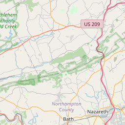
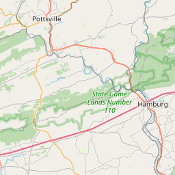

Check out our interactive map of Hutchinson, New Jersey and you'll easily find your way around the Hutchinson major roads and highways.
Satellite Map of Hutchinson, NJ, USA
This is online map of the address Hutchinson, NJ, United States. You may use button to move and zoom in / out. The map information is for reference only.
Couillard Seaplane Base (863 m / 0.54 Miles)
Markle Airport (2.36 Km / 1.47 Miles)
Martins Creek Airport (3.81 Km / 2.37 Miles)
Harmony Balloonport (3.85 Km / 2.39 Miles)
Merrill Creek Reservoir Heliport (5.08 Km / 3.16 Miles)
Matthews Airport (5.51 Km / 3.42 Miles)
Johnson Farms Airport (6.07 Km / 3.77 Miles)
Pheasant Run Heliport (7.17 Km / 4.46 Miles)
View Finder Balloonport (8.25 Km / 5.12 Miles)
Air-List-Ads Airport (8.67 Km / 5.39 Miles)
Warren Hospital Heliport (8.83 Km / 5.49 Miles)
Ingersoll-Rand Company Heliport (9.12 Km / 5.67 Miles)
Gap View Airport (9.52 Km / 5.91 Miles)
Flicksville Heliport (9.93 Km / 6.17 Miles)
Warren County Public Safety Department (9.94 Km / 6.17 Miles)
Braden Airpark (10.03 Km / 6.23 Miles)
Oti Heliport (12.39 Km / 7.70 Miles)
Perin Heliport (12.49 Km / 7.76 Miles)
Bower, Schman & Welch Heliport (12.65 Km / 7.86 Miles)
Used Parts Heliport (12.83 Km / 7.97 Miles)
Harmony Township School (3.54 Km / 2.20 Miles)
List of places near to Hutchinson
| Name | Distance |
|---|---|
| Harmony (Township) | 2.98 Km / 1.85 Miles |
| Harmony | 3.04 Km / 1.89 Miles |
| Brainards | 3.23 Km / 2.01 Miles |
| Lower Mount Bethel | 3.74 Km / 2.32 Miles |
| Martins Creek | 4.76 Km / 2.96 Miles |
| Lopatcong | 6.94 Km / 4.31 Miles |
| New Village | 7.50 Km / 4.66 Miles |
| Brookfield | 7.65 Km / 4.75 Miles |
| Belvidere | 7.70 Km / 4.78 Miles |
| Upper Stewartsville | 7.95 Km / 4.94 Miles |
| Broadway | 8.16 Km / 5.07 Miles |
| Lopatcong Overlook | 8.59 Km / 5.34 Miles |
| Delaware Park | 9.01 Km / 5.60 Miles |
| Stewartsville | 9.06 Km / 5.63 Miles |
| Forks | 9.07 Km / 5.64 Miles |
| Franklin | 9.49 Km / 5.90 Miles |
| Washington | 9.75 Km / 6.06 Miles |
| Greenwich | 9.88 Km / 6.14 Miles |
| White | 9.99 Km / 6.21 Miles |
| Brass Castle | 10.18 Km / 6.33 Miles |
| Phillipsburg | 10.19 Km / 6.33 Miles |
| Ackermanville | 10.40 Km / 6.46 Miles |
| Greenwich (Township) | 10.44 Km / 6.49 Miles |
| Upper Pohatcong | 10.91 Km / 6.78 Miles |
| Tatamy | 11.21 Km / 6.97 Miles |
| Stockertown | 11.23 Km / 6.98 Miles |
| Bridgeville | 11.30 Km / 7.02 Miles |
| Plainfield | 11.97 Km / 7.44 Miles |
| Bangor | 12.03 Km / 7.48 Miles |
| Alpha | 12.06 Km / 7.49 Miles |
| Easton | 12.11 Km / 7.52 Miles |
| Oxford (Township) | 12.24 Km / 7.61 Miles |
| Oxford | 12.37 Km / 7.69 Miles |
| Belfast | 12.37 Km / 7.69 Miles |
| Buttzville | 12.38 Km / 7.69 Miles |
| East Bangor | 12.57 Km / 7.81 Miles |
| Washington | 12.91 Km / 8.02 Miles |
| Asbury | 13.38 Km / 8.31 Miles |
| Palmer | 13.65 Km / 8.48 Miles |
| Wilson | 13.65 Km / 8.48 Miles |
| Roseto | 13.80 Km / 8.57 Miles |
| West Easton | 13.81 Km / 8.58 Miles |
| Bloomsbury | 13.84 Km / 8.60 Miles |
| Eastlawn Gardens | 14.08 Km / 8.75 Miles |
| Upper Mount Bethel | 14.18 Km / 8.81 Miles |
| Delaware | 14.39 Km / 8.94 Miles |
| Palmer Heights | 14.64 Km / 9.10 Miles |
| Pen Argyl | 14.82 Km / 9.21 Miles |
| Glendon | 14.86 Km / 9.23 Miles |
| Port Colden | 14.99 Km / 9.31 Miles |