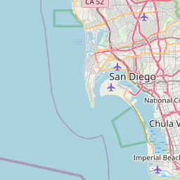
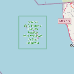
Imperial Beach Map, Satellite view of Imperial Beach, California
Imperial Beach is a city located in San Diego County, California, USA.
Location informations of Imperial Beach
Latitude of city of Imperial Beach is 32.58389 and longitude of city of Imperial Beach is -117.11306- What Country is Imperial Beach In? Imperial Beach is located in the United States of America.
- What State is Imperial Beach located in? Imperial Beach is located in California.
- What County is Imperial Beach In? The County of Imperial Beach is San Diego County
Imperial Beach, California (CA), USA Geographic Information
| Country | United States |
| Country Code | US |
| State Name | California |
| Latitude | 32.58389 |
| Longitude | -117.11306 |
| DMS Lat | 32°35'2.004" N |
| DMS Long | 117°6'47.016" W |
| DMS coordinates : | 32°35'2.004" N 117°6'47.016" W |
Current Date and Time in Imperial Beach, California, USA
| Imperial Beach Time Zone : America/Los_Angeles |
What day is it in Imperial Beach right now?Thursday (June 12, 2025) |
What time is it?Current local time and date at Imperial Beach is 09:16:18 (06/12/2025) : (America/Los_Angeles) |
Postcode / zip code of Imperial Beach
Imperial Beach is the actual or alternate city name associated with 3 ZIP Codes by the US Postal Service.
List of all postal codes in Imperial Beach, California, United States.
91932 Zip Code 91933 Zip Code 92154 Zip Code
Area Codes Imperial Beach, California, USA
Imperial Beach, California covers 1 Area Codes
619 Area CodeOnline Map of Imperial Beach - road map, satellite view and street view


Check out our interactive map of Imperial Beach, California and you'll easily find your way around the Imperial Beach major roads and highways.
Satellite Map of Imperial Beach, CA, USA
This is online map of the address Imperial Beach, CA, United States. You may use button to move and zoom in / out. The map information is for reference only.
Naval Outlying Field Imperial Beach (Ream Field) (1.95 Km / 1.21 Miles)
US Border Patrol Imperial Beach Heliport (2.41 Km / 1.50 Miles)
Parking Lot Heliport (2.85 Km / 1.77 Miles)
Grande Vista Airport (4.35 Km / 2.70 Miles)
Borderland Field (4.73 Km / 2.94 Miles)
Tyce Airport (5.19 Km / 3.23 Miles)
Border Field (5.21 Km / 3.24 Miles)
Wolfe Airpark (5.67 Km / 3.52 Miles)
National City Airport (7.52 Km / 4.67 Miles)
Sharp Chula Vista Medical Center Heliport (9.32 Km / 5.79 Miles)
Turner Field/Amphibious Base Heliport (11.24 Km / 6.99 Miles)
Paradise Valley Hospital Heliport (11.49 Km / 7.14 Miles)
Brown Field Municipal Airport (12.53 Km / 7.79 Miles)
Marriott Marquis San Diego Marina Helipad (14.61 Km / 9.08 Miles)
San Diego Police Headquarters Heliport (15.04 Km / 9.34 Miles)
UC San Diego Health Downtown Helipad (15.19 Km / 9.44 Miles)
KGTV-10 Parking Lot Heliport (15.23 Km / 9.46 Miles)
Koll Center Helipad (15.48 Km / 9.62 Miles)
Symphony Towers South Helipad (15.49 Km / 9.63 Miles)
Wells Fargo Plaza Helipad (15.50 Km / 9.63 Miles)
Bayside STEAM Academy (534 m / 0.33 Miles)
Imperial Beach Charter (821 m / 0.51 Miles)
Central Elementary (908 m / 0.56 Miles)
Mar Vista Senior High (968 m / 0.60 Miles)
Sweetwater Community Day (979 m / 0.61 Miles)
VIP Village Preschool (1.09 Km / 0.68 Miles)
Oneonta Elementary (1.23 Km / 0.76 Miles)
Mar Vista Academy (1.94 Km / 1.20 Miles)
Emory Elementary (2.17 Km / 1.35 Miles)
Teofilo Mendoza (2.32 Km / 1.44 Miles)
Godfrey G. Berry Elementary (2.76 Km / 1.72 Miles)
Sunnyslope Elementary (3.16 Km / 1.96 Miles)
Nestor Language Academy Charter (3.20 Km / 1.99 Miles)
Southwest Senior High (3.41 Km / 2.12 Miles)
Harborside Elementary (3.70 Km / 2.30 Miles)
Hawking S.T.E.A.M. Charter School 2 (3.84 Km / 2.38 Miles)
Southwest Middle (3.98 Km / 2.47 Miles)
Palomar High (4.38 Km / 2.72 Miles)
Montgomery (John J.) Elementary (4.45 Km / 2.77 Miles)
Montgomery Senior High (4.52 Km / 2.81 Miles)
Bellus Academy-Chula Vista (4.40 Km / 2.73 Miles)
Pima Medical Institute-Chula Vista (4.40 Km / 2.74 Miles)
List of places near to Imperial Beach
| Name | Distance |
|---|---|
| Chula Vista | 6.80 Km / 4.23 Miles |
| National City | 10.55 Km / 6.56 Miles |
| Bonita | 11.31 Km / 7.03 Miles |
| Coronado | 13.09 Km / 8.13 Miles |
| San Diego | 15.19 Km / 9.44 Miles |
| La Presa | 17.56 Km / 10.91 Miles |
| Lemon Grove | 19.23 Km / 11.95 Miles |
| Spring Valley | 20.84 Km / 12.95 Miles |
| La Mesa | 22.11 Km / 13.74 Miles |
| Casa de Oro-Mount Helix | 24.15 Km / 15.01 Miles |
| Rancho San Diego | 24.64 Km / 15.31 Miles |