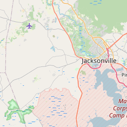
Jacksonville Map, Satellite view of Jacksonville, North Carolina
Jacksonville is a city located in Onslow County, North Carolina, USA.
Location informations of Jacksonville
Latitude of city of Jacksonville is 34.75405 and longitude of city of Jacksonville is -77.43024- What Country is Jacksonville In? Jacksonville is located in the United States of America.
- What State is Jacksonville located in? Jacksonville is located in North Carolina.
- What County is Jacksonville In? The County of Jacksonville is Onslow County
Jacksonville, North Carolina (NC), USA Geographic Information
| Country | United States |
| Country Code | US |
| State Name | North Carolina |
| Latitude | 34.75405 |
| Longitude | -77.43024 |
| DMS Lat | 34°45'14.58" N |
| DMS Long | 77°25'48.864" W |
| DMS coordinates : | 34°45'14.58" N 77°25'48.864" W |
Current Date and Time in Jacksonville, North Carolina, USA
| Jacksonville Time Zone : America/New_York |
What day is it in Jacksonville right now?Tuesday (June 17, 2025) |
What time is it?Current local time and date at Jacksonville is 6/17/2025 - 2:44:09 PM |
Postcode / zip code of Jacksonville
Jacksonville is the actual or alternate city name associated with 7 ZIP Codes by the US Postal Service.
List of all postal codes in Jacksonville, North Carolina, United States.
28540 Zip Code 28541 Zip Code 28542 Zip Code 28543 Zip Code 28544 Zip Code 28546 Zip Code 28547 Zip Code
Area Codes Jacksonville, North Carolina, USA
Jacksonville, North Carolina covers 1 Area Codes
910 Area CodeOnline Map of Jacksonville - road map, satellite view and street view


Check out our interactive map of Jacksonville, North Carolina and you'll easily find your way around the Jacksonville major roads and highways.
Satellite Map of Jacksonville, NC, USA
This is online map of the address Jacksonville, NC, United States. You may use button to move and zoom in / out. The map information is for reference only.
Onslow Memorial Hospital Heliport (4.21 Km / 2.62 Miles)
McGee 04 Heliport (4.22 Km / 2.62 Miles)
MCAS New River / McCutcheon Field (5.15 Km / 3.20 Miles)
Sky Manor Airport (15.37 Km / 9.55 Miles)
Epley Airport (18.01 Km / 11.19 Miles)
Albert J Ellis Airport (18.59 Km / 11.55 Miles)
Winding Creek Airport (20.92 Km / 13.00 Miles)
Camp Lejeune LZ Bluebird Airstrip (24.58 Km / 15.28 Miles)
Parker Field (24.65 Km / 15.31 Miles)
New Bridge Middle (509 m / 0.32 Miles)
Z.E.C.A. School of Arts and Technology (1.57 Km / 0.97 Miles)
Clyde Erwin Elementary (1.64 Km / 1.02 Miles)
Northwoods Elementary (2.06 Km / 1.28 Miles)
Northwoods Park Middle (2.15 Km / 1.34 Miles)
Parkwood Elementary (3.04 Km / 1.89 Miles)
Jacksonville High (3.39 Km / 2.10 Miles)
Bell Fork Elementary (3.48 Km / 2.16 Miles)
Blue Creek Elementary (4.34 Km / 2.69 Miles)
Southwest Middle (4.58 Km / 2.85 Miles)
Onslow Early College (4.69 Km / 2.91 Miles)
Southwest High (4.82 Km / 3.00 Miles)
Coastal Carolina Community College (4.59 Km / 2.85 Miles)
Platt College-Miller-Motte-Jacksonville (4.87 Km / 3.03 Miles)
List of places near to Jacksonville
| Name | Distance |
|---|---|
| Pumpkin Center | 6.73 Km / 4.18 Miles |
| Half Moon | 8.43 Km / 5.24 Miles |
| Piney Green | 10.91 Km / 6.78 Miles |
| Richlands | 19.33 Km / 12.01 Miles |
| Sneads Ferry | 22.60 Km / 14.04 Miles |
| Maysville | 24.72 Km / 15.36 Miles |