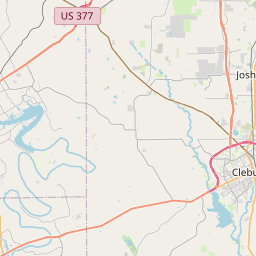
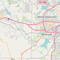
Joshua Map, Satellite view of Joshua, Texas
Joshua is a city located in Johnson County, Texas, USA.
Location informations of Joshua
Latitude of city of Joshua is 32.46153 and longitude of city of Joshua is -97.38807- What Country is Joshua In? Joshua is located in the United States of America.
- What State is Joshua located in? Joshua is located in Texas.
- What County is Joshua In? The County of Joshua is Johnson County
Joshua, Texas (TX), USA Geographic Information
| Country | United States |
| Country Code | US |
| State Name | Texas |
| Latitude | 32.46153 |
| Longitude | -97.38807 |
| DMS Lat | 32°27'41.508" N |
| DMS Long | 97°23'17.052" W |
| DMS coordinates : | 32°27'41.508" N 97°23'17.052" W |
Current Date and Time in Joshua, Texas, USA
| Joshua Time Zone : America/Chicago |
What day is it in Joshua right now?Wednesday (April 16, 2025) |
What time is it?Current local time and date at Joshua is 08:59:32 (04/16/2025) : (America/Chicago) |
Postcode / zip code of Joshua
Joshua is the actual or alternate city name associated with 1 ZIP Codes by the US Postal Service.
List of all postal codes in Joshua, Texas, United States.
76058 Zip Code
Online Map of Joshua - road map, satellite view and street view


Check out our interactive map of Joshua, Texas and you'll easily find your way around the Joshua major roads and highways.
Satellite Map of Joshua, TX, USA
This is online map of the address Joshua, TX, United States. You may use button to move and zoom in / out. The map information is for reference only.
Taylor's Air Park (1.71 Km / 1.06 Miles)
Stol Field (1.99 Km / 1.23 Miles)
Peacock Willow Creek Heliport (4.00 Km / 2.49 Miles)
Texas Health Resources Burleson Heliport (4.40 Km / 2.74 Miles)
Blackwood Airpark (5.78 Km / 3.59 Miles)
Brabsom Farm Airport (6.46 Km / 4.01 Miles)
Buffalo Chips Airpark (7.31 Km / 4.54 Miles)
Allen Ponderosa Heliport (8.98 Km / 5.58 Miles)
Benjamin Franklin Airport (10.01 Km / 6.22 Miles)
Hawkins Field (10.74 Km / 6.68 Miles)
Rafter J Airport (12.46 Km / 7.74 Miles)
Cleburne Regional Airport (12.72 Km / 7.90 Miles)
Fort Worth Spinks Airport (13.75 Km / 8.55 Miles)
Hodges Air Field (13.80 Km / 8.58 Miles)
Coppenger Farm Airport (14.52 Km / 9.02 Miles)
Texas Health Harris Methodist Hospital Cleburne Heliport (15.04 Km / 9.34 Miles)
Texas Health Huguley Hospital Fort Worth South Helipad (15.45 Km / 9.60 Miles)
Aresti Aerodrome (16.19 Km / 10.06 Miles)
Retta Airport (16.35 Km / 10.16 Miles)
Luck Field (16.47 Km / 10.23 Miles)
H D STAPLES EL (501 m / 0.31 Miles)
A G ELDER EL (1.09 Km / 0.68 Miles)
JOSHUA H S (1.26 Km / 0.78 Miles)
JOSHUA H S NINTH GRADE CAMPUS (1.65 Km / 1.03 Miles)
R C LOFLIN MIDDLE (1.66 Km / 1.03 Miles)
NEW HORIZON H S (1.95 Km / 1.21 Miles)
PLUM CREEK EL (2.01 Km / 1.25 Miles)
CADDO GROVE EL (3.62 Km / 2.25 Miles)
NORTH JOSHUA EL (3.78 Km / 2.35 Miles)
List of places near to Joshua
| Name | Distance |
|---|---|
| Burleson | 8.35 Km / 5.19 Miles |
| Briaroaks | 9.08 Km / 5.64 Miles |
| Keene | 9.38 Km / 5.83 Miles |
| Cross Timber | 9.82 Km / 6.10 Miles |
| Cleburne | 12.66 Km / 7.87 Miles |
| Crowley | 13.06 Km / 8.12 Miles |
| Godley | 13.08 Km / 8.13 Miles |
| Coyote Flats | 14.83 Km / 9.21 Miles |
| Alvarado | 17.65 Km / 10.97 Miles |
| Rendon | 18.76 Km / 11.66 Miles |
| Everman | 21.00 Km / 13.05 Miles |
| Edgecliff Village | 22.21 Km / 13.80 Miles |
| Cresson | 22.63 Km / 14.06 Miles |
| Benbrook | 24.50 Km / 15.22 Miles |