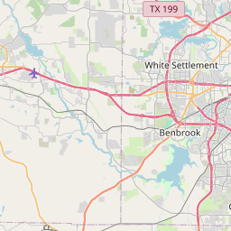
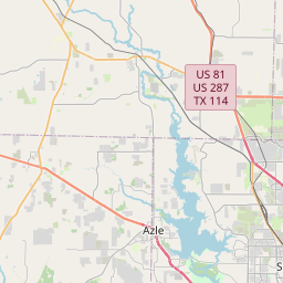
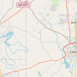
Kennedale Map, Satellite view of Kennedale, Texas
Kennedale is a city located in Tarrant County, Texas, USA.
Location informations of Kennedale
Latitude of city of Kennedale is 32.64680 and longitude of city of Kennedale is -97.22585- What Country is Kennedale In? Kennedale is located in the United States of America.
- What State is Kennedale located in? Kennedale is located in Texas.
- What County is Kennedale In? The County of Kennedale is Tarrant County
Kennedale, Texas (TX), USA Geographic Information
| Country | United States |
| Country Code | US |
| State Name | Texas |
| Latitude | 32.6468 |
| Longitude | -97.22585 |
| DMS Lat | 32°38'48.48" N |
| DMS Long | 97°13'33.06" W |
| DMS coordinates : | 32°38'48.48" N 97°13'33.06" W |
Current Date and Time in Kennedale, Texas, USA
| Kennedale Time Zone : America/Chicago |
What day is it in Kennedale right now?Tuesday (September 2, 2025) |
What time is it?Current local time and date at Kennedale is 9/2/2025 - 11:29:14 AM |
Postcode / zip code of Kennedale
Kennedale is the actual or alternate city name associated with 3 ZIP Codes by the US Postal Service.
List of all postal codes in Kennedale, Texas, United States.
76017 Zip Code 76060 Zip Code 76140 Zip Code
Online Map of Kennedale - road map, satellite view and street view


Check out our interactive map of Kennedale, Texas and you'll easily find your way around the Kennedale major roads and highways.
Satellite Map of Kennedale, TX, USA
This is online map of the address Kennedale, TX, United States. You may use button to move and zoom in / out. The map information is for reference only.
Coker Hill Heliport (3.23 Km / 2.01 Miles)
Birk Airport (3.80 Km / 2.36 Miles)
Action Aero Airport (4.25 Km / 2.64 Miles)
Alpine Range Airport (4.61 Km / 2.87 Miles)
Tcjc-South Campus Heliport (5.97 Km / 3.71 Miles)
Southwest Custom Aircraft Heliport (7.77 Km / 4.83 Miles)
Naval Outlying Landing Field Arlington (10.24 Km / 6.36 Miles)
Hess Airport (10.26 Km / 6.37 Miles)
Naval Outlying Landing Field Five Points (10.26 Km / 6.38 Miles)
Luck Field (10.52 Km / 6.54 Miles)
Schmidts Heliport (10.62 Km / 6.60 Miles)
Texas Health Huguley Hospital Fort Worth South Helipad (10.79 Km / 6.70 Miles)
Thirty Thirty Matlock Office Center Heliport (11.57 Km / 7.19 Miles)
Retta Airport (11.77 Km / 7.31 Miles)
Medical Center of Arlington Heliport (11.87 Km / 7.37 Miles)
Fort Worth Spinks Airport (11.90 Km / 7.40 Miles)
Action 5 Heliport (12.11 Km / 7.53 Miles)
Sycamore Strip (12.13 Km / 7.54 Miles)
Short Field (12.30 Km / 7.64 Miles)
Arlington Municipal Airport (12.46 Km / 7.74 Miles)
JAMES F DELANEY EL (376 m / 0.23 Miles)
KENNEDALE ALTER ED PROG (379 m / 0.24 Miles)
JAMES A ARTHUR INT (807 m / 0.50 Miles)
KENNEDALE J H (1.12 Km / 0.69 Miles)
KENNEDALE H S (2.61 Km / 1.62 Miles)
DAVID K SELLARS EL (4.11 Km / 2.55 Miles)
MILLER EL (4.22 Km / 2.62 Miles)
SOUDER EL (4.44 Km / 2.76 Miles)
W M GREEN EL (4.59 Km / 2.85 Miles)
R F PATTERSON EL (4.89 Km / 3.04 Miles)
COREY FINE ARTS / DUAL LANGUAGE ACADEMY (4.93 Km / 3.06 Miles)
List of places near to Kennedale
| Name | Distance |
|---|---|
| Forest Hill | 4.94 Km / 3.07 Miles |
| Everman | 6.19 Km / 3.85 Miles |
| Rendon | 7.98 Km / 4.96 Miles |
| Dalworthington Gardens | 9.09 Km / 5.65 Miles |
| Pantego | 9.93 Km / 6.17 Miles |
| Edgecliff Village | 11.01 Km / 6.84 Miles |
| Mansfield | 13.11 Km / 8.15 Miles |
| Crowley | 14.75 Km / 9.17 Miles |
| Arlington | 14.80 Km / 9.20 Miles |
| Cross Timber | 15.79 Km / 9.81 Miles |
| Burleson | 17.34 Km / 10.77 Miles |
| Haltom City | 17.46 Km / 10.85 Miles |
| Briaroaks | 17.58 Km / 10.92 Miles |
| Fort Worth | 18.77 Km / 11.66 Miles |
| Richland Hills | 18.81 Km / 11.69 Miles |
| Grand Prairie | 19.69 Km / 12.23 Miles |
| Hurst | 20.31 Km / 12.62 Miles |
| Westover Hills | 20.68 Km / 12.85 Miles |
| North Richland Hills | 20.85 Km / 12.96 Miles |
| River Oaks | 21.42 Km / 13.31 Miles |
| Benbrook | 22.17 Km / 13.78 Miles |
| Westworth Village | 22.48 Km / 13.97 Miles |
| Bedford | 23.26 Km / 14.45 Miles |
| Watauga | 23.63 Km / 14.68 Miles |
| Sansom Park | 24.25 Km / 15.07 Miles |