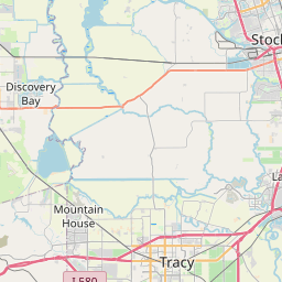
Kennedy Map, Satellite view of Kennedy, California
Kennedy is a census-designated place (CDP) located in San Joaquin County, California, USA.
Location informations of Kennedy
Latitude of city of Kennedy is 37.92992 and longitude of city of Kennedy is -121.25272- What Country is Kennedy In? Kennedy is located in the United States of America.
- What State is Kennedy located in? Kennedy is located in California.
- What County is Kennedy In? The County of Kennedy is San Joaquin County
Kennedy, California (CA), USA Geographic Information
| Country | United States |
| Country Code | US |
| State Name | California |
| Latitude | 37.92992 |
| Longitude | -121.25272 |
| DMS Lat | 37°55'47.712" N |
| DMS Long | 121°15'9.792" W |
| DMS coordinates : | 37°55'47.712" N 121°15'9.792" W |
Current Date and Time in Kennedy, California, USA
| Kennedy Time Zone : America/Los_Angeles |
What day is it in Kennedy right now?Sunday (May 18, 2025) |
What time is it?Current local time and date at Kennedy is 5/18/2025 - 3:19:08 PM |
Postcode / zip code of Kennedy
Kennedy is the actual or alternate city name associated with 2 ZIP Codes by the US Postal Service.
List of all postal codes in Kennedy, California, United States.
95205 Zip Code 95206 Zip Code
Online Map of Kennedy - road map, satellite view and street view


Check out our interactive map of Kennedy, California and you'll easily find your way around the Kennedy major roads and highways.
Satellite Map of Kennedy, CA, USA
This is online map of the address Kennedy, CA, United States. You may use button to move and zoom in / out. The map information is for reference only.
Harley Airport (2.47 Km / 1.54 Miles)
Stockton Metropolitan Airport (4.18 Km / 2.59 Miles)
San Joaquin General Hospital Heliport (5.37 Km / 3.34 Miles)
St Joseph's Medical Center Heliport (5.44 Km / 3.38 Miles)
Jones Heliport (5.90 Km / 3.67 Miles)
West Lane Airport (9.78 Km / 6.08 Miles)
Sharpe AAF (10.38 Km / 6.45 Miles)
Ag Air Airport (10.80 Km / 6.71 Miles)
Oranges Airport (12.46 Km / 7.74 Miles)
Summer Home Airport (13.01 Km / 8.08 Miles)
Fowler's Airport (14.30 Km / 8.88 Miles)
Cortopassi Airport (14.50 Km / 9.01 Miles)
Kaiser Permanente Manteca Heliport (14.69 Km / 9.13 Miles)
Wallom Field (15.78 Km / 9.81 Miles)
A G Spanos Companies Hq Heliport (16.66 Km / 10.35 Miles)
Lodi Airpark (18.02 Km / 11.20 Miles)
Lost Isle Seaplane Base (19.72 Km / 12.25 Miles)
Kingdon Airpark (20.25 Km / 12.58 Miles)
J-B Airport (20.86 Km / 12.96 Miles)
Faber Vineyards Airport (21.28 Km / 13.22 Miles)
Monroe Elementary (311 m / 0.19 Miles)
Alexander Hamilton Elementary (422 m / 0.26 Miles)
Van Buren Elementary (563 m / 0.35 Miles)
Edward C. Merlo Institute of Environmental Studies (1.08 Km / 0.67 Miles)
Nightingale Charter (1.19 Km / 0.74 Miles)
Montezuma Elementary (1.44 Km / 0.89 Miles)
District Special Education (2.46 Km / 1.53 Miles)
McKinley Elementary (2.65 Km / 1.65 Miles)
John F. Cruikshank Jr. (2.91 Km / 1.81 Miles)
San Joaquin County ROCP (2.92 Km / 1.82 Miles)
San Joaquin County Special Education (2.92 Km / 1.82 Miles)
San Joaquin County Community (2.92 Km / 1.82 Miles)
Roosevelt Elementary (3.00 Km / 1.87 Miles)
King Elementary (3.19 Km / 1.98 Miles)
Taft Elementary (3.30 Km / 2.05 Miles)
Spanos (Alex G.) Elementary (3.32 Km / 2.06 Miles)
Edison High (3.33 Km / 2.07 Miles)
Dolores Huerta Elementary (3.45 Km / 2.15 Miles)
Wilhelmina Henry Elementary (3.46 Km / 2.15 Miles)
Jane Frederick High (3.60 Km / 2.24 Miles)
Teachers College of San Joaquin (3.01 Km / 1.87 Miles)
List of places near to Kennedy
| Name | Distance |
|---|---|
| Taft Mosswood | 3.27 Km / 2.03 Miles |
| Garden Acres | 4.29 Km / 2.67 Miles |
| Stockton | 4.55 Km / 2.83 Miles |
| French Camp | 5.34 Km / 3.32 Miles |
| August | 5.50 Km / 3.42 Miles |
| Country Club | 8.85 Km / 5.50 Miles |
| Lincoln Village | 10.67 Km / 6.63 Miles |
| Morada | 12.09 Km / 7.51 Miles |
| Lathrop | 12.11 Km / 7.52 Miles |
| Waterloo | 13.00 Km / 8.08 Miles |
| Manteca | 15.08 Km / 9.37 Miles |
| Linden | 17.96 Km / 11.16 Miles |
| Peters | 18.82 Km / 11.69 Miles |
| Farmington | 22.15 Km / 13.76 Miles |
| Lodi | 22.34 Km / 13.88 Miles |
| Victor | 23.49 Km / 14.60 Miles |
| Ripon | 23.78 Km / 14.78 Miles |