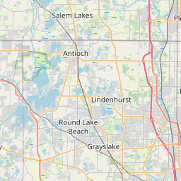
Kenosha Map, Satellite view of Kenosha, Wisconsin
Kenosha is a city located in Kenosha County, Wisconsin, USA.
Location informations of Kenosha
Latitude of city of Kenosha is 42.58474 and longitude of city of Kenosha is -87.82119- What Country is Kenosha In? Kenosha is located in the United States of America.
- What State is Kenosha located in? Kenosha is located in Wisconsin.
- What County is Kenosha In? The County of Kenosha is Kenosha County
Kenosha, Wisconsin (WI), USA Geographic Information
| Country | United States |
| Country Code | US |
| State Name | Wisconsin |
| Latitude | 42.58474 |
| Longitude | -87.82119 |
| DMS Lat | 42°35'5.064" N |
| DMS Long | 87°49'16.284" W |
| DMS coordinates : | 42°35'5.064" N 87°49'16.284" W |
Current Date and Time in Kenosha, Wisconsin, USA
| Kenosha Time Zone : America/Chicago |
What day is it in Kenosha right now?Friday (April 25, 2025) |
What time is it?Current local time and date at Kenosha is 4/25/2025 - 11:08:18 PM |
Postcode / zip code of Kenosha
Kenosha is the actual or alternate city name associated with 6 ZIP Codes by the US Postal Service.
List of all postal codes in Kenosha, Wisconsin, United States.
53104 Zip Code 53140 Zip Code 53141 Zip Code 53142 Zip Code 53143 Zip Code 53144 Zip Code
Online Map of Kenosha - road map, satellite view and street view


Check out our interactive map of Kenosha, Wisconsin and you'll easily find your way around the Kenosha major roads and highways.
Satellite Map of Kenosha, WI, USA
This is online map of the address Kenosha, WI, United States. You may use button to move and zoom in / out. The map information is for reference only.
Kenosha Hospital and Medical Center Heliport (696 m / 0.43 Miles)
Froedtert Pleasant Prairie Hospital Heliport (8.72 Km / 5.42 Miles)
Kenosha Regional Airport (8.81 Km / 5.48 Miles)
Aurora Medical Center Kenosha Heliport (9.54 Km / 5.93 Miles)
Thompson Strawberry Farm Airport (12.91 Km / 8.02 Miles)
Johnson Wax Heliport (13.96 Km / 8.67 Miles)
Herbert C. Maas Airport (14.41 Km / 8.95 Miles)
S C Johnson Waxdale Heliport (14.99 Km / 9.31 Miles)
Midwestern Regional Medical Center Heliport (15.14 Km / 9.41 Miles)
Binzel Airport (15.81 Km / 9.82 Miles)
Bristol Airport (15.90 Km / 9.88 Miles)
St Mary's Medical Center Heliport (16.23 Km / 10.08 Miles)
Sylvania Airport (17.35 Km / 10.78 Miles)
Dutch Gap Airstrip (17.41 Km / 10.82 Miles)
Winfield Airport (18.30 Km / 11.37 Miles)
Kenosha County Heliport (18.45 Km / 11.46 Miles)
Waukegan National Airport (18.47 Km / 11.48 Miles)
John H Batten Airport (19.56 Km / 12.15 Miles)
Donald Alfred Gade Airport (22.34 Km / 13.88 Miles)
Vista Medical Center-East Heliport (22.94 Km / 14.25 Miles)
Reuther Central High (184 m / 0.11 Miles)
Harborside Academy (804 m / 0.50 Miles)
Frank Elementary (833 m / 0.52 Miles)
Washington Middle (1.54 Km / 0.96 Miles)
Lincoln Middle (1.58 Km / 0.98 Miles)
Brass Community School (1.67 Km / 1.04 Miles)
Kenosha School of Technology Enhanced Curriculum (1.67 Km / 1.04 Miles)
Dimensions of Learning Academy (1.68 Km / 1.04 Miles)
Jefferson Elementary (1.70 Km / 1.06 Miles)
Kenosha eSchool K-12 (1.76 Km / 1.09 Miles)
Chavez Learning Station (1.90 Km / 1.18 Miles)
Kenosha 4 Year Old Kindergarten (1.91 Km / 1.19 Miles)
Edward Bain School - Creative Arts (1.93 Km / 1.20 Miles)
Edward Bain School - Dual Language (1.94 Km / 1.20 Miles)
McKinley Elementary (2.24 Km / 1.39 Miles)
Southport Elementary (2.27 Km / 1.41 Miles)
Grant Elementary (2.56 Km / 1.59 Miles)
Grewenow Elementary (2.64 Km / 1.64 Miles)
Wilson Elementary (2.65 Km / 1.65 Miles)
Kenosha Pike School (2.68 Km / 1.66 Miles)
Herzing University-Kenosha (251 m / 0.16 Miles)
Gateway Technical College (3.13 Km / 1.94 Miles)
The Salon Professional Academy-Kenosha (3.95 Km / 2.46 Miles)
Carthage College (4.25 Km / 2.64 Miles)
List of places near to Kenosha
| Name | Distance |
|---|---|
| Somers (Town) | 6.36 Km / 3.95 Miles |
| Somers | 9.56 Km / 5.94 Miles |
| Pleasant Prairie | 9.84 Km / 6.11 Miles |
| Winthrop Harbor | 11.77 Km / 7.31 Miles |
| Elmwood Park | 11.95 Km / 7.43 Miles |
| Mount Pleasant | 12.85 Km / 7.98 Miles |
| Sturtevant | 13.96 Km / 8.67 Miles |
| Zion (Township) | 14.10 Km / 8.76 Miles |
| Benton | 14.70 Km / 9.13 Miles |
| Zion | 15.44 Km / 9.59 Miles |
| Racine | 16.03 Km / 9.96 Miles |
| Paris | 16.11 Km / 10.01 Miles |
| Newport | 17.96 Km / 11.16 Miles |
| Beach Park | 18.31 Km / 11.38 Miles |
| Bristol | 18.89 Km / 11.74 Miles |
| Wadsworth | 19.30 Km / 11.99 Miles |
| North Bay | 20.30 Km / 12.61 Miles |
| Old Mill Creek | 21.95 Km / 13.64 Miles |
| Union Grove | 22.07 Km / 13.71 Miles |
| Wind Point | 22.66 Km / 14.08 Miles |
| Paddock Lake | 23.26 Km / 14.45 Miles |
| Waukegan (Township) | 23.45 Km / 14.57 Miles |
| Salem Lakes | 23.71 Km / 14.73 Miles |
| Yorkville | 24.25 Km / 15.07 Miles |
| Waukegan | 24.66 Km / 15.32 Miles |
| Gurnee | 24.75 Km / 15.38 Miles |