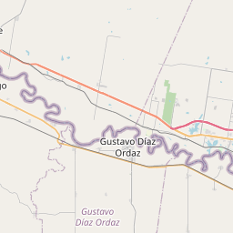
La Joya Map, Satellite view of La Joya, Texas
La Joya is a city located in Hidalgo County, Texas, USA.
Location informations of La Joya
Latitude of city of La Joya is 26.24702 and longitude of city of La Joya is -98.48141- What Country is La Joya In? La Joya is located in the United States of America.
- What State is La Joya located in? La Joya is located in Texas.
- What County is La Joya In? The County of La Joya is Hidalgo County
La Joya, Texas (TX), USA Geographic Information
| Country | United States |
| Country Code | US |
| State Name | Texas |
| Latitude | 26.24702 |
| Longitude | -98.48141 |
| DMS Lat | 26°14'49.272" N |
| DMS Long | 98°28'53.076" W |
| DMS coordinates : | 26°14'49.272" N 98°28'53.076" W |
Current Date and Time in La Joya, Texas, USA
| La Joya Time Zone : America/Chicago |
What day is it in La Joya right now?Saturday (May 17, 2025) |
What time is it?Current local time and date at La Joya is 10:53:45 (05/17/2025) : (America/Chicago) |
Postcode / zip code of La Joya
La Joya is the actual or alternate city name associated with 2 ZIP Codes by the US Postal Service.
List of all postal codes in La Joya, Texas, United States.
78560 Zip Code 78576 Zip Code
Online Map of La Joya - road map, satellite view and street view


Check out our interactive map of La Joya, Texas and you'll easily find your way around the La Joya major roads and highways.
Satellite Map of La Joya, TX, USA
This is online map of the address La Joya, TX, United States. You may use button to move and zoom in / out. The map information is for reference only.
Moore Airpark (8.39 Km / 5.21 Miles)
Putz Airport (9.25 Km / 5.75 Miles)
Palmview Police Department (11.07 Km / 6.88 Miles)
Eppright Flying Service / Mission Agro Airport (12.57 Km / 7.81 Miles)
Rio Grande Field (13.95 Km / 8.67 Miles)
Mission Regional Medical Center Helipad (17.71 Km / 11.00 Miles)
Shary / Hopson Putz Airport (20.84 Km / 12.95 Miles)
Gross Private Airport (20.97 Km / 13.03 Miles)
Moore Field (21.17 Km / 13.15 Miles)
TABASCO EL (331 m / 0.21 Miles)
HOPE ACADEMY (336 m / 0.21 Miles)
LA JOYA ISD HEAD START PROGRAM (383 m / 0.24 Miles)
JIMMY CARTER EARLY COLLEGE H S (1.03 Km / 0.64 Miles)
THELMA ROSA SALINAS STEM EARLY COLLEGE H S (1.06 Km / 0.66 Miles)
LA JOYA H S (1.14 Km / 0.71 Miles)
LORENZO DE ZAVALA MIDDLE (1.62 Km / 1.01 Miles)
JOHN F KENNEDY EL (4.04 Km / 2.51 Miles)
UCAS University of Cosmetology Arts & Sciences-La Joya (1.34 Km / 0.83 Miles)
List of places near to La Joya
| Name | Distance |
|---|---|
| Havana | 2.81 Km / 1.75 Miles |
| Penitas | 4.09 Km / 2.54 Miles |
| Los Ebanos | 8.02 Km / 4.98 Miles |
| Perezville | 8.44 Km / 5.24 Miles |
| Abram | 8.76 Km / 5.44 Miles |
| Sullivan City | 8.87 Km / 5.51 Miles |
| Cuevitas | 9.80 Km / 6.09 Miles |
| Doffing | 10.01 Km / 6.22 Miles |
| Nina | 10.63 Km / 6.61 Miles |
| Quesada | 10.74 Km / 6.67 Miles |
| Palmview South | 11.02 Km / 6.85 Miles |
| Palmview | 11.13 Km / 6.92 Miles |
| La Homa | 12.77 Km / 7.93 Miles |
| Citrus City | 13.03 Km / 8.10 Miles |
| Buena Vista | 13.93 Km / 8.66 Miles |
| Casa Blanca | 14.03 Km / 8.72 Miles |
| West Sharyland | 15.50 Km / 9.63 Miles |
| Mission | 15.95 Km / 9.91 Miles |
| La Paloma Ranchettes | 16.00 Km / 9.94 Miles |
| Palmhurst | 16.34 Km / 10.15 Miles |
| East Alto Bonito | 16.57 Km / 10.30 Miles |
| La Grulla | 16.73 Km / 10.40 Miles |
| Mikes | 16.94 Km / 10.53 Miles |
| Rafael Pena | 16.99 Km / 10.56 Miles |
| Narciso Pena | 17.01 Km / 10.57 Miles |
| E. Lopez | 17.04 Km / 10.59 Miles |
| Rivereno | 17.06 Km / 10.60 Miles |
| Pablo Pena | 17.07 Km / 10.61 Miles |
| Longoria | 17.20 Km / 10.69 Miles |
| Alton | 17.35 Km / 10.78 Miles |
| Zarate | 17.50 Km / 10.87 Miles |
| Villarreal | 17.56 Km / 10.91 Miles |
| Alto Bonito Heights | 17.68 Km / 10.99 Miles |
| Gutierrez | 18.33 Km / 11.39 Miles |
| El Castillo | 18.47 Km / 11.48 Miles |
| El Socio | 18.68 Km / 11.61 Miles |
| Valle Vista | 18.90 Km / 11.74 Miles |
| La Victoria | 18.95 Km / 11.77 Miles |
| Olmito and Olmito | 19.06 Km / 11.84 Miles |
| Eugenio Saenz | 19.54 Km / 12.14 Miles |
| West Alto Bonito | 19.60 Km / 12.18 Miles |
| Elias-Fela Solis | 20.81 Km / 12.93 Miles |
| Granjeno | 21.60 Km / 13.42 Miles |
| Manuel Garcia II | 22.16 Km / 13.77 Miles |
| Ramirez-Perez | 22.50 Km / 13.98 Miles |
| Victoria Vera | 22.52 Km / 13.99 Miles |
| Loma Linda East | 22.61 Km / 14.05 Miles |
| Garciasville | 22.66 Km / 14.08 Miles |
| Manuel Garcia | 23.98 Km / 14.90 Miles |
| La Casita | 24.83 Km / 15.43 Miles |