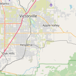
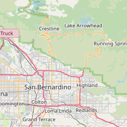
Lake Arrowhead Map, Satellite view of Lake Arrowhead, California
Lake Arrowhead is a census-designated place (CDP) located in San Bernardino County, California, USA.
Location informations of Lake Arrowhead
Latitude of city of Lake Arrowhead is 34.24834 and longitude of city of Lake Arrowhead is -117.18921- What Country is Lake Arrowhead In? Lake Arrowhead is located in the United States of America.
- What State is Lake Arrowhead located in? Lake Arrowhead is located in California.
- What County is Lake Arrowhead In? The County of Lake Arrowhead is San Bernardino County
Lake Arrowhead, California (CA), USA Geographic Information
| Country | United States |
| Country Code | US |
| State Name | California |
| Latitude | 34.24834 |
| Longitude | -117.18921 |
| DMS Lat | 34°14'54.024" N |
| DMS Long | 117°11'21.156" W |
| DMS coordinates : | 34°14'54.024" N 117°11'21.156" W |
Current Date and Time in Lake Arrowhead, California, USA
| Lake Arrowhead Time Zone : America/Los_Angeles |
What day is it in Lake Arrowhead right now?Tuesday (June 10, 2025) |
What time is it?Current local time and date at Lake Arrowhead is 19:25:02 (06/10/2025) : (America/Los_Angeles) |
Postcode / zip code of Lake Arrowhead
Lake Arrowhead is the actual or alternate city name associated with 7 ZIP Codes by the US Postal Service.
List of all postal codes in Lake Arrowhead, California, United States.
92317 Zip Code 92321 Zip Code 92326 Zip Code 92352 Zip Code 92378 Zip Code 92385 Zip Code 92391 Zip Code
Area Codes Lake Arrowhead, California, USA
Lake Arrowhead, California covers 1 Area Codes
909 Area CodeOnline Map of Lake Arrowhead - road map, satellite view and street view


Check out our interactive map of Lake Arrowhead, California and you'll easily find your way around the Lake Arrowhead major roads and highways.
Satellite Map of Lake Arrowhead, CA, USA
This is online map of the address Lake Arrowhead, CA, United States. You may use button to move and zoom in / out. The map information is for reference only.
Mountains Community Hospital Heliport (2.74 Km / 1.70 Miles)
MH15 Heaps Peak US Forest Service Heliport (3.48 Km / 2.16 Miles)
Lake Arrowhead Airport (7.11 Km / 4.42 Miles)
San Bernardino Airport (1942) (14.59 Km / 9.07 Miles)
Oak Springs Heliport (14.82 Km / 9.21 Miles)
San Bernardino County Medical Center Heliport (15.24 Km / 9.47 Miles)
Shandin Hills Airport (16.41 Km / 10.20 Miles)
San Bernardino International Airport (17.52 Km / 10.89 Miles)
County Heliport (17.84 Km / 11.08 Miles)
San Bernardino Community Hospital Heliport (17.88 Km / 11.11 Miles)
Hesperia Airport (18.46 Km / 11.47 Miles)
Redlands Municipal Airport (18.56 Km / 11.53 Miles)
R.I. San Bernardino G/L Helistop (20.68 Km / 12.85 Miles)
SCE Lugo Substation Heliport (21.30 Km / 13.23 Miles)
Tri-City Airport (21.50 Km / 13.36 Miles)
SCE Eastern Division Heliport (21.87 Km / 13.59 Miles)
Loma Linda University Medical Center Heliport (23.08 Km / 14.34 Miles)
Mill Creek Ranger Station Heliport (23.11 Km / 14.36 Miles)
Loma Linda University Hospital East Helipad (23.13 Km / 14.37 Miles)
Loma Linda University Hospital South Helipad (23.21 Km / 14.42 Miles)
Rim Virtual (1.64 Km / 1.02 Miles)
Mountain High (2.47 Km / 1.54 Miles)
Rim of the World Senior High (2.58 Km / 1.60 Miles)
Mary P. Henck Intermediate (2.77 Km / 1.72 Miles)
Lake Arrowhead Elementary (2.94 Km / 1.83 Miles)
List of places near to Lake Arrowhead
| Name | Distance |
|---|---|
| Running Springs | 8.63 Km / 5.36 Miles |
| Crestline | 8.89 Km / 5.52 Miles |
| Highland | 13.46 Km / 8.36 Miles |
| Muscoy | 17.69 Km / 10.99 Miles |
| San Bernardino | 18.11 Km / 11.25 Miles |
| Mentone | 20.46 Km / 12.71 Miles |
| Redlands | 21.44 Km / 13.32 Miles |
| Hesperia | 22.30 Km / 13.86 Miles |
| Colton | 22.52 Km / 13.99 Miles |
| Rialto | 22.95 Km / 14.26 Miles |
| Oak Hills | 23.15 Km / 14.38 Miles |
| Loma Linda | 23.20 Km / 14.42 Miles |